
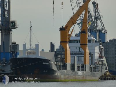
MONIKA
General Cargo
Current Trip
| Trip Time | 4 days |
|---|---|
| Trip Distance | 1316.35 nm |
| AVG Speed | 11.1 Noeuds |
| MAX Speed | 12.8 Noeuds |
| Tirant d eau | 4.8 m |
| AVG Wind | 10.3 knots |
| MAX Wind | 22.9 knots |
| MIN Temp | 14.9°C / 58.82°F |
| MAX Temp | 22.4°C / 72.32°F |
| Position reçue | 12 h, 59 m depuis |
Current Position
| Longitude | 29.77290° |
|---|---|
| Latitude | 31.52589° |
| Etat | Under way using engine |
| Vitesse | 10.5 Noeuds |
| Parcours | 120.8° |
| Zone | Mediterranean Sea - Eastern Basin |
| Station | T-AIS |
| Position reçue | 12 h, 59 m depuis |
Info
Information
The current position of MONIKA is in Mediterranean Sea - Eastern Basin with coordinates 31.52589° / 29.77290° as reported on 2024-05-10 03:43 by AIS to our vessel tracker app. The vessel's current speed is 10.5 Noeuds and is currently inside the port of ABU QIR.
The vessel MONIKA (IMO: 9344370, MMSI: 305089000) is a General Cargo that was built in 2007 ( 17 Age ). It's sailing under the flag of [AG] Antigua Barbuda.
In this page you can find informations about the vessels current position, last detected port calls, and current voyage information. If the vessels is not in coverage by AIS you will find the latest position.
The current position of MONIKA is detected by our AIS receivers and we are not responsible for the reliability of the data. The last position was recorded while the vessel was in Coverage by the Ais receivers of our vessel tracking app.
The current draught of MONIKA as reported by AIS is 4.8 meters
Weather
| Temperature | 21.6°C / 70.88°F |
|---|---|
| Wind Speed | 8 knots |
| Direction | 342° NNW |
| Pressure | 1008.1 hPa |
| Humidity | 59.7 % |
| Cloud Coverage | 21 % |
Featured Company
Last Port Calls
| Port | Arrival | Departure | Time In Port |
|---|---|---|---|
| 2024-05-10 09:16 | |||
| 2024-05-04 19:13 | 2024-05-05 09:19 | 14 h | |
| 2024-04-24 18:30 | 2024-04-26 07:12 | 1 d | |
| 2024-04-22 02:07 | 2024-04-23 02:17 | 1 d | |
| 2024-04-17 05:48 | 2024-04-17 14:05 | 8 h | |
| 2024-04-15 02:33 | 2024-04-15 02:37 | 3 m | |
| 2024-04-12 02:17 | 2024-04-13 15:53 | 1 d | |
| 2024-04-01 07:35 | 2024-04-01 16:51 | 9 h | |
| 2024-03-29 20:57 | 2024-03-30 07:53 | 10 h | |
| 2024-03-25 06:41 | 2024-03-25 14:49 | 8 h |
Last Trips
| Origin | Departure | Destination | Arrival | Distance | |
|---|---|---|---|---|---|
| 2024-05-05 11:19 | 2024-05-10 11:16 | 1316.35 nm | |||
| 2024-04-26 09:12 | 2024-05-04 21:13 | 2319.68 nm | |||
| 2024-04-23 03:17 | 2024-04-24 20:30 | 438.13 nm | |||
| 2024-04-17 17:05 | 2024-04-22 03:07 | 1069.92 nm | |||
| 2024-04-15 04:37 | 2024-04-17 08:48 | 560.51 nm | |||
| 2024-04-13 17:53 | 2024-04-15 04:33 | 330.92 nm | |||
| 2024-04-01 16:51 | 2024-04-12 04:17 | 2642.01 nm | |||
| 2024-03-30 07:53 | 2024-04-01 07:35 | 452.43 nm | |||
| 2024-03-25 14:49 | 2024-03-29 20:57 | 1047.41 nm | |||
| 2024-03-21 16:22 | 2024-03-25 06:41 | 578.15 nm |
Events
| Heure | Evenement | Détails | Position/ Destination | Info |
|---|---|---|---|---|
| 2024-05-10 10:04 | Arret |
31.32273 / 30.07401
[EG] ABU QIR
|
Vitesse: 0.2 kn Parcours: 268° |
|
| 2024-05-10 09:16 | Port d'arrivée |
|
31.32663 / 30.08460
[EG] ABU QIR
|
Vitesse: 4.2 kn Parcours: 201° |
| 2024-05-10 07:56 | Démarrage | 4.34 nm, North of ABU QIR |
31.38703 / 30.07484
EGAKI
|
Vitesse: 5.1 kn Parcours: 105° |
| 2024-05-10 05:41 | Arret | 4.3 nm, North of ABU QIR |
31.38497 / 30.06365
EGAKI
|
Vitesse: Parcours: 140° |
| 2024-05-10 03:51 | Etat Changé | Default Under way using engine |
31.51508 / 29.79575
EGAKI
|
Vitesse: 10.5 kn Parcours: 120.8° |
| 2024-05-10 03:43 | Hors de la zone couverte |
31.52589 / 29.77290
Mediterranean Sea - Eastern Basin
EGAKI
|
Vitesse: 10.5 kn Parcours: 120.8° |
|
| 2024-05-10 03:40 | Etat Changé | Under way using engine Default |
31.53167 / 29.76154
EGAKI
|
Vitesse: 10.6 kn Parcours: 121° |
| 2024-05-10 03:33 | Dans la zone couverte |
31.53044 / 29.76396
Mediterranean Sea - Eastern Basin
EGAKI
|
Vitesse: 10.5 kn Parcours: 120.9° |
|
| 2024-05-10 01:58 | Etat Changé | Default Under way using engine |
31.67724 / 29.45374
EGAKI
|
Vitesse: 10.6 kn Parcours: 118.2° |
| 2024-05-10 01:56 | Hors de la zone couverte |
31.68006 / 29.44759
Mediterranean Sea - Eastern Basin
EGAKI
|
Vitesse: 10.6 kn Parcours: 118.2° |