
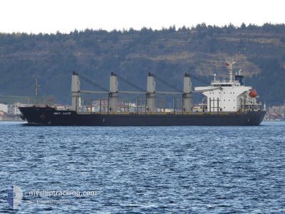
SKY GATE
Bulk Carrier
Current Trip
| Time Travelled | 1 day |
|---|---|
| Remaining Time | --- |
| Distance Travelled | 233.89 nm |
| Remaining Distance | --- |
| AVG Speed | 9.4 Noeuds |
| MAX Speed | 12.2 Noeuds |
| AVG Wind | 7.9 knots |
| MAX Wind | 12 knots |
| MIN Temp | 23.7°C / 74.66°F |
| MAX Temp | 26.9°C / 80.42°F |
| Tirant d eau | 8 m |
| Position reçue | 2 h, 56 m depuis |
Current Position
| Longitude | --- |
|---|---|
| Latitude | --- |
| Etat | Under way using engine |
| Vitesse | 11.4 Noeuds |
| Parcours | 128.5° |
| Zone | Gulf of Oman |
| Station | T-AIS |
| Position reçue | 2 h, 56 m depuis |
Info
Information
The current position of SKY GATE is in Gulf of Oman with coordinates 25.01647° / 57.07985° as reported on 2025-12-10 02:07 by AIS to our vessel tracker app. The vessel's current speed is 11.4 Noeuds and is heading at the port of ABU QIR. The estimated time of arrival as calculated by MyShipTracking vessel tracking app is 2025-12-22 14:00 LT
The vessel SKY GATE (IMO: 9445136, MMSI: 268238201) is a Bulk Carrier that was built in 2008 ( 17 Age ). It's sailing under the flag of [SM] San Marino.
In this page you can find informations about the vessels current position, last detected port calls, and current voyage information. If the vessels is not in coverage by AIS you will find the latest position.
The current position of SKY GATE is detected by our AIS receivers and we are not responsible for the reliability of the data. The last position was recorded while the vessel was in Coverage by the Ais receivers of our vessel tracking app.
The current draught of SKY GATE as reported by AIS is 8 meters
Weather
| Temperature | 25.2°C / 77.36°F |
|---|---|
| Wind Speed | 9 knots |
| Direction | 115° ESE |
| Pressure | 1019.2 hPa |
| Humidity | 50.4 % |
| Cloud Coverage | 88 % |
Featured Company
Last Port Calls
| Port | Arrival | Departure | Time In Port |
|---|---|---|---|
| 2025-12-01 15:54 | 2025-12-08 19:09 | 7 d | |
| 2025-11-20 18:48 | 2025-11-26 15:33 | 5 d | |
| 2025-10-21 01:19 | 2025-10-22 17:36 | 1 d | |
| 2025-10-20 13:06 | 2025-10-21 00:53 | 11 h | |
| 2025-10-19 22:43 | 2025-10-20 12:36 | 13 h | |
| 2025-10-03 18:12 | 2025-10-19 22:19 | 16 d |
Most Visited Ports (Last year)
| Port | Arrivals | |
|---|---|---|
| 4 | ||
| 4 | ||
| 4 | ||
| 3 | ||
| 2 | ||
| 2 |
Last Trips
| Origin | Departure | Destination | Arrival | Distance | |
|---|---|---|---|---|---|
| 2025-11-26 15:33 | 2025-12-01 15:54 | 742.08 nm | |||
| 2025-10-22 17:36 | 2025-11-20 18:48 | 3773.08 nm | |||
| 2025-10-21 00:53 | 2025-10-21 01:19 | 2.46 nm | |||
| 2025-10-20 12:36 | 2025-10-20 13:06 | 0.74 nm | |||
| 2025-10-19 22:19 | 2025-10-19 22:43 | 2.34 nm | |||
| 2025-09-17 18:32 | 2025-10-03 18:12 | 1261.03 nm |
Events
| Heure | Evenement | Détails | Position/ Destination | Info |
|---|---|---|---|---|
| 2025-12-10 02:11 | Etat Changé | Default Under way using engine |
25.00826 / 57.09114
ABU QIR
|
Vitesse: 11.4 kn Parcours: 128.5° |
| 2025-12-10 02:07 | Hors de la zone couverte |
25.01647 / 57.07985
Gulf of Oman
ABU QIR
|
Vitesse: 11.4 kn Parcours: 128.5° |
|
| 2025-12-10 02:07 | Etat Changé | Under way using engine Default |
25.01748 / 57.07849
ABU QIR
|
Vitesse: 11.4 kn Parcours: 126° |
| 2025-12-10 01:57 | Etat Changé | Default Under way using engine |
25.03560 / 57.05128
ABU QIR
|
Vitesse: 11.4 kn Parcours: 125.5° |
| 2025-12-10 01:33 | Changement de zone | Omani part of the Gulf of Oman United Arab Emirates part of the Gulf of Oman |
25.07991 / 56.98219
Gulf of Oman
ABU QIR
|
Vitesse: 11.3 kn Parcours: 125.6° |
| 2025-12-09 22:20 | Démarrage | 7.3 nm, North East of KHORFAKKAN |
25.40953 / 56.48358
ABU QIR
|
Vitesse: 3.1 kn Parcours: 82° |
| 2025-12-09 07:31 | Arret | 7.27 nm, North East of KHORFAKKAN |
25.41142 / 56.48194
ABU QIR
|
Vitesse: 0.3 kn Parcours: 219° |
| 2025-12-09 05:19 | Changement de zone | United Arab Emirates part of the Gulf of Oman Omani part of the Gulf of Oman |
25.66814 / 56.59963
Gulf of Oman
ABU QIR
|
Vitesse: 10.7 kn Parcours: 179.8° |
| 2025-12-09 03:49 | Changement de zone | Omani part of the Gulf of Oman Omani part of the Persian Gulf |
25.93848 / 56.60903
Gulf of Oman
ABU QIR
|
Vitesse: 10.7 kn Parcours: 180° |
| 2025-12-09 03:48 | Etat Changé | Under way using engine Default |
25.94253 / 56.60907
ABU QIR
|
Vitesse: 10.7 kn Parcours: 182° |