
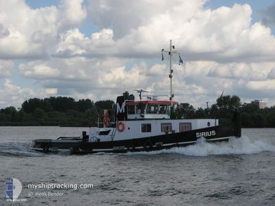
SIRIUS
Cargo
Current Trip
FRGIV
| Time Travelled | 2 days |
|---|---|
| Remaining Time | --- |
| Distance Travelled | 91.58 nm |
| Remaining Distance | --- |
| AVG Speed | 7.3 Noeuds |
| MAX Speed | 8.4 Noeuds |
| AVG Wind | 4.5 knots |
| MAX Wind | 6 knots |
| MIN Temp | 3.6°C / 38.48°F |
| MAX Temp | 10.7°C / 51.26°F |
| Tirant d eau | 2.5 m |
| Position reçue | 1 d depuis |
Current Position
| Longitude | --- |
|---|---|
| Latitude | --- |
| Etat | Under way using engine |
| Vitesse | 8.3 Noeuds |
| Parcours | 179.4° |
| Zone | North Sea |
| Station | T-AIS |
| Position reçue | 1 d depuis |
Info
Information
The current position of SIRIUS is in North Sea with coordinates 50.78890° / 5.68886° as reported on 2025-12-13 09:20 by AIS to our vessel tracker app. The vessel's current speed is 8.3 Noeuds
The vessel SIRIUS (MMSI: 244051000) is a Cargo It's sailing under the flag of [NL] Netherlands.
In this page you can find informations about the vessels current position, last detected port calls, and current voyage information. If the vessels is not in coverage by AIS you will find the latest position.
The current position of SIRIUS is detected by our AIS receivers and we are not responsible for the reliability of the data. The last position was recorded while the vessel was in Coverage by the Ais receivers of our vessel tracking app.
The current draught of SIRIUS as reported by AIS is 2.5 meters
Weather
| Temperature | 4.7°C / 40.46°F |
|---|---|
| Wind Speed | 7 knots |
| Direction | 180° S |
| Pressure | 1020.2 hPa |
| Humidity | 92.9 % |
| Cloud Coverage | 10 % |
Featured Company
Last Port Calls
| Port | Arrival | Departure | Time In Port |
|---|---|---|---|
| 2025-12-12 14:09 | 2025-12-12 15:04 | 54 m | |
| 2025-12-11 07:56 | 2025-12-12 06:58 | 23 h | |
| 2025-12-10 21:12 | 2025-12-11 07:21 | 10 h | |
| 2025-12-10 19:11 | 2025-12-10 19:28 | 17 m | |
| 2025-12-10 18:26 | 2025-12-10 18:41 | 14 m | |
| 2025-12-10 07:49 | 2025-12-10 18:10 | 10 h | |
| 2025-12-09 20:14 | 2025-12-10 07:18 | 11 h | |
| 2025-12-09 02:24 | 2025-12-09 18:35 | 16 h | |
| 2025-12-07 21:24 | 2025-12-08 21:33 | 1 d | |
| 2025-12-06 18:06 | 2025-12-07 18:23 | 1 d |
Most Visited Ports (Last year)
| Port | Arrivals | |
|---|---|---|
| 50 | ||
| 7 | ||
| 7 | ||
| 5 | ||
| 5 | ||
| 5 |
Last Trips
| Origin | Departure | Destination | Arrival | Distance | |
|---|---|---|---|---|---|
| 2025-12-12 06:58 | 2025-12-12 14:09 | 49.09 nm | |||
| 2025-12-11 07:21 | 2025-12-11 07:56 | 2.75 nm | |||
| 2025-12-10 19:28 | 2025-12-10 21:12 | 8.92 nm | |||
| 2025-12-10 18:41 | 2025-12-10 19:11 | 5.30 nm | |||
| 2025-12-10 18:10 | 2025-12-10 18:26 | 2.33 nm | |||
| 2025-12-10 07:18 | 2025-12-10 07:49 | 2.76 nm | |||
| 2025-12-09 18:35 | 2025-12-09 20:14 | 13.25 nm | |||
| 2025-12-08 21:33 | 2025-12-09 02:24 | 35.09 nm | |||
| 2025-12-07 18:23 | 2025-12-07 21:24 | 19.18 nm | |||
| 2025-12-06 16:53 | 2025-12-06 18:06 | 8.59 nm |
Events
| Heure | Evenement | Détails | Position/ Destination | Info |
|---|---|---|---|---|
| 2025-12-14 08:16 | Arret | 17.91 nm, East of CHARLEROI |
50.46500 / 4.89667
FRGIV
|
Vitesse: Parcours: -1° |
| 2025-12-13 15:16 | Démarrage | 7.27 nm, South West of ENGIS |
50.52667 / 5.21833
FRGIV
|
Vitesse: 6 kn Parcours: 303° |
| 2025-12-13 09:20 | Hors de la zone couverte |
50.78890 / 5.68886
North Sea
FRGIV
|
Vitesse: 8.3 kn Parcours: 179.4° |
|
| 2025-12-13 09:18 | Dans la zone couverte |
50.79351 / 5.68793
North Sea
FRGIV
|
Vitesse: 8.3 kn Parcours: 164.1° |
|
| 2025-12-13 07:07 | Arret | 0.35 nm, South West of GENK |
50.93500 / 5.49167
FRGIV
|
Vitesse: Parcours: -1° |
| 2025-12-12 16:49 | Démarrage | 0.05 nm, East of OLEN |
51.15500 / 4.87333
FRGIV
|
Vitesse: 8 kn Parcours: 108° |
| 2025-12-12 14:49 | Démarrage | 1.9 nm, South East of WIJNEGEM |
51.22067 / 4.55722
FRGIV
|
Vitesse: 7.7 kn Parcours: 118° |
| 2025-12-12 14:25 | Arret | 1.01 nm, South East of WIJNEGEM |
51.22696 / 4.53578
FRGIV
|
Vitesse: 0.3 kn Parcours: -1° |
| 2025-12-12 14:21 | Etat Changé | Default Under way using engine |
51.22870 / 4.53100
FRGIV
|
Vitesse: 7.6 kn Parcours: 115.1° |
| 2025-12-12 14:11 | Hors de la zone couverte |
51.23693 / 4.50608
North Sea
FRGIV
|
Vitesse: 7.6 kn Parcours: 115.1° |