
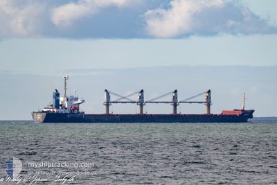
SELIN-M
Bulk Carrier
Current Trip
| Time Travelled | 2 days |
|---|---|
| Remaining Time | --- |
| Distance Travelled | 433.91 nm |
| Remaining Distance | --- |
| AVG Speed | 11.7 Noeuds |
| MAX Speed | 22.7 Noeuds |
| AVG Wind | 10.2 knots |
| MAX Wind | 16.6 knots |
| MIN Temp | 14.3°C / 57.74°F |
| MAX Temp | 17.5°C / 63.5°F |
| Tirant d eau | 9.8 m |
| Position reçue | 2 m depuis |
Current Position
| Longitude | 29.37474° |
|---|---|
| Latitude | 41.46578° |
| Etat | Under way using engine |
| Vitesse | 0.4 Noeuds |
| Parcours | 337° |
| Zone | Black Sea |
| Station | T-AIS |
| Position reçue | 2 m depuis |
Info
Information
The current position of SELIN-M is in Black Sea with coordinates 41.46578° / 29.37474° as reported on 2024-05-20 17:57 by AIS to our vessel tracker app. The vessel's current speed is 0.4 Noeuds and is heading at the port of SOKHNA. The estimated time of arrival as calculated by MyShipTracking vessel tracking app is 2024-05-23 11:00 LT
The vessel SELIN-M (IMO: 9178551, MMSI: 370387000) is a Bulk Carrier that was built in 1998 ( 26 Age ). It's sailing under the flag of [PA] Panama.
In this page you can find informations about the vessels current position, last detected port calls, and current voyage information. If the vessels is not in coverage by AIS you will find the latest position.
The current position of SELIN-M is detected by our AIS receivers and we are not responsible for the reliability of the data. The last position was recorded while the vessel was in Coverage by the Ais receivers of our vessel tracking app.
The current draught of SELIN-M as reported by AIS is 9.8 meters
Weather
| Temperature | 15.8°C / 60.44°F |
|---|---|
| Wind Speed | 12 knots |
| Direction | 55° NE |
| Pressure | 1015.7 hPa |
| Humidity | 84.7 % |
| Cloud Coverage | 100 % |
Featured Company
Last Port Calls
| Port | Arrival | Departure | Time In Port |
|---|---|---|---|
| 2024-05-12 01:20 | 2024-05-18 14:41 | 6 d | |
| 2024-04-24 00:46 | 2024-04-24 20:03 | 19 h | |
| 2024-03-20 16:15 | 2024-04-15 03:05 | 25 d |
Most Visited Ports (Last year)
| Port | Arrivals | |
|---|---|---|
| 3 | ||
| 2 | ||
| 2 | ||
| 1 | ||
| 1 | ||
| 1 |
Last Trips
| Origin | Departure | Destination | Arrival | Distance | |
|---|---|---|---|---|---|
| 2024-04-15 03:05 | 2024-05-12 01:20 | 2469.41 nm | |||
| 2024-04-15 03:05 | 2024-04-24 00:46 | 883.00 nm |
Events
| Heure | Evenement | Détails | Position/ Destination | Info |
|---|---|---|---|---|
| 2024-05-20 16:17 | Etat Changé | Under way using engine Default |
41.47015 / 29.37861
EG AIS
|
Vitesse: 0.3 kn Parcours: 316° |
| 2024-05-20 16:08 | Etat Changé | Default Under way using engine |
41.47082 / 29.37838
EG AIS
|
Vitesse: 0.5 kn Parcours: 322° |
| 2024-05-20 15:29 | Etat Changé | Under way using engine Default |
41.47397 / 29.37524
EG AIS
|
Vitesse: 0.3 kn Parcours: 342° |
| 2024-05-20 15:21 | Etat Changé | Default Under way using engine |
41.47449 / 29.37477
EG AIS
|
Vitesse: 0.3 kn Parcours: 330° |
| 2024-05-20 14:42 | Etat Changé | Under way using engine Default |
41.47607 / 29.37036
EG AIS
|
Vitesse: 0.5 kn Parcours: 334° |
| 2024-05-20 14:41 | Etat Changé | Default Under way using engine |
41.47609 / 29.37023
EG AIS
|
Vitesse: 0.4 kn Parcours: 334° |
| 2024-05-20 14:15 | Etat Changé | Under way using engine Default |
41.47682 / 29.36655
EG AIS
|
Vitesse: 0.6 kn Parcours: 343° |
| 2024-05-20 14:13 | Etat Changé | Default Under way using engine |
41.47691 / 29.36616
EG AIS
|
Vitesse: 1 kn Parcours: 348° |
| 2024-05-20 10:05 | Etat Changé | Under way using engine Default |
41.47077 / 29.33198
EG AIS
|
Vitesse: 0.3 kn Parcours: 16° |
| 2024-05-20 09:56 | Etat Changé | Default Under way using engine |
41.47018 / 29.33101
EG AIS
|
Vitesse: 0.5 kn Parcours: 7° |