
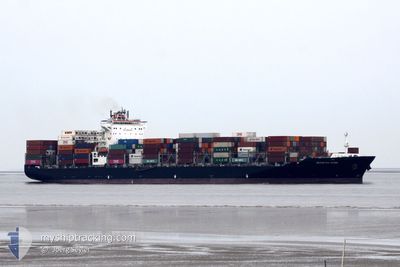
SEASPAN KOBE
Container Ship
Current Trip
VNCAI
| Time Travelled | 9 days |
|---|---|
| Remaining Time | --- |
| Distance Travelled | 3077.15 nm |
| Remaining Distance | --- |
| AVG Speed | 13.4 Noeuds |
| MAX Speed | 21.2 Noeuds |
| AVG Wind | 10.3 knots |
| MAX Wind | 19.9 knots |
| MIN Temp | 12.8°C / 55.04°F |
| MAX Temp | 20.5°C / 68.9°F |
| Tirant d eau | 9.3 m |
| Position reçue | 9 d depuis |
Current Position
| Longitude | -119.64573° |
|---|---|
| Latitude | 34.15873° |
| Etat | Under way using engine |
| Vitesse | 14.1 Noeuds |
| Parcours | 285.6° |
| Zone | North Pacific Ocean |
| Station | T-AIS |
| Position reçue | 9 d depuis |
Info
Information
The current position of SEASPAN KOBE is in North Pacific Ocean with coordinates 34.15873° / -119.64573° as reported on 2024-04-24 16:59 by AIS to our vessel tracker app. The vessel's current speed is 14.1 Noeuds
The vessel SEASPAN KOBE (IMO: 9492701, MMSI: 477866300) is a Container Ship that was built in 2011 ( 13 Age ). It's sailing under the flag of [HK] Hong Kong.
In this page you can find informations about the vessels current position, last detected port calls, and current voyage information. If the vessels is not in coverage by AIS you will find the latest position.
The current position of SEASPAN KOBE is detected by our AIS receivers and we are not responsible for the reliability of the data. The last position was recorded while the vessel was in Coverage by the Ais receivers of our vessel tracking app.
The current draught of SEASPAN KOBE as reported by AIS is 9.3 meters
Weather
| Temperature | 18.6°C / 65.48°F |
|---|---|
| Wind Speed | 7 knots |
| Direction | 84° E |
| Pressure | 1022.5 hPa |
| Humidity | 77.5 % |
| Cloud Coverage | 41 % |
Featured Company
Last Port Calls
| Port | Arrival | Departure | Time In Port |
|---|---|---|---|
| 2024-04-23 00:14 | 2024-04-24 09:47 | 1 d | |
| 2024-04-08 01:25 | 2024-04-09 03:53 | 1 d | |
| 2024-04-05 00:37 | 2024-04-05 14:21 | 13 h | |
| 2024-03-11 21:13 | 2024-03-13 10:43 | 1 d |
Most Visited Ports (Last year)
| Port | Arrivals | |
|---|---|---|
| 5 | ||
| 4 | ||
| 3 | ||
| 3 | ||
| 3 | ||
| 3 |
Last Trips
| Origin | Departure | Destination | Arrival | Distance | |
|---|---|---|---|---|---|
| 2024-04-09 11:53 | 2024-04-22 17:14 | 6649.27 nm | |||
| 2024-04-05 21:21 | 2024-04-08 09:25 | 563.48 nm | |||
| 2024-03-13 03:43 | 2024-04-05 07:37 | 7276.30 nm | |||
| 2024-02-27 05:58 | 2024-03-11 14:13 | 6587.90 nm |
Events
| Heure | Evenement | Détails | Position/ Destination | Info |
|---|---|---|---|---|
| 2024-04-24 17:06 | Etat Changé | Default Under way using engine |
34.16718 / -119.68098
VNCAI
|
Vitesse: 14.1 kn Parcours: 285.6° |
| 2024-04-24 16:59 | Hors de la zone couverte |
34.15873 / -119.64573
North Pacific Ocean
VNCAI
|
Vitesse: 14.1 kn Parcours: 285.6° |
|
| 2024-04-24 16:51 | Etat Changé | Under way using engine Default |
34.15089 / -119.60856
VNCAI
|
Vitesse: 14 kn Parcours: 284° |
| 2024-04-24 16:46 | Etat Changé | Default Under way using engine |
34.14706 / -119.59038
VNCAI
|
Vitesse: 13.8 kn Parcours: 284.9° |
| 2024-04-24 15:52 | Etat Changé | Under way using engine Default |
34.09210 / -119.34798
VNCAI
|
Vitesse: 13.5 kn Parcours: 286° |
| 2024-04-24 15:38 | Etat Changé | Default Under way using engine |
34.07870 / -119.29104
VNCAI
|
Vitesse: 13.3 kn Parcours: 286.6° |
| 2024-04-24 15:33 | Etat Changé | Under way using engine Default |
34.07349 / -119.26879
VNCAI
|
Vitesse: 13.1 kn Parcours: 296° |
| 2024-04-24 15:26 | Etat Changé | Default Under way using engine |
34.06277 / -119.24177
VNCAI
|
Vitesse: 13.5 kn Parcours: 298.5° |
| 2024-04-24 14:51 | Etat Changé | Under way using engine Default |
33.99728 / -119.10273
VNCAI
|
Vitesse: 13.3 kn Parcours: 297° |
| 2024-04-24 14:50 | Etat Changé | Default Under way using engine |
33.99611 / -119.10004
VNCAI
|
Vitesse: 13.4 kn Parcours: 297.8° |