
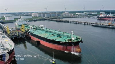
SEA SHELL
Tanker D
Current Trip
| Time Travelled | 19 days |
|---|---|
| Remaining Time | 1 day |
| Distance Travelled | 5355.04 nm |
| Remaining Distance | 488.17 nm |
| AVG Speed | 11.3 Noeuds |
| MAX Speed | 15.7 Noeuds |
| AVG Wind | 17 knots |
| MAX Wind | 29 knots |
| MIN Temp | 1.4°C / 34.52°F |
| MAX Temp | 23.5°C / 74.3°F |
| Tirant d eau | 14.6 m |
| Position reçue | 1 d depuis |
Current Position
| Longitude | --- |
|---|---|
| Latitude | --- |
| Etat | Under way using engine |
| Vitesse | 6 Noeuds |
| Parcours | 173.1° |
| Zone | Gulf of Suez |
| Station | T-AIS |
| Position reçue | 1 d depuis |
Info
Information
The current position of SEA SHELL is in Gulf of Suez with coordinates 29.86929° / 32.55124° as reported on 2025-12-08 19:08 by AIS to our vessel tracker app. The vessel's current speed is 6 Noeuds and is heading at the port of PORT SAID. The estimated time of arrival as calculated by MyShipTracking vessel tracking app is 2025-12-11 19:29 LT
The vessel SEA SHELL (IMO: 9773947, MMSI: 373834000) is a Tanker D It's sailing under the flag of [PA] Panama.
In this page you can find informations about the vessels current position, last detected port calls, and current voyage information. If the vessels is not in coverage by AIS you will find the latest position.
The current position of SEA SHELL is detected by our AIS receivers and we are not responsible for the reliability of the data. The last position was recorded while the vessel was in Coverage by the Ais receivers of our vessel tracking app.
The current draught of SEA SHELL as reported by AIS is 14.6 meters
Weather
| Temperature | 23.5°C / 74.3°F |
|---|---|
| Wind Speed | 11 knots |
| Direction | 319° NW |
| Pressure | 1015.6 hPa |
| Humidity | 45.9 % |
| Cloud Coverage | 61 % |
Featured Company
Last Port Calls
| Port | Arrival | Departure | Time In Port |
|---|---|---|---|
| 2025-12-08 11:05 | 2025-12-08 20:20 | 9 h | |
| 2025-11-17 13:03 | 2025-11-20 13:06 | 3 d | |
| 2025-10-28 09:47 | 2025-11-02 12:11 | 5 d | |
| 2025-10-15 07:57 | 2025-10-15 17:09 | 9 h |
Last Trips
| Origin | Departure | Destination | Arrival | Distance | |
|---|---|---|---|---|---|
| 2025-11-20 13:06 | 2025-12-08 11:05 | 4839.81 nm | |||
| 2025-11-02 12:11 | 2025-11-17 13:03 | 1657.71 nm | |||
| 2025-09-16 21:25 | 2025-10-28 09:47 | 11119.05 nm | |||
| 2025-09-16 21:25 | 2025-10-15 07:57 | 7672.44 nm |
Events
| Heure | Evenement | Détails | Position/ Destination | Info |
|---|---|---|---|---|
| 2025-12-08 19:17 | Etat Changé | Default Under way using engine |
29.85544 / 32.55306
EGPSD
|
Vitesse: 6 kn Parcours: 173.1° |
| 2025-12-08 19:08 | Hors de la zone couverte |
29.86929 / 32.55124
Gulf of Suez
|
Vitesse: 6 kn Parcours: 173.1° |
|
| 2025-12-08 18:22 | Changement de zone | Egyptian part of the Gulf of Suez Egyptian part of the Mediterranean Sea - Eastern Basin |
29.94237 / 32.57463
Gulf of Suez
|
Vitesse: 7.5 kn Parcours: 220.7° |
| 2025-12-08 18:20 | PORT DE DEPART |
|
29.94538 / 32.57741
EGPSD
|
Vitesse: 7.7 kn Parcours: 220° |
| 2025-12-08 17:04 | Etat Changé | Under way using engine Default |
30.14389 / 32.56967
[EG] SUEZ CANAL
|
Vitesse: 9.3 kn Parcours: 182° |
| 2025-12-08 16:56 | Etat Changé | Default Under way using engine |
30.16327 / 32.56970
[EG] SUEZ CANAL
|
Vitesse: 9.2 kn Parcours: 180° |
| 2025-12-08 16:24 | Changement de destination | EGPSD GIBRALTAR FOR ORDER |
30.23924 / 32.53698
[EG] SUEZ CANAL
|
Vitesse: 9.4 kn Parcours: 144° |
| 2025-12-08 16:24 | Changement d'ETA | 2025/12/08 09:00 2025/12/01 08:00 |
30.23924 / 32.53698
[EG] SUEZ CANAL
|
Vitesse: 9.4 kn Parcours: 144° |
| 2025-12-08 16:24 | Dans la zone couverte |
30.23790 / 32.53822
Mediterranean Sea - Eastern Basin
[EG] SUEZ CANAL
|
Vitesse: 9.4 kn Parcours: 142.8° |
|
| 2025-12-08 16:23 | Etat Changé | Under way using engine Default |
30.24128 / 32.53504
[EG] SUEZ CANAL
|
Vitesse: 9.1 kn Parcours: 127° |