
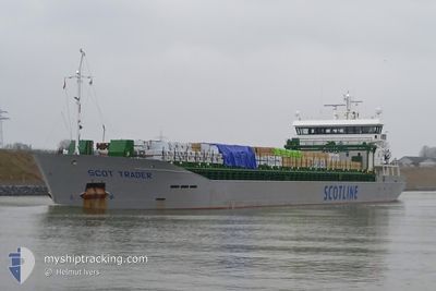
SCOT TRADER
Cargo
Current Trip
ARDCASTLE
| Time Travelled | 6 h, 2 mins |
|---|---|
| Remaining Time | --- |
| Distance Travelled | 70.49 nm |
| Remaining Distance | --- |
| AVG Speed | 11.9 Noeuds |
| MAX Speed | 13.7 Noeuds |
| AVG Wind | 26.5 knots |
| MAX Wind | 29.7 knots |
| MIN Temp | 6.8°C / 44.24°F |
| MAX Temp | 10°C / 50°F |
| Tirant d eau | 4 m |
| Position reçue | 5 m depuis |
Current Position
| Longitude | --- |
|---|---|
| Latitude | --- |
| Etat | Under way using engine |
| Vitesse | 10.9 Noeuds |
| Parcours | 339.9° |
| Zone | Inner Seas off the West Coast of Scotland |
| Station | T-AIS |
| Position reçue | 5 m depuis |
Info
Information
The current position of SCOT TRADER is in Inner Seas off the West Coast of Scotland with coordinates 54.91747° / -5.24940° as reported on 2025-12-17 03:27 by AIS to our vessel tracker app. The vessel's current speed is 10.9 Noeuds
The vessel SCOT TRADER (IMO: 9728784, MMSI: 232047453) is a Cargo It's sailing under the flag of [GB] United Kingdom.
In this page you can find informations about the vessels current position, last detected port calls, and current voyage information. If the vessels is not in coverage by AIS you will find the latest position.
The current position of SCOT TRADER is detected by our AIS receivers and we are not responsible for the reliability of the data. The last position was recorded while the vessel was in Coverage by the Ais receivers of our vessel tracking app.
The current draught of SCOT TRADER as reported by AIS is 4 meters
Weather
| Temperature | 9.6°C / 49.28°F |
|---|---|
| Wind Speed | 28 knots |
| Direction | 187° S |
| Pressure | 1005.2 hPa |
| Humidity | 79.1 % |
| Cloud Coverage | 100 % |
Featured Company
Last Port Calls
| Port | Arrival | Departure | Time In Port |
|---|---|---|---|
| 2025-12-15 07:55 | 2025-12-16 21:31 | 1 d | |
| 2025-12-14 02:29 | 2025-12-14 21:37 | 19 h | |
| 2025-12-05 07:11 | 2025-12-05 21:34 | 14 h | |
| 2025-12-03 00:35 | 2025-12-03 17:25 | 16 h | |
| 2025-11-30 03:32 | 2025-11-30 03:35 | 2 m | |
| 2025-11-21 07:11 | 2025-11-24 14:05 | 3 d | |
| 2025-11-15 18:41 | 2025-11-18 22:13 | 3 d | |
| 2025-11-13 07:48 | 2025-11-13 07:53 | 4 m | |
| 2025-11-10 10:54 | 2025-11-12 18:02 | 2 d | |
| 2025-11-04 18:35 | 2025-11-05 18:16 | 23 h |
Most Visited Ports (Last year)
| Port | Arrivals | |
|---|---|---|
| 9 | ||
| 8 | ||
| 4 | ||
| 3 | ||
| 3 | ||
| 3 |
Last Trips
| Origin | Departure | Destination | Arrival | Distance | |
|---|---|---|---|---|---|
| 2025-12-05 21:34 | 2025-12-15 07:55 | 1922.44 nm | |||
| 2025-12-05 21:34 | 2025-12-14 02:29 | 1829.45 nm | |||
| 2025-12-03 17:25 | 2025-12-05 07:11 | 394.02 nm | |||
| 2025-11-30 03:35 | 2025-12-03 00:35 | 713.48 nm | |||
| 2025-11-24 14:05 | 2025-11-30 03:32 | 633.08 nm | |||
| 2025-11-18 22:13 | 2025-11-21 07:11 | 544.85 nm | |||
| 2025-11-13 07:53 | 2025-11-15 18:41 | 445.12 nm | |||
| 2025-11-12 18:02 | 2025-11-13 07:48 | 79.17 nm | |||
| 2025-11-05 18:16 | 2025-11-10 10:54 | 949.82 nm | |||
| 2025-11-04 01:52 | 2025-11-04 18:35 | 187.35 nm |
Events
| Heure | Evenement | Détails | Position/ Destination | Info |
|---|---|---|---|---|
| 2025-12-17 02:34 | Tirant d'eau modifié | 4 5.7 |
54.76143 / -5.12067
ARDCASTLE
|
Vitesse: 12.2 kn Parcours: 330.7° |
| 2025-12-17 02:34 | Changement de destination | ARDCASTLE GBWOR |
54.76143 / -5.12067
ARDCASTLE
|
Vitesse: 12.2 kn Parcours: 330.7° |
| 2025-12-17 02:34 | Changement d'ETA | 2025/12/17 10:00 2025/12/15 08:00 |
54.76143 / -5.12067
ARDCASTLE
|
Vitesse: 12.2 kn Parcours: 330.7° |
| 2025-12-17 02:02 | Changement de zone | United Kingdom part of the Inner Seas off the West Coast of Scotland United Kingdom part of the Irish Sea and St. George's Channel |
54.66475 / -5.03442
Inner Seas off the West Coast of Scotland
|
Vitesse: 13.2 kn Parcours: 331.9° |
| 2025-12-17 02:01 | Etat Changé | Under way using engine Default |
54.65912 / -5.02926
GBWOR
|
Vitesse: 13.2 kn Parcours: 333° |
| 2025-12-17 02:00 | Etat Changé | Default Under way using engine |
54.65665 / -5.02693
GBWOR
|
Vitesse: 13.1 kn Parcours: 330.8° |
| 2025-12-17 01:57 | Etat Changé | Under way using engine Default |
54.64663 / -5.01730
GBWOR
|
Vitesse: 13.2 kn Parcours: 330° |
| 2025-12-17 01:56 | Etat Changé | Default Under way using engine |
54.64386 / -5.01445
GBWOR
|
Vitesse: 13.3 kn Parcours: 328.2° |
| 2025-12-17 01:55 | Etat Changé | Under way using engine Default |
54.64142 / -5.01203
GBWOR
|
Vitesse: 12.9 kn Parcours: 326° |
| 2025-12-17 01:40 | Dans la zone couverte |
54.64142 / -5.01203
Irish Sea and St. George's Channel
|
Vitesse: 13.3 kn Parcours: 328.2° |