
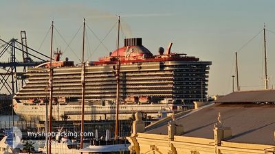
SCARLET LADY
Passenger
Current Trip
| Time Travelled | 8 h, 8 mins |
|---|---|
| Remaining Time | 4 h, 42 mins |
| Distance Travelled | 124.33 nm |
| Remaining Distance | 83.37 nm |
| AVG Speed | 14.9 Noeuds |
| MAX Speed | 16.7 Noeuds |
| AVG Wind | 9 knots |
| MAX Wind | 11 knots |
| MIN Temp | 17.1°C / 62.78°F |
| MAX Temp | 18.7°C / 65.66°F |
| Tirant d eau | 8 m |
| Position reçue | 1 m depuis |
Current Position
| Longitude | 8.49228° |
|---|---|
| Latitude | 43.42592° |
| Etat | Under way using engine |
| Vitesse | 16.8 Noeuds |
| Parcours | 70° |
| Zone | Mediterranean Sea - Western Basin |
| Station | T-AIS |
| Position reçue | 1 m depuis |
Info
Information
The current position of SCARLET LADY is in Mediterranean Sea - Western Basin with coordinates 43.42592° / 8.49228° as reported on 2024-05-21 00:22 by AIS to our vessel tracker app. The vessel's current speed is 16.8 Noeuds and is heading at the port of MARINA DI CARRARA. The estimated time of arrival as calculated by MyShipTracking vessel tracking app is 2024-05-21 05:06 LT
The vessel SCARLET LADY (IMO: 9804801, MMSI: 311000807) is a Passenger It's sailing under the flag of [BS] Bahamas.
In this page you can find informations about the vessels current position, last detected port calls, and current voyage information. If the vessels is not in coverage by AIS you will find the latest position.
The current position of SCARLET LADY is detected by our AIS receivers and we are not responsible for the reliability of the data. The last position was recorded while the vessel was in Coverage by the Ais receivers of our vessel tracking app.
The current draught of SCARLET LADY as reported by AIS is 8 meters
Weather
| Temperature | 17.2°C / 62.96°F |
|---|---|
| Wind Speed | 4 knots |
| Direction | 226° SW |
| Pressure | 1007.4 hPa |
| Humidity | 85.1 % |
| Cloud Coverage | 100 % |
Featured Company
Last Port Calls
| Port | Arrival | Departure | Time In Port |
|---|---|---|---|
| 2024-05-20 06:13 | 2024-05-20 16:16 | 10 h | |
| 2024-05-19 03:37 | 2024-05-19 16:21 | 12 h | |
| 2024-05-17 16:15 | 2024-05-18 15:08 | 22 h | |
| 2024-05-16 05:25 | 2024-05-16 18:17 | 12 h | |
| 2024-05-13 05:03 | 2024-05-13 17:14 | 12 h | |
| 2024-05-12 01:07 | 2024-05-12 17:06 | 15 h | |
| 2024-05-10 16:16 | 2024-05-11 15:10 | 22 h | |
| 2024-05-08 04:52 | 2024-05-08 15:09 | 10 h | |
| 2024-05-07 05:33 | 2024-05-07 18:13 | 12 h | |
| 2024-05-06 06:16 | 2024-05-06 16:16 | 9 h |
Most Visited Ports (Last year)
| Port | Arrivals | |
|---|---|---|
| 74 | ||
| 20 | ||
| 20 | ||
| 17 | ||
| 6 | ||
| 4 |
Last Trips
| Origin | Departure | Destination | Arrival | Distance | |
|---|---|---|---|---|---|
| 2024-05-19 18:21 | 2024-05-20 08:13 | 211.75 nm | |||
| 2024-05-18 17:08 | 2024-05-19 05:37 | 160.78 nm | |||
| 2024-05-16 20:17 | 2024-05-17 18:15 | 180.35 nm | |||
| 2024-05-13 19:14 | 2024-05-16 07:25 | 500.71 nm | |||
| 2024-05-12 19:06 | 2024-05-13 07:03 | 196.49 nm | |||
| 2024-05-11 17:10 | 2024-05-12 03:07 | 154.41 nm | |||
| 2024-05-08 17:09 | 2024-05-10 18:16 | 399.66 nm | |||
| 2024-05-07 20:13 | 2024-05-08 06:52 | 171.17 nm | |||
| 2024-05-06 18:16 | 2024-05-07 07:33 | 207.28 nm | |||
| 2024-05-05 18:32 | 2024-05-06 08:16 | 210.86 nm |
Events
| Heure | Evenement | Détails | Position/ Destination | Info |
|---|---|---|---|---|
| 2024-05-21 00:16 | Changement de zone | Italian part of the Ligurian Sea Italian part of the Mediterranean Sea - Western Basin |
43.41638 / 8.45625
Ligurian Sea
IT MDC
|
Vitesse: 16.7 kn Parcours: 69.8° |
| 2024-05-20 22:22 | Changement de zone | Italian part of the Mediterranean Sea - Western Basin French part of the Mediterranean Sea - Western Basin |
43.20293 / 7.81463
Mediterranean Sea - Western Basin
IT MDC
|
Vitesse: 16.1 kn Parcours: 64.2° |
| 2024-05-20 22:01 | Changement de zone | French part of the Mediterranean Sea - Western Basin Mon�gasque part of the Mediterranean Sea - Western Basin |
43.16093 / 7.69626
Mediterranean Sea - Western Basin
IT MDC
|
Vitesse: 16.4 kn Parcours: 65.1° |
| 2024-05-20 21:56 | Detecté en mer | Mon�gasque part of the Mediterranean Sea - Western Basin |
43.14999 / 7.66425
Mediterranean Sea - Western Basin
IT MDC
|
Vitesse: 16.3 kn Parcours: 64.3° |
| 2024-05-20 17:54 | Etat Changé | Under way using engine Default |
42.87544 / 6.26680
IT MDC
|
Vitesse: 16 kn Parcours: 103° |
| 2024-05-20 17:51 | Etat Changé | Default Under way using engine |
42.87833 / 6.25167
IT MDC
|
Vitesse: 15.8 kn Parcours: 103.4° |
| 2024-05-20 16:16 | PORT DE DEPART |
|
43.10354 / 5.91828
IT MDC
|
Vitesse: 8.2 kn Parcours: 208° |
| 2024-05-20 16:02 | Démarrage |
43.11473 / 5.92917
[FR] TOULON
|
Vitesse: 3.1 kn Parcours: 50° |
|
| 2024-05-20 15:53 | Etat Changé | Under way using engine Moored |
43.11680 / 5.93296
[FR] TOULON
|
Vitesse: Parcours: 69° |
| 2024-05-20 13:18 | Changement de destination | IT MDC FR TLN |
43.11680 / 5.93295
[FR] TOULON
|
Vitesse: Parcours: 69° |