
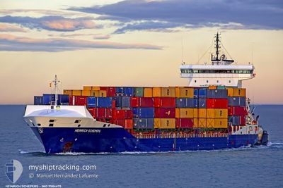
SAMSKIP TOUBKAL
Container Ship
Current Trip
| Time Travelled | 6 days |
|---|---|
| Remaining Time | 1 day |
| Distance Travelled | 1232.60 nm |
| Remaining Distance | 637.61 nm |
| AVG Speed | 12.6 Noeuds |
| MAX Speed | 16.7 Noeuds |
| AVG Wind | 18.1 knots |
| MAX Wind | 35.5 knots |
| MIN Temp | 4°C / 39.2°F |
| MAX Temp | 17.4°C / 63.32°F |
| Tirant d eau | 7 m |
| Position reçue | 20 h, 56 m depuis |
Current Position
| Longitude | --- |
|---|---|
| Latitude | --- |
| Etat | Under way using engine |
| Vitesse | 12.6 Noeuds |
| Parcours | 265.1° |
| Zone | North Atlantic Ocean |
| Station | T-AIS |
| Position reçue | 20 h, 56 m depuis |
Info
Information
The current position of SAMSKIP TOUBKAL is in North Atlantic Ocean with coordinates 44.02500° / -7.73907° as reported on 2025-12-09 11:52 by AIS to our vessel tracker app. The vessel's current speed is 12.6 Noeuds and is heading at the port of CASABLANCA. The estimated time of arrival as calculated by MyShipTracking vessel tracking app is 2025-12-11 19:21 LT
The vessel SAMSKIP TOUBKAL (IMO: 9584475, MMSI: 255806484) is a Container Ship that was built in 2012 ( 13 Age ). It's sailing under the flag of [PT] Portugal.
In this page you can find informations about the vessels current position, last detected port calls, and current voyage information. If the vessels is not in coverage by AIS you will find the latest position.
The current position of SAMSKIP TOUBKAL is detected by our AIS receivers and we are not responsible for the reliability of the data. The last position was recorded while the vessel was in Coverage by the Ais receivers of our vessel tracking app.
The current draught of SAMSKIP TOUBKAL as reported by AIS is 7 meters
Weather
| Temperature | 15.2°C / 59.36°F |
|---|---|
| Wind Speed | 11 knots |
| Direction | 354° N |
| Pressure | 1020.9 hPa |
| Humidity | 65.5 % |
| Cloud Coverage | --- |
Featured Company
Last Port Calls
| Port | Arrival | Departure | Time In Port |
|---|---|---|---|
| 2025-12-04 04:21 | 2025-12-04 04:31 | 9 m | |
| 2025-12-03 16:21 | |||
| 2025-12-02 06:51 | 2025-12-02 16:06 | 9 h | |
| 2025-12-02 06:31 | 2025-12-02 06:42 | 10 m | |
| 2025-11-26 07:01 | 2025-11-28 00:11 | 1 d | |
| 2025-11-20 05:33 | 2025-11-21 00:13 | 18 h | |
| 2025-11-19 04:19 | 2025-11-19 11:02 | 6 h | |
| 2025-11-14 11:38 | 2025-11-14 17:42 | 6 h | |
| 2025-11-08 05:57 | 2025-11-10 13:48 | 2 d | |
| 2025-10-30 23:34 | 2025-10-31 16:28 | 16 h |
Last Trips
| Origin | Departure | Destination | Arrival | Distance | |
|---|---|---|---|---|---|
| 2025-12-02 16:06 | 2025-12-04 04:21 | 180.23 nm | |||
| 2025-12-02 16:06 | 2025-12-03 16:21 | 179.73 nm | |||
| 2025-12-02 06:42 | 2025-12-02 06:51 | 0.23 nm | |||
| 2025-11-28 00:11 | 2025-12-02 06:31 | 1544.44 nm | |||
| 2025-11-21 00:13 | 2025-11-26 07:01 | 1663.46 nm | |||
| 2025-11-19 11:02 | 2025-11-20 05:33 | 217.18 nm | |||
| 2025-11-14 17:42 | 2025-11-19 04:19 | 1598.22 nm | |||
| 2025-11-10 13:48 | 2025-11-14 11:38 | 11.61 nm | |||
| 2025-10-31 16:28 | 2025-11-08 05:57 | 1629.51 nm | |||
| 2025-10-30 15:57 | 2025-10-30 23:34 | 79.78 nm |
Events
| Heure | Evenement | Détails | Position/ Destination | Info |
|---|---|---|---|---|
| 2025-12-09 11:56 | Etat Changé | Default Under way using engine |
44.02297 / -7.75946
MACAS
|
Vitesse: 12.6 kn Parcours: 265.1° |
| 2025-12-09 11:52 | Etat Changé | Under way using engine Default |
44.02500 / -7.73907
MACAS
|
Vitesse: 12.7 kn Parcours: 261° |
| 2025-12-09 11:52 | Hors de la zone couverte |
44.02500 / -7.73907
North Atlantic Ocean
MACAS
|
Vitesse: 12.6 kn Parcours: 265.1° |
|
| 2025-12-09 11:47 | Etat Changé | Default Under way using engine |
44.02691 / -7.71598
MACAS
|
Vitesse: 13 kn Parcours: 264° |
| 2025-12-09 11:36 | Etat Changé | Under way using engine Default |
44.03133 / -7.65904
MACAS
|
Vitesse: 13.5 kn Parcours: 266° |
| 2025-12-09 11:35 | Etat Changé | Default Under way using engine |
44.03154 / -7.65550
MACAS
|
Vitesse: 13 kn Parcours: 265.9° |
| 2025-12-09 11:29 | Changement de zone | Spanish part of the North Atlantic Ocean Spanish part of the Bay of Biscay |
44.03361 / -7.62762
North Atlantic Ocean
MACAS
|
Vitesse: 13 kn Parcours: 265.9° |
| 2025-12-09 11:21 | Etat Changé | Under way using engine Default |
44.03688 / -7.58547
MACAS
|
Vitesse: 13.6 kn Parcours: 265° |
| 2025-12-09 11:11 | Etat Changé | Default Under way using engine |
44.04049 / -7.53434
MACAS
|
Vitesse: 12.7 kn Parcours: 268.4° |
| 2025-12-09 11:03 | Etat Changé | Under way using engine Default |
44.04241 / -7.49358
MACAS
|
Vitesse: 13.5 kn Parcours: 269° |