
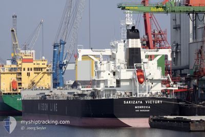
SAKIZAYA VICTORY
Cargo
Current Trip
| Time Travelled | 6 days |
|---|---|
| Remaining Time | --- |
| Distance Travelled | 1686.44 nm |
| Remaining Distance | --- |
| AVG Speed | 10.8 Noeuds |
| MAX Speed | 13.2 Noeuds |
| AVG Wind | 14 knots |
| MAX Wind | 26.2 knots |
| MIN Temp | 11.7°C / 53.06°F |
| MAX Temp | 19.2°C / 66.56°F |
| Tirant d eau | 12.6 m |
| Position reçue | 2 d depuis |
Current Position
| Longitude | 117.26695° |
|---|---|
| Latitude | -35.68796° |
| Etat | Under way using engine |
| Vitesse | 9.7 Noeuds |
| Parcours | 250.7° |
| Zone | Indian Ocean |
| Station | T-AIS |
| Position reçue | 2 d depuis |
Info
Information
The current position of SAKIZAYA VICTORY is in Indian Ocean with coordinates -35.68796° / 117.26695° as reported on 2024-04-23 20:59 by AIS to our vessel tracker app. The vessel's current speed is 9.7 Noeuds and is heading at the port of LAS PALMAS. The estimated time of arrival as calculated by MyShipTracking vessel tracking app is 2024-05-28 01:00 LT
The vessel SAKIZAYA VICTORY (IMO: 9892688, MMSI: 636020768) is a Cargo It's sailing under the flag of [LR] Liberia.
In this page you can find informations about the vessels current position, last detected port calls, and current voyage information. If the vessels is not in coverage by AIS you will find the latest position.
The current position of SAKIZAYA VICTORY is detected by our AIS receivers and we are not responsible for the reliability of the data. The last position was recorded while the vessel was in Coverage by the Ais receivers of our vessel tracking app.
The current draught of SAKIZAYA VICTORY as reported by AIS is 12.6 meters
Weather
| Temperature | 17.1°C / 62.78°F |
|---|---|
| Wind Speed | 14 knots |
| Direction | 294° WNW |
| Pressure | 1018.6 hPa |
| Humidity | 80.3 % |
| Cloud Coverage | 86 % |
Featured Company
Last Port Calls
| Port | Arrival | Departure | Time In Port |
|---|---|---|---|
| 2024-04-16 06:01 | 2024-04-19 19:21 | 3 d | |
| 2024-03-08 16:03 | |||
| 2024-02-16 09:48 | 2024-02-17 13:21 | 1 d |
Most Visited Ports (Last year)
| Port | Arrivals | |
|---|---|---|
| 2 | ||
| 1 | ||
| 1 | ||
| 1 | ||
| 1 | ||
| 1 |
Last Trips
| Origin | Departure | Destination | Arrival | Distance | |
|---|---|---|---|---|---|
| 2024-03-09 00:03 | 2024-04-16 15:31 | 6064.11 nm | |||
| 2023-12-12 12:01 | 2024-02-16 17:48 | 4669.67 nm |
Events
| Heure | Evenement | Détails | Position/ Destination | Info |
|---|---|---|---|---|
| 2024-04-23 21:06 | Etat Changé | Default Under way using engine |
-35.69492 / 117.24339
LAS PALMAS
|
Vitesse: 9.7 kn Parcours: 250.7° |
| 2024-04-23 20:59 | Hors de la zone couverte |
-35.68796 / 117.26695
Indian Ocean
|
Vitesse: 9.7 kn Parcours: 250.7° |
|
| 2024-04-23 15:10 | Detecté en mer | Australian part of the Indian Ocean |
-35.35385 / 118.33800
Indian Ocean
|
Vitesse: 10.4 kn Parcours: 247.4° |
| 2024-04-23 11:50 | Etat Changé | Under way using engine Default |
-35.16368 / 119.03587
LAS PALMAS
|
Vitesse: 10.1 kn Parcours: 246° |
| 2024-04-23 11:50 | Dans la zone couverte |
-35.16633 / 119.02734
Great Australian Bight
|
Vitesse: 10.1 kn Parcours: 250.7° |
|
| 2024-04-23 03:05 | Etat Changé | Default Under way using engine |
-34.91464 / 120.79050
LAS PALMAS
|
Vitesse: 10 kn Parcours: 274° |
| 2024-04-23 02:57 | Hors de la zone couverte |
-34.91502 / 120.81838
Great Australian Bight
|
Vitesse: 10 kn Parcours: 274° |
|
| 2024-04-23 02:55 | Etat Changé | Under way using engine Default |
-34.91541 / 120.82826
LAS PALMAS
|
Vitesse: 10.4 kn Parcours: 273° |
| 2024-04-23 02:47 | Dans la zone couverte |
-34.91530 / 120.82535
Great Australian Bight
|
Vitesse: 10.5 kn Parcours: 272.4° |
|
| 2024-04-21 02:15 | Hors de la zone couverte |
-35.49802 / 131.53749
Great Australian Bight
|
Vitesse: 11.7 kn Parcours: 272.7° |