
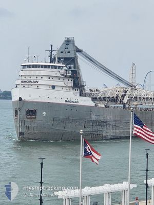
SAGINAW
Self Discharging Bulk Carrier
Current Trip
| Trip Time | 9 h, 52 mins |
|---|---|
| Trip Distance | 93.85 nm |
| AVG Speed | 8.5 Noeuds |
| MAX Speed | 14.2 Noeuds |
| Tirant d eau | 5.7 m |
| AVG Wind | 8.2 knots |
| MAX Wind | 11.8 knots |
| MIN Temp | 21.7°C / 71.06°F |
| MAX Temp | 25.4°C / 77.72°F |
| Position reçue | 1 m depuis |
Current Position
| Longitude | -82.72946° |
|---|---|
| Latitude | 41.54454° |
| Etat | Under way using engine |
| Vitesse | |
| Parcours | 183° |
| Zone | Gulf of St-Lawrence |
| Station | T-AIS |
| Position reçue | 1 m depuis |
Info
Information
The current position of SAGINAW is in Gulf of St-Lawrence with coordinates 41.54454° / -82.72946° as reported on 2024-09-01 04:19 by AIS to our vessel tracker app. The vessel's current speed is 0 Noeuds and is currently inside the port of LAKESIDE MARBLEHEAD.
The vessel SAGINAW (IMO: 5173876, MMSI: 316004950) is a Self Discharging Bulk Carrier that was built in 1953 ( 71 Age ). It's sailing under the flag of [CA] Canada.
In this page you can find informations about the vessels current position, last detected port calls, and current voyage information. If the vessels is not in coverage by AIS you will find the latest position.
The current position of SAGINAW is detected by our AIS receivers and we are not responsible for the reliability of the data. The last position was recorded while the vessel was in Coverage by the Ais receivers of our vessel tracking app.
The current draught of SAGINAW as reported by AIS is 5.7 meters
Weather
| Temperature | 20.7°C / 69.26°F |
|---|---|
| Wind Speed | 10 knots |
| Direction | 213° SSW |
| Pressure | 1013.9 hPa |
| Humidity | 56.2 % |
| Cloud Coverage | 89 % |
Featured Company
Last Port Calls
| Port | Arrival | Departure | Time In Port |
|---|---|---|---|
| 2024-08-31 19:14 | |||
| 2024-08-29 23:33 | 2024-08-31 09:22 | 1 d | |
| 2024-08-29 10:06 | 2024-08-29 12:45 | 2 h | |
| 2024-08-26 11:54 | 2024-08-27 15:51 | 1 d | |
| 2024-08-25 07:55 | 2024-08-25 18:40 | 10 h | |
| 2024-08-25 06:07 | 2024-08-25 06:54 | 47 m | |
| 2024-08-24 13:35 | 2024-08-25 01:23 | 11 h | |
| 2024-08-23 12:20 | 2024-08-23 19:12 | 6 h | |
| 2024-08-21 20:51 | 2024-08-22 08:07 | 11 h | |
| 2024-08-21 04:18 | 2024-08-21 13:42 | 9 h |
Most Visited Ports (Last year)
| Port | Arrivals | |
|---|---|---|
| 66 | ||
| 21 | ||
| 16 | ||
| 16 | ||
| 13 | ||
| 10 |
Last Trips
| Origin | Departure | Destination | Arrival | Distance | |
|---|---|---|---|---|---|
| 2024-08-31 09:22 | 2024-08-31 19:14 | 93.85 nm | |||
| 2024-08-29 12:45 | 2024-08-29 23:33 | 104.03 nm | |||
| 2024-08-27 15:51 | 2024-08-29 10:06 | 498.75 nm | |||
| 2024-08-25 18:40 | 2024-08-26 11:54 | 232.99 nm | |||
| 2024-08-25 06:54 | 2024-08-25 07:55 | 2.50 nm | |||
| 2024-08-25 01:23 | 2024-08-25 06:07 | 40.68 nm | |||
| 2024-08-23 19:12 | 2024-08-24 13:35 | 200.59 nm | |||
| 2024-08-22 08:07 | 2024-08-23 12:20 | 239.95 nm | |||
| 2024-08-21 13:42 | 2024-08-21 20:51 | 69.24 nm | |||
| 2024-08-18 08:21 | 2024-08-21 04:18 | 471.46 nm |
Events
| Heure | Evenement | Détails | Position/ Destination | Info |
|---|---|---|---|---|
| 2024-09-01 01:15 | Changement de destination | WINDSOR MARBLE HEAD |
41.54429 / -82.72948
[US] LAKESIDE MARBLEHEAD
|
Vitesse: Parcours: 182° |
| 2024-09-01 01:15 | Changement d'ETA | 2024/09/01 16:30 2024/09/01 00:30 |
41.54429 / -82.72948
[US] LAKESIDE MARBLEHEAD
|
Vitesse: Parcours: 182° |
| 2024-09-01 01:04 | Etat Changé | Under way using engine Default |
41.54428 / -82.72948
[US] LAKESIDE MARBLEHEAD
|
Vitesse: Parcours: 182° |
| 2024-09-01 01:01 | Etat Changé | Default Under way using engine |
41.54428 / -82.72948
[US] LAKESIDE MARBLEHEAD
|
Vitesse: Parcours: 183° |
| 2024-08-31 23:14 | Arret |
41.54584 / -82.72938
[US] LAKESIDE MARBLEHEAD
|
Vitesse: 0.3 kn Parcours: 182° |
|
| 2024-08-31 23:14 | Port d'arrivée |
|
41.54591 / -82.72940
[US] LAKESIDE MARBLEHEAD
|
Vitesse: 0.6 kn Parcours: 181° |
| 2024-08-31 17:00 | Changement d'ETA | 2024/09/01 00:30 2024/09/01 05:00 |
41.65640 / -82.53268
MARBLE HEAD
|
Vitesse: 14.1 kn Parcours: 89.6° |
| 2024-08-31 13:22 | PORT DE DEPART |
|
41.69497 / -83.46631
MARBLE HEAD
|
Vitesse: 6 kn Parcours: 42° |
| 2024-08-31 12:45 | Tirant d'eau modifié | 5.7 6.8 |
41.65837 / -83.51812
[US] TOLEDO
|
Vitesse: 4.4 kn Parcours: 54° |
| 2024-08-31 12:45 | Changement de destination | MARBLE HEAD TOLEDO |
41.65837 / -83.51812
[US] TOLEDO
|
Vitesse: 4.4 kn Parcours: 54° |