
RIVER HARMONY
Other Type
Current Trip
| Time Travelled | 1 day |
|---|---|
| Remaining Time | --- |
| Distance Travelled | 46.03 nm |
| Remaining Distance | --- |
| AVG Speed | 7.7 Noeuds |
| MAX Speed | 9 Noeuds |
| AVG Wind | 5.7 knots |
| MAX Wind | 6.8 knots |
| MIN Temp | 8.6°C / 47.48°F |
| MAX Temp | 12.4°C / 54.32°F |
| Tirant d eau | 1.6 m |
| Position reçue | 1 d depuis |
Current Position
| Longitude | --- |
|---|---|
| Latitude | --- |
| Etat | Under way using engine |
| Vitesse | 6.7 Noeuds |
| Parcours | 208.8° |
| Zone | North Sea |
| Station | T-AIS |
| Position reçue | 1 d depuis |
Info
Information
The current position of RIVER HARMONY is in North Sea with coordinates 49.35055° / 8.48545° as reported on 2025-12-09 04:11 by AIS to our vessel tracker app. The vessel's current speed is 6.7 Noeuds
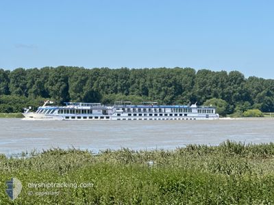
The vessel RIVER HARMONY (MMSI: 256897000) is a Other Type It's sailing under the flag of [MT] Malta.
In this page you can find informations about the vessels current position, last detected port calls, and current voyage information. If the vessels is not in coverage by AIS you will find the latest position.
The current position of RIVER HARMONY is detected by our AIS receivers and we are not responsible for the reliability of the data. The last position was recorded while the vessel was in Coverage by the Ais receivers of our vessel tracking app.
The current draught of RIVER HARMONY as reported by AIS is 1.6 meters
Weather
| Temperature | 8.6°C / 47.48°F |
|---|---|
| Wind Speed | 6 knots |
| Direction | 200° SSW |
| Pressure | 1019.2 hPa |
| Humidity | 77.2 % |
| Cloud Coverage | 61 % |
Featured Company
Last Port Calls
| Port | Arrival | Departure | Time In Port |
|---|---|---|---|
| 2025-12-07 20:44 | 2025-12-08 22:11 | 1 d | |
| 2025-12-07 06:32 | 2025-12-07 13:57 | 7 h | |
| 2025-12-06 08:34 | 2025-12-06 22:46 | 14 h | |
| 2025-12-03 19:58 | 2025-12-04 21:39 | 1 d | |
| 2025-12-01 15:36 | 2025-12-02 22:59 | 1 d | |
| 2025-11-30 22:59 | 2025-12-01 14:00 | 15 h | |
| 2025-11-30 11:39 | 2025-11-30 20:15 | 8 h | |
| 2025-11-28 16:09 | 2025-11-30 07:35 | 1 d | |
| 2025-11-26 05:37 | 2025-11-27 06:16 | 1 d | |
| 2025-11-21 04:38 | 2025-11-22 15:01 | 1 d |
Most Visited Ports (Last year)
| Port | Arrivals | |
|---|---|---|
| 15 | ||
| 14 | ||
| 10 | ||
| 9 | ||
| 6 | ||
| 5 |
Last Trips
| Origin | Departure | Destination | Arrival | Distance | |
|---|---|---|---|---|---|
| 2025-12-07 13:57 | 2025-12-07 20:44 | 17.90 nm | |||
| 2025-12-06 22:46 | 2025-12-07 06:32 | 42.83 nm | |||
| 2025-12-04 21:39 | 2025-12-06 08:34 | 143.91 nm | |||
| 2025-12-02 22:59 | 2025-12-03 19:58 | 145.94 nm | |||
| 2025-12-01 14:00 | 2025-12-01 15:36 | 13.62 nm | |||
| 2025-11-30 20:15 | 2025-11-30 22:59 | 14.15 nm | |||
| 2025-11-30 07:35 | 2025-11-30 11:39 | 39.68 nm | |||
| 2025-11-27 06:16 | 2025-11-28 16:09 | 44.98 nm | |||
| 2025-11-22 15:01 | 2025-11-26 05:37 | 123.11 nm | |||
| 2025-11-14 19:05 | 2025-11-21 04:38 | 272.07 nm |
Events
| Heure | Evenement | Détails | Position/ Destination | Info |
|---|---|---|---|---|
| 2025-12-09 04:11 | Hors de la zone couverte |
49.35055 / 8.48545
North Sea
BASEL
|
Vitesse: 6.7 kn Parcours: 208.8° |
|
| 2025-12-09 03:14 | Dans la zone couverte |
49.44427 / 8.48921
North Sea
BASEL
|
Vitesse: 6.7 kn Parcours: 90.9° |
|
| 2025-12-08 23:52 | Hors de la zone couverte |
49.73251 / 8.44787
North Sea
BASEL
|
Vitesse: 7.6 kn Parcours: 204.4° |
|
| 2025-12-08 23:51 | Etat Changé | Under way using engine Default |
49.73533 / 8.44984
BASEL
|
Vitesse: 8 kn Parcours: 225° |
| 2025-12-08 23:40 | Etat Changé | Default Under way using engine |
49.75167 / 8.47166
BASEL
|
Vitesse: 7.4 kn Parcours: 211.7° |
| 2025-12-08 21:18 | Dans la zone couverte |
49.98576 / 8.30406
North Sea
BASEL
|
Vitesse: 7.9 kn Parcours: 132.4° |
|
| 2025-12-08 21:11 | PORT DE DEPART |
|
49.98576 / 8.30406
BASEL
|
Vitesse: Parcours: -1° |
| 2025-12-07 19:44 | Port d'arrivée |
|
49.99500 / 8.28333
[DE] MAINZ
|
Vitesse: 6.7 kn Parcours: 66.8° |
| 2025-12-07 18:34 | Hors de la zone couverte |
50.01455 / 8.08128
North Sea
BASEL
|
Vitesse: 6.7 kn Parcours: 66.8° |
|
| 2025-12-07 17:55 | Dans la zone couverte |
49.98206 / 7.98000
North Sea
BASEL
|
Vitesse: 6.9 kn Parcours: 62.5° |