
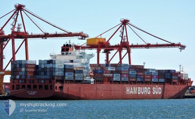
RIO BLANCO
Container Ship
Current Trip
| Time Travelled | 2 days |
|---|---|
| Remaining Time | 6 days |
| Distance Travelled | 1254.49 nm |
| Remaining Distance | 2754.56 nm |
| AVG Speed | 17.6 Noeuds |
| MAX Speed | 19.3 Noeuds |
| AVG Wind | 14.9 knots |
| MAX Wind | 22.9 knots |
| MIN Temp | 13.5°C / 56.3°F |
| MAX Temp | 18.4°C / 65.12°F |
| Tirant d eau | 13.6 m |
| Position reçue | 1 h, 20 m depuis |
Current Position
| Longitude | 120.36238° |
|---|---|
| Latitude | -35.98868° |
| Etat | Under way using engine |
| Vitesse | 17.6 Noeuds |
| Parcours | 280.1° |
| Zone | Indian Ocean |
| Station | T-AIS |
| Position reçue | 1 h, 20 m depuis |
Info
Information
The current position of RIO BLANCO is in Indian Ocean with coordinates -35.98868° / 120.36238° as reported on 2024-04-27 00:07 by AIS to our vessel tracker app. The vessel's current speed is 17.6 Noeuds and is heading at the port of TANJUNG PELEPAS. The estimated time of arrival as calculated by MyShipTracking vessel tracking app is 2024-05-03 10:36 LT
The vessel RIO BLANCO (IMO: 9348089, MMSI: 563050200) is a Container Ship that was built in 2009 ( 15 Age ). It's sailing under the flag of [SG] Singapore.
In this page you can find informations about the vessels current position, last detected port calls, and current voyage information. If the vessels is not in coverage by AIS you will find the latest position.
The current position of RIO BLANCO is detected by our AIS receivers and we are not responsible for the reliability of the data. The last position was recorded while the vessel was in Coverage by the Ais receivers of our vessel tracking app.
The current draught of RIO BLANCO as reported by AIS is 13.6 meters
Weather
| Temperature | 17.8°C / 64.04°F |
|---|---|
| Wind Speed | 17 knots |
| Direction | 269° W |
| Pressure | 1015.2 hPa |
| Humidity | 85.7 % |
| Cloud Coverage | 100 % |
Featured Company
Last Port Calls
| Port | Arrival | Departure | Time In Port |
|---|---|---|---|
| 2024-04-23 02:36 | 2024-04-24 03:08 | 1 d | |
| 2024-04-16 04:46 | 2024-04-18 06:19 | 2 d | |
| 2024-04-11 20:35 | 2024-04-13 08:40 | 1 d | |
| 2024-04-06 00:50 | 2024-04-07 07:04 | 1 d | |
| 2024-03-31 02:33 | 2024-04-01 18:24 | 1 d | |
| 2024-03-17 23:34 | 2024-03-19 06:29 | 1 d | |
| 2024-03-15 19:58 | 2024-03-16 22:13 | 1 d | |
| 2024-02-27 07:57 | 2024-03-01 07:48 | 2 d | |
| 2024-02-22 03:59 | 2024-02-23 19:25 | 1 d | |
| 2024-02-19 09:18 | 2024-02-20 09:56 | 1 d |
Most Visited Ports (Last year)
| Port | Arrivals | |
|---|---|---|
| 8 | ||
| 8 | ||
| 8 | ||
| 8 | ||
| 8 | ||
| 5 |
Last Trips
| Origin | Departure | Destination | Arrival | Distance | |
|---|---|---|---|---|---|
| 2024-04-18 18:19 | 2024-04-23 12:36 | 1377.93 nm | |||
| 2024-04-13 20:40 | 2024-04-16 16:46 | 206.70 nm | |||
| 2024-04-07 19:04 | 2024-04-12 08:35 | 639.06 nm | |||
| 2024-04-02 05:24 | 2024-04-06 13:50 | 1390.31 nm | |||
| 2024-03-19 14:29 | 2024-03-31 13:33 | 4252.73 nm | |||
| 2024-03-17 06:13 | 2024-03-18 07:34 | 59.77 nm | |||
| 2024-03-01 20:48 | 2024-03-16 03:58 | 5878.43 nm | |||
| 2024-02-24 08:25 | 2024-02-27 20:57 | 208.43 nm | |||
| 2024-02-20 22:56 | 2024-02-22 16:59 | 357.82 nm | |||
| 2024-02-19 03:18 | 2024-02-19 22:18 | 317.45 nm |
Events
| Heure | Evenement | Détails | Position/ Destination | Info |
|---|---|---|---|---|
| 2024-04-27 00:12 | Etat Changé | Default Under way using engine |
-35.98425 / 120.33247
MYTPPTM
|
Vitesse: 17.6 kn Parcours: 280.1° |
| 2024-04-27 00:07 | Hors de la zone couverte |
-35.98868 / 120.36238
Indian Ocean
MYTPPTM
|
Vitesse: 17.6 kn Parcours: 280.1° |
|
| 2024-04-26 23:50 | Etat Changé | Under way using engine Default |
-36.00287 / 120.45950
MYTPPTM
|
Vitesse: 17.4 kn Parcours: 279° |
| 2024-04-26 23:45 | Etat Changé | Default Under way using engine |
-36.00773 / 120.49384
MYTPPTM
|
Vitesse: 17.6 kn Parcours: 279.3° |
| 2024-04-26 23:23 | Changement de zone | Australian part of the Indian Ocean Australian part of the Great Australian Bight |
-36.02575 / 120.62378
Indian Ocean
MYTPPTM
|
Vitesse: 17.8 kn Parcours: 280.2° |
| 2024-04-26 23:20 | Tirant d'eau modifié | 13.6 13 |
-36.02852 / 120.64227
MYTPPTM
|
Vitesse: 17.8 kn Parcours: 280.7° |
| 2024-04-26 23:13 | Etat Changé | Under way using engine Default |
-36.03448 / 120.68170
MYTPPTM
|
Vitesse: 17.7 kn Parcours: 280° |
| 2024-04-26 23:02 | Dans la zone couverte |
-36.03385 / 120.67748
Great Australian Bight
MYTPPTM
|
Vitesse: 17.9 kn Parcours: 281.7° |
|
| 2024-04-24 13:15 | Etat Changé | Default Under way using engine |
-38.95032 / 142.48244
MYTPPTM
|
Vitesse: 17.3 kn Parcours: 279° |
| 2024-04-24 13:10 | Hors de la zone couverte |
-38.95463 / 142.51250
Great Australian Bight
MYTPPTM
|
Vitesse: 17.3 kn Parcours: 279° |