
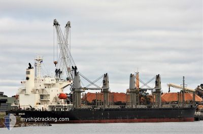
REIWA BREEZE
Cargo
Current Trip
BR RIG
| Time Travelled | 1 day |
|---|---|
| Remaining Time | --- |
| Distance Travelled | 280.56 nm |
| Remaining Distance | --- |
| AVG Speed | 10 Noeuds |
| MAX Speed | 15.7 Noeuds |
| AVG Wind | 16.8 knots |
| MAX Wind | 29 knots |
| MIN Temp | 10.3°C / 50.54°F |
| MAX Temp | 16.5°C / 61.7°F |
| Tirant d eau | 9.5 m |
| Position reçue | 7 d depuis |
Current Position
| Longitude | -52.07335° |
|---|---|
| Latitude | -32.04587° |
| Etat | Moored |
| Vitesse | |
| Parcours | 345° |
| Zone | South Atlantic Ocean |
| Station | T-AIS |
| Position reçue | 7 d depuis |
Info
Information
The current position of REIWA BREEZE is in South Atlantic Ocean with coordinates -32.04587° / -52.07335° as reported on 2024-05-27 13:07 by AIS to our vessel tracker app. The vessel's current speed is 0 Noeuds
The vessel REIWA BREEZE (IMO: 9757802, MMSI: 563930000) is a Cargo It's sailing under the flag of [SG] Singapore.
In this page you can find informations about the vessels current position, last detected port calls, and current voyage information. If the vessels is not in coverage by AIS you will find the latest position.
The current position of REIWA BREEZE is detected by our AIS receivers and we are not responsible for the reliability of the data. The last position was recorded while the vessel was in Coverage by the Ais receivers of our vessel tracking app.
The current draught of REIWA BREEZE as reported by AIS is 9.5 meters
Weather
| Temperature | 10.5°C / 50.9°F |
|---|---|
| Wind Speed | 12 knots |
| Direction | 185° S |
| Pressure | 1028.3 hPa |
| Humidity | 63.4 % |
| Cloud Coverage | 100 % |
Featured Company
Last Port Calls
| Port | Arrival | Departure | Time In Port |
|---|---|---|---|
| 2024-05-25 18:05 | 2024-06-02 07:59 | 7 d | |
| 2024-05-13 20:41 | 2024-05-18 20:28 | 4 d | |
| 2024-04-10 12:41 | 2024-04-13 20:18 | 3 d |
Most Visited Ports (Last year)
| Port | Arrivals | |
|---|---|---|
| 2 | ||
| 2 | ||
| 2 | ||
| 1 | ||
| 1 | ||
| 1 |
Events
| Heure | Evenement | Détails | Position/ Destination | Info |
|---|---|---|---|---|
| 2024-06-02 10:59 | PORT DE DEPART |
|
-32.05624 / -52.06976
BR RIG
|
Vitesse: 3.8 kn Parcours: 353° |
| 2024-06-02 10:55 | Démarrage |
-32.05183 / -52.07021
[BR] RIO GRANDE
|
Vitesse: 3.8 kn Parcours: 353° |
|
| 2024-05-27 13:13 | Etat Changé | Default Moored |
-32.04589 / -52.07339
[BR] RIO GRANDE
|
Vitesse: Parcours: 345° |
| 2024-05-27 13:07 | Hors de la zone couverte |
-32.04587 / -52.07335
South Atlantic Ocean
[BR] RIO GRANDE
|
Vitesse: Parcours: 290.3° |
|
| 2024-05-27 11:55 | Etat Changé | Moored Default |
-32.04591 / -52.07335
[BR] RIO GRANDE
|
Vitesse: Parcours: 345° |
| 2024-05-27 11:52 | Etat Changé | Default Moored |
-32.04589 / -52.07336
[BR] RIO GRANDE
|
Vitesse: Parcours: 345° |
| 2024-05-27 11:25 | Etat Changé | Moored Default |
-32.04586 / -52.07333
[BR] RIO GRANDE
|
Vitesse: Parcours: 345° |
| 2024-05-27 11:22 | Dans la zone couverte |
-32.04586 / -52.07333
South Atlantic Ocean
[BR] RIO GRANDE
|
Vitesse: Parcours: 143.9° |
|
| 2024-05-26 21:01 | Etat Changé | Default Moored |
-32.04593 / -52.07332
[BR] RIO GRANDE
|
Vitesse: Parcours: 345° |
| 2024-05-26 20:55 | Hors de la zone couverte |
-32.04588 / -52.07334
South Atlantic Ocean
[BR] RIO GRANDE
|
Vitesse: Parcours: 139.5° |