
RAYES
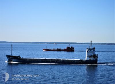
General Cargo
Current Trip
| Trip Time | 26 days |
|---|---|
| Trip Distance | 1302.68 nm |
| AVG Speed | 8.4 Noeuds |
| MAX Speed | 11.8 Noeuds |
| Tirant d eau | 4.5 m |
| AVG Wind | 9.5 knots |
| MAX Wind | 21 knots |
| MIN Temp | 9.2°C / 48.56°F |
| MAX Temp | 21.2°C / 70.16°F |
| Position reçue | 4 d depuis |
Current Position
| Longitude | 35.67283° |
|---|---|
| Latitude | 34.50335° |
| Etat | Under way using engine |
| Vitesse | 9.7 Noeuds |
| Parcours | 88.5° |
| Zone | Mediterranean Sea - Eastern Basin |
| Station | T-AIS |
| Position reçue | 4 d depuis |
Info
Information
The current position of RAYES is in Mediterranean Sea - Eastern Basin with coordinates 34.50335° / 35.67283° as reported on 2024-05-01 19:52 by AIS to our vessel tracker app. The vessel's current speed is 9.7 Noeuds and is currently inside the port of TRIPOLI.
The vessel RAYES (IMO: 8806151, MMSI: 667001994) is a General Cargo that was built in 1989 ( 35 Age ). It's sailing under the flag of [SL] Sierra Leone.
In this page you can find informations about the vessels current position, last detected port calls, and current voyage information. If the vessels is not in coverage by AIS you will find the latest position.
The current position of RAYES is detected by our AIS receivers and we are not responsible for the reliability of the data. The last position was recorded while the vessel was in Coverage by the Ais receivers of our vessel tracking app.
The current draught of RAYES as reported by AIS is 4.5 meters
Weather
| Temperature | 17.9°C / 64.22°F |
|---|---|
| Wind Speed | 17 knots |
| Direction | 220° SW |
| Pressure | 1008.2 hPa |
| Humidity | 74.3 % |
| Cloud Coverage | 100 % |
Featured Company
Last Port Calls
| Port | Arrival | Departure | Time In Port |
|---|---|---|---|
| 2024-05-02 11:51 | |||
| 2024-04-01 09:04 | 2024-04-06 05:36 | 4 d | |
| 2024-03-27 21:07 | 2024-04-01 06:35 | 4 d | |
| 2024-03-08 16:19 |
Most Visited Ports (Last year)
| Port | Arrivals | |
|---|---|---|
| 3 | ||
| 3 | ||
| 2 | ||
| 2 | ||
| 1 | ||
| 1 |
Last Trips
| Origin | Departure | Destination | Arrival | Distance | |
|---|---|---|---|---|---|
| 2024-04-06 08:36 | 2024-05-02 14:51 | 1302.68 nm | |||
| 2024-04-01 09:35 | 2024-04-01 12:04 | 19.30 nm | |||
| 2024-03-08 18:19 | 2024-03-27 23:07 | 1523.69 nm |
Events
| Heure | Evenement | Détails | Position/ Destination | Info |
|---|---|---|---|---|
| 2024-05-02 11:51 | Port d'arrivée |
|
34.45833 / 35.82667
[LB] TRIPOLI
|
Vitesse: Parcours: -1° |
| 2024-05-01 20:16 | Etat Changé | Default Under way using engine |
34.50670 / 35.74620
TRIPOLI
|
Vitesse: 9.7 kn Parcours: 88.5° |
| 2024-05-01 19:52 | Hors de la zone couverte |
34.50335 / 35.67283
Mediterranean Sea - Eastern Basin
|
Vitesse: 9.7 kn Parcours: 88.5° |
|
| 2024-05-01 18:56 | Tirant d'eau modifié | 4.5 7.1 |
34.51712 / 35.51693
TRIPOLI
|
Vitesse: 9.2 kn Parcours: 188.2° |
| 2024-05-01 18:56 | Changement d'ETA | 2025/01/05 20:00 2024/04/13 13:00 |
34.51712 / 35.51693
TRIPOLI
|
Vitesse: 9.2 kn Parcours: 188.2° |
| 2024-05-01 18:50 | Etat Changé | Under way using engine Default |
34.53002 / 35.51913
TRIPOLI
|
Vitesse: 9.2 kn Parcours: 187° |
| 2024-05-01 18:47 | Etat Changé | Default Under way using engine |
34.53853 / 35.52063
TRIPOLI
|
Vitesse: 8.9 kn Parcours: 187.7° |
| 2024-05-01 18:36 | Detecté en mer | Lebanese part of the Mediterranean Sea - Eastern Basin |
34.56788 / 35.52610
Mediterranean Sea - Eastern Basin
|
Vitesse: 9.2 kn Parcours: 189.4° |
| 2024-05-01 18:36 | Etat Changé | Under way using engine Default |
34.56788 / 35.52610
TRIPOLI
|
Vitesse: 9 kn Parcours: 187° |
| 2024-05-01 18:36 | Dans la zone couverte |
34.56788 / 35.52610
Mediterranean Sea - Eastern Basin
|
Vitesse: 9.2 kn Parcours: 189.4° |