
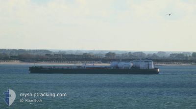
PROTEUS RONG NA
Tanker
Current Trip
| Trip Time | 2 days |
|---|---|
| Trip Distance | 562.76 nm |
| AVG Speed | 10.3 Noeuds |
| MAX Speed | 14.2 Noeuds |
| Tirant d eau | 10.8 m |
| AVG Wind | 10.6 knots |
| MAX Wind | 22 knots |
| MIN Temp | 11°C / 51.8°F |
| MAX Temp | 19.3°C / 66.74°F |
| Position reçue | 8 h, 19 m depuis |
Current Position
| Longitude | --- |
|---|---|
| Latitude | --- |
| Etat | Under way using engine |
| Vitesse | 13.6 Noeuds |
| Parcours | 63.4° |
| Zone | Bass Strait |
| Station | T-AIS |
| Position reçue | 8 h, 19 m depuis |
Info
Information
The current position of PROTEUS RONG NA is in Bass Strait with coordinates -38.43839° / 145.20220° as reported on 2025-12-09 18:07 by AIS to our vessel tracker app. The vessel's current speed is 13.6 Noeuds and is currently inside the port of WESTERNPORT.
The vessel PROTEUS RONG NA (IMO: 9923475, MMSI: 563195500) is a Tanker It's sailing under the flag of [SG] Singapore.
In this page you can find informations about the vessels current position, last detected port calls, and current voyage information. If the vessels is not in coverage by AIS you will find the latest position.
The current position of PROTEUS RONG NA is detected by our AIS receivers and we are not responsible for the reliability of the data. The last position was recorded while the vessel was in Coverage by the Ais receivers of our vessel tracking app.
The current draught of PROTEUS RONG NA as reported by AIS is 10.8 meters
Weather
| Temperature | 15.2°C / 59.36°F |
|---|---|
| Wind Speed | 8 knots |
| Direction | 184° S |
| Pressure | 1022.4 hPa |
| Humidity | 62.1 % |
| Cloud Coverage | 100 % |
Featured Company
Last Port Calls
| Port | Arrival | Departure | Time In Port |
|---|---|---|---|
| 2025-12-10 06:08 | |||
| 2025-12-06 19:47 | 2025-12-07 23:45 | 1 d | |
| 2025-12-04 18:26 | 2025-12-05 18:59 | 1 d | |
| 2025-11-12 08:56 | 2025-11-13 16:28 | 1 d |
Most Visited Ports (Last year)
| Port | Arrivals | |
|---|---|---|
| 3 | ||
| 2 | ||
| 2 | ||
| 2 | ||
| 1 | ||
| 1 |
Last Trips
Events
| Heure | Evenement | Détails | Position/ Destination | Info |
|---|---|---|---|---|
| 2025-12-09 19:08 | Arret |
-38.34961 / 145.22629
[AU] WESTERNPORT
|
Vitesse: 0.1 kn Parcours: 352° |
|
| 2025-12-09 19:08 | Port d'arrivée |
|
-38.34961 / 145.22629
[AU] WESTERNPORT
|
Vitesse: 3.8 kn Parcours: 315° |
| 2025-12-09 18:12 | Etat Changé | Default Under way using engine |
-38.42977 / 145.22226
AUHAS
|
Vitesse: 13.6 kn Parcours: 63.4° |
| 2025-12-09 18:07 | Hors de la zone couverte |
-38.43839 / 145.20220
Bass Strait
AUHAS
|
Vitesse: 13.6 kn Parcours: 63.4° |
|
| 2025-12-09 18:04 | Etat Changé | Under way using engine Default |
-38.44268 / 145.19116
AUHAS
|
Vitesse: 14.1 kn Parcours: 65° |
| 2025-12-09 18:00 | Etat Changé | Default Under way using engine |
-38.45052 / 145.17119
AUHAS
|
Vitesse: 14.1 kn Parcours: 64.3° |
| 2025-12-09 17:59 | Etat Changé | Under way using engine Default |
-38.45134 / 145.16900
AUHAS
|
Vitesse: 14.2 kn Parcours: 46° |
| 2025-12-09 17:08 | Etat Changé | Default Under way using engine |
-38.57044 / 145.02181
AUHAS
|
Vitesse: 8.4 kn Parcours: 29.3° |
| 2025-12-09 16:55 | Etat Changé | Under way using engine Default |
-38.59714 / 145.00731
AUHAS
|
Vitesse: 10.5 kn Parcours: 303° |
| 2025-12-09 16:40 | Etat Changé | Default Under way using engine |
-38.62192 / 145.05356
AUHAS
|
Vitesse: 10 kn Parcours: 303.4° |