
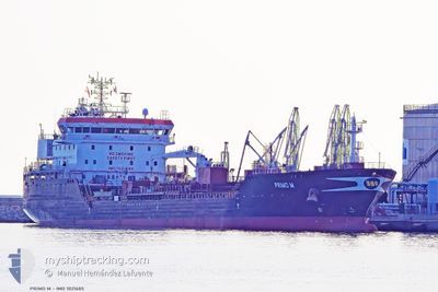
PRIMO M
Tanker A
Current Trip
| Time Travelled | 2 days |
|---|---|
| Remaining Time | 1 day |
| Distance Travelled | 69.98 nm |
| Remaining Distance | 548.34 nm |
| AVG Speed | 9.7 Noeuds |
| MAX Speed | 14.7 Noeuds |
| AVG Wind | 14.9 knots |
| MAX Wind | 28 knots |
| MIN Temp | 12.1°C / 53.78°F |
| MAX Temp | 14.1°C / 57.38°F |
| Tirant d eau | 9.3 m |
| Position reçue | 5 h, 12 m depuis |
Current Position
| Longitude | --- |
|---|---|
| Latitude | --- |
| Etat | Under way using engine |
| Vitesse | 13.3 Noeuds |
| Parcours | 345.4° |
| Zone | English Channel |
| Station | T-AIS |
| Position reçue | 5 h, 12 m depuis |
Info
Information
The current position of PRIMO M is in English Channel with coordinates 49.70725° / -1.03221° as reported on 2025-12-09 19:45 by AIS to our vessel tracker app. The vessel's current speed is 13.3 Noeuds and is heading at the port of BORDEAUX. The estimated time of arrival as calculated by MyShipTracking vessel tracking app is 2025-12-11 15:46 LT
The vessel PRIMO M (IMO: 1021685, MMSI: 247487800) is a Tanker A It's sailing under the flag of [IT] Italy.
In this page you can find informations about the vessels current position, last detected port calls, and current voyage information. If the vessels is not in coverage by AIS you will find the latest position.
The current position of PRIMO M is detected by our AIS receivers and we are not responsible for the reliability of the data. The last position was recorded while the vessel was in Coverage by the Ais receivers of our vessel tracking app.
The current draught of PRIMO M as reported by AIS is 9.3 meters
Weather
| Temperature | 13.7°C / 56.66°F |
|---|---|
| Wind Speed | 21 knots |
| Direction | 235° SW |
| Pressure | 1008 hPa |
| Humidity | 83.6 % |
| Cloud Coverage | 100 % |
Featured Company
Last Port Calls
| Port | Arrival | Departure | Time In Port |
|---|---|---|---|
| 2025-12-05 23:25 | 2025-12-07 22:26 | 1 d | |
| 2025-11-30 18:43 | 2025-12-01 19:00 | 1 d | |
| 2025-11-27 00:10 | 2025-11-27 00:15 | 4 m | |
| 2025-11-24 16:10 | 2025-11-25 19:33 | 1 d | |
| 2025-11-21 01:48 | 2025-11-22 13:39 | 1 d | |
| 2025-11-11 03:20 | 2025-11-12 00:59 | 21 h | |
| 2025-11-04 21:51 | 2025-11-05 20:07 | 22 h | |
| 2025-10-25 00:49 | 2025-10-27 00:27 | 2 d | |
| 2025-10-21 11:33 | 2025-10-24 12:38 | 3 d | |
| 2025-10-17 06:30 | 2025-10-18 10:33 | 1 d |
Last Trips
| Origin | Departure | Destination | Arrival | Distance | |
|---|---|---|---|---|---|
| 2025-12-01 19:00 | 2025-12-05 23:25 | 790.37 nm | |||
| 2025-11-27 00:15 | 2025-11-30 18:43 | 398.01 nm | |||
| 2025-11-25 19:33 | 2025-11-27 00:10 | 89.76 nm | |||
| 2025-11-22 13:39 | 2025-11-24 16:10 | 325.33 nm | |||
| 2025-11-12 00:59 | 2025-11-21 01:48 | 1256.54 nm | |||
| 2025-11-05 20:07 | 2025-11-11 03:20 | 79.39 nm | |||
| 2025-10-27 00:27 | 2025-11-04 21:51 | 1092.09 nm | |||
| 2025-10-24 12:38 | 2025-10-25 00:49 | 40.89 nm | |||
| 2025-10-18 10:33 | 2025-10-21 11:33 | 753.92 nm | |||
| 2025-10-11 12:48 | 2025-10-17 06:30 | 813.43 nm |
Events
| Heure | Evenement | Détails | Position/ Destination | Info |
|---|---|---|---|---|
| 2025-12-09 19:45 | Hors de la zone couverte |
49.70725 / -1.03221
English Channel
FRBOD
|
Vitesse: 13.3 kn Parcours: 345.4° |
|
| 2025-12-09 19:15 | Démarrage | 10.1 nm, East of ILE DE TATIHOU |
49.60976 / -.99258
FRBOD
|
Vitesse: 6.1 kn Parcours: 345° |
| 2025-12-09 19:08 | Etat Changé | Under way using engine At anchor |
49.60495 / -.99366
FRBOD
|
Vitesse: 0.5 kn Parcours: 154° |
| 2025-12-08 22:59 | Dans la zone couverte |
49.60254 / -.99334
English Channel
FRBOD
|
Vitesse: Parcours: 144.7° |
|
| 2025-12-08 20:29 | Hors de la zone couverte |
49.60267 / -.99293
English Channel
FRBOD
|
Vitesse: Parcours: 183.3° |
|
| 2025-12-08 10:20 | Dans la zone couverte |
49.60245 / -.99268
English Channel
FRBOD
|
Vitesse: Parcours: 27.5° |
|
| 2025-12-08 07:59 | Hors de la zone couverte |
49.60275 / -.99306
English Channel
FRBOD
|
Vitesse: 0.1 kn Parcours: 194.9° |
|
| 2025-12-08 02:56 | Etat Changé | At anchor Under way using engine |
49.60709 / -.99516
FRBOD
|
Vitesse: 0.1 kn Parcours: 104° |
| 2025-12-08 02:50 | Arret | 9.99 nm, East of ILE DE TATIHOU |
49.60477 / -.99472
FRBOD
|
Vitesse: 0.1 kn Parcours: 110° |
| 2025-12-07 21:26 | PORT DE DEPART |
|
49.48351 / .51768
FRBOD
|
Vitesse: 4.5 kn Parcours: 302° |