
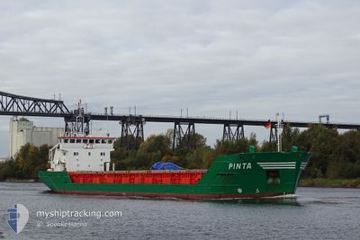
PINTA
General Cargo
Current Trip
| Time Travelled | 4 days |
|---|---|
| Remaining Time | 5 h, 22 mins |
| Distance Travelled | 1107.26 nm |
| Remaining Distance | 50.01 nm |
| AVG Speed | 9.3 Noeuds |
| MAX Speed | 13.7 Noeuds |
| AVG Wind | 7.1 knots |
| MAX Wind | 17.8 knots |
| MIN Temp | 2.4°C / 36.32°F |
| MAX Temp | 9.2°C / 48.56°F |
| Tirant d eau | 5.2 m |
| Position reçue | 6 h, 51 m depuis |
Current Position
| Longitude | -5.10548° |
|---|---|
| Latitude | 54.17351° |
| Etat | Under way using engine |
| Vitesse | 9.2 Noeuds |
| Parcours | 173.9° |
| Zone | Irish Sea and St. George's Channel |
| Station | T-AIS |
| Position reçue | 6 h, 51 m depuis |
Info
Information
The current position of PINTA is in Irish Sea and St. George's Channel with coordinates 54.17351° / -5.10548° as reported on 2024-04-28 08:58 by AIS to our vessel tracker app. The vessel's current speed is 9.2 Noeuds and is heading at the port of GARSTON. The estimated time of arrival as calculated by MyShipTracking vessel tracking app is 2024-04-28 21:11 LT
The vessel PINTA (IMO: 9063299, MMSI: 236180000) is a General Cargo that was built in 1993 ( 31 Age ). It's sailing under the flag of [GI] Gibraltar.
In this page you can find informations about the vessels current position, last detected port calls, and current voyage information. If the vessels is not in coverage by AIS you will find the latest position.
The current position of PINTA is detected by our AIS receivers and we are not responsible for the reliability of the data. The last position was recorded while the vessel was in Coverage by the Ais receivers of our vessel tracking app.
The current draught of PINTA as reported by AIS is 5.2 meters
Weather
| Temperature | 8.6°C / 47.48°F |
|---|---|
| Wind Speed | 11 knots |
| Direction | 278° W |
| Pressure | 1006.5 hPa |
| Humidity | 66.2 % |
| Cloud Coverage | 3 % |
Featured Company
Last Port Calls
| Port | Arrival | Departure | Time In Port |
|---|---|---|---|
| 2024-04-23 14:30 | 2024-04-23 15:56 | 1 h | |
| 2024-04-17 15:03 | 2024-04-18 04:12 | 13 h | |
| 2024-04-11 18:57 | 2024-04-12 17:02 | 22 h | |
| 2024-04-04 11:21 | 2024-04-08 07:58 | 3 d | |
| 2024-03-26 11:33 | 2024-03-26 17:31 | 5 h | |
| 2024-03-22 13:14 | 2024-03-22 13:19 | 4 m | |
| 2024-03-20 07:26 | |||
| 2024-03-11 12:59 | 2024-03-14 16:26 | 3 d | |
| 2024-02-28 21:27 | 2024-03-04 13:03 | 4 d | |
| 2024-02-22 03:15 | 2024-02-23 15:31 | 1 d |
Last Trips
| Origin | Departure | Destination | Arrival | Distance | |
|---|---|---|---|---|---|
| 2024-04-18 06:12 | 2024-04-23 16:30 | 462.27 nm | |||
| 2024-04-12 19:02 | 2024-04-17 17:03 | 1132.77 nm | |||
| 2024-04-08 09:58 | 2024-04-11 20:57 | 589.88 nm | |||
| 2024-03-26 18:31 | 2024-04-04 13:21 | 1843.15 nm | |||
| 2024-03-22 14:19 | 2024-03-26 12:33 | 890.67 nm | |||
| 2024-03-14 17:26 | 2024-03-22 14:14 | 455.28 nm | |||
| 2024-03-14 17:26 | 2024-03-20 08:26 | 454.80 nm | |||
| 2024-03-04 14:03 | 2024-03-11 13:59 | 1525.40 nm | |||
| 2024-02-23 16:31 | 2024-02-28 22:27 | 371.21 nm | |||
| 2024-02-15 19:18 | 2024-02-22 04:15 | 1313.56 nm |
Events
| Heure | Evenement | Détails | Position/ Destination | Info |
|---|---|---|---|---|
| 2024-04-28 09:06 | Etat Changé | Default Under way using engine |
54.15192 / -5.10182
GBGTN
|
Vitesse: 9.2 kn Parcours: 173.9° |
| 2024-04-28 08:58 | Hors de la zone couverte |
54.17351 / -5.10548
Irish Sea and St. George's Channel
GBGTN
|
Vitesse: 9.2 kn Parcours: 173.9° |
|
| 2024-04-28 08:56 | Etat Changé | Under way using engine Default |
54.17686 / -5.10596
GBGTN
|
Vitesse: 9.2 kn Parcours: 174° |
| 2024-04-28 08:50 | Etat Changé | Default Under way using engine |
54.19203 / -5.10818
GBGTN
|
Vitesse: 9.4 kn Parcours: 177.3° |
| 2024-04-28 07:50 | Etat Changé | Under way using engine Default |
54.34685 / -5.13332
GBGTN
|
Vitesse: 8.7 kn Parcours: 176° |
| 2024-04-28 07:38 | Etat Changé | Default Under way using engine |
54.37471 / -5.13838
GBGTN
|
Vitesse: 8.8 kn Parcours: 171.6° |
| 2024-04-28 07:32 | Etat Changé | Under way using engine Default |
54.39098 / -5.14273
GBGTN
|
Vitesse: 8.9 kn Parcours: 172° |
| 2024-04-28 07:30 | Etat Changé | Default Under way using engine |
54.39418 / -5.14356
GBGTN
|
Vitesse: 8.9 kn Parcours: 170.5° |
| 2024-04-28 07:30 | Etat Changé | Under way using engine Default |
54.39548 / -5.14388
GBGTN
|
Vitesse: 8.9 kn Parcours: 171° |
| 2024-04-28 07:30 | Changement de zone | United Kingdom part of the Irish Sea and St. George's Channel United Kingdom part of the Inner Seas off the West Coast of Scotland |
54.39548 / -5.14388
Irish Sea and St. George's Channel
GBGTN
|
Vitesse: 8.9 kn Parcours: 170.5° |