
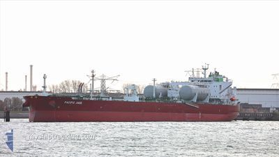
PACIFIC JADE
Tanker
Current Trip
CA VAN
| Time Travelled | 12 h, 25 mins |
|---|---|
| Remaining Time | --- |
| Distance Travelled | 1.82 nm |
| Remaining Distance | --- |
| AVG Speed | 3.5 Noeuds |
| MAX Speed | 3.8 Noeuds |
| AVG Wind | 4 knots |
| MAX Wind | 4 knots |
| MIN Temp | 7.8°C / 46.04°F |
| MAX Temp | 9°C / 48.2°F |
| Tirant d eau | 9.5 m |
| Position reçue | 3 m depuis |
Current Position
| Longitude | --- |
|---|---|
| Latitude | --- |
| Etat | Moored |
| Vitesse | |
| Parcours | 107° |
| Zone | The Coastal Waters of Southeast Alaska and British Columbia |
| Station | T-AIS |
| Position reçue | 3 m depuis |
Info
Information
The current position of PACIFIC JADE is in The Coastal Waters of Southeast Alaska and British Columbia with coordinates 49.29232° / -122.95605° as reported on 2025-12-10 06:45 by AIS to our vessel tracker app. The vessel's current speed is 0 Noeuds
The vessel PACIFIC JADE (IMO: 9893060, MMSI: 538009201) is a Tanker It's sailing under the flag of [MH] Marshall Is.
In this page you can find informations about the vessels current position, last detected port calls, and current voyage information. If the vessels is not in coverage by AIS you will find the latest position.
The current position of PACIFIC JADE is detected by our AIS receivers and we are not responsible for the reliability of the data. The last position was recorded while the vessel was in Coverage by the Ais receivers of our vessel tracking app.
The current draught of PACIFIC JADE as reported by AIS is 9.5 meters
Weather
| Temperature | 6.2°C / 43.16°F |
|---|---|
| Wind Speed | 4 knots |
| Direction | 23° NNE |
| Pressure | 1012.3 hPa |
| Humidity | 92.2 % |
| Cloud Coverage | 100 % |
Featured Company
Events
| Heure | Evenement | Détails | Position/ Destination | Info |
|---|---|---|---|---|
| 2025-12-10 05:00 | Etat Changé | Moored Default |
49.29230 / -122.95606
CA VAN
|
Vitesse: Parcours: 107° |
| 2025-12-10 04:57 | Etat Changé | Default Moored |
49.29232 / -122.95609
CA VAN
|
Vitesse: Parcours: 107° |
| 2025-12-10 04:03 | Etat Changé | Moored Default |
49.29229 / -122.95608
CA VAN
|
Vitesse: Parcours: 107° |
| 2025-12-10 03:57 | Etat Changé | Default Moored |
49.29229 / -122.95607
CA VAN
|
Vitesse: Parcours: 107° |
| 2025-12-10 02:54 | Etat Changé | Moored Default |
49.29227 / -122.95609
CA VAN
|
Vitesse: Parcours: 107° |
| 2025-12-10 02:48 | Etat Changé | Default Moored |
49.29232 / -122.95615
CA VAN
|
Vitesse: Parcours: 107° |
| 2025-12-10 00:36 | Etat Changé | Moored Default |
49.29230 / -122.95609
CA VAN
|
Vitesse: Parcours: 107° |
| 2025-12-10 00:33 | Etat Changé | Default Moored |
49.29232 / -122.95612
CA VAN
|
Vitesse: Parcours: 107° |
| 2025-12-09 22:20 | Etat Changé | Moored Default |
49.29231 / -122.95611
CA VAN
|
Vitesse: Parcours: 107° |
| 2025-12-09 22:17 | Etat Changé | Default Moored |
49.29227 / -122.95604
CA VAN
|
Vitesse: Parcours: 107° |