
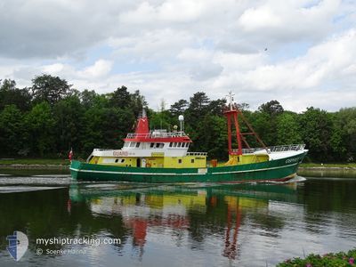
OSPREY
Utility Vessel
Current Trip
OFFSHORE
| Time Travelled | --- |
|---|---|
| Remaining Time | --- |
| Distance Travelled | 39.65 nm |
| Remaining Distance | --- |
| AVG Speed | 4.5 Noeuds |
| MAX Speed | 5.5 Noeuds |
| AVG Wind | 21.1 knots |
| MAX Wind | 28 knots |
| MIN Temp | -0.6°C / 30.92°F |
| MAX Temp | 12.2°C / 53.96°F |
| Tirant d eau | 4.7 m |
| Position reçue | 59 m depuis |
Current Position
| Longitude | 13.79899° |
|---|---|
| Latitude | 54.40909° |
| Etat | Under way using engine |
| Vitesse | 0.5 Noeuds |
| Parcours | 318° |
| Zone | Baltic Sea |
| Station | T-AIS |
| Position reçue | 59 m depuis |
Info
Information
The current position of OSPREY is in Baltic Sea with coordinates 54.40909° / 13.79899° as reported on 2024-06-01 08:48 by AIS to our vessel tracker app. The vessel's current speed is 0.5 Noeuds
The vessel OSPREY (IMO: 8402694, MMSI: 311000473) is a Utility Vessel that was built in 1984 ( 40 Age ). It's sailing under the flag of [BS] Bahamas.
In this page you can find informations about the vessels current position, last detected port calls, and current voyage information. If the vessels is not in coverage by AIS you will find the latest position.
The current position of OSPREY is detected by our AIS receivers and we are not responsible for the reliability of the data. The last position was recorded while the vessel was in Coverage by the Ais receivers of our vessel tracking app.
The current draught of OSPREY as reported by AIS is 4.7 meters
Weather
| Temperature | 15.4°C / 59.72°F |
|---|---|
| Wind Speed | 13 knots |
| Direction | 55° NE |
| Pressure | 1012.6 hPa |
| Humidity | 89.4 % |
| Cloud Coverage | 56 % |
Featured Company
Last Port Calls
Most Visited Ports (Last year)
| Port | Arrivals | |
|---|---|---|
| 1 |
Last Trips
| Origin | Departure | Destination | Arrival | Distance |
|---|
Events
| Heure | Evenement | Détails | Position/ Destination | Info |
|---|---|---|---|---|
| 2024-06-01 04:50 | Démarrage | 8.64 nm, South East of MUKRAN |
54.37724 / 13.76152
OFFSHORE
|
Vitesse: 3.3 kn Parcours: 65° |
| 2024-06-01 00:03 | Dans la zone couverte |
54.39489 / 13.80582
Baltic Sea
|
Vitesse: 0.3 kn Parcours: 256.8° |
|
| 2024-05-31 22:48 | Hors de la zone couverte |
54.39909 / 13.81960
Baltic Sea
|
Vitesse: 0.3 kn Parcours: 254.6° |
|
| 2024-05-31 22:13 | Arret | 9.24 nm, South East of SASSNITZ |
54.40085 / 13.82613
OFFSHORE
|
Vitesse: 0.3 kn Parcours: 127° |
| 2024-05-31 14:51 | Dans la zone couverte |
54.38910 / 13.78988
Baltic Sea
|
Vitesse: 0.6 kn Parcours: 243.4° |
|
| 2024-05-31 12:25 | Hors de la zone couverte |
54.40191 / 13.81989
Baltic Sea
|
Vitesse: 0.5 kn Parcours: 226.5° |
|
| 2024-05-31 11:34 | Arret | 9.1 nm, South East of SASSNITZ |
54.40604 / 13.82913
OFFSHORE
|
Vitesse: 0.3 kn Parcours: 118° |
| 2024-05-31 11:11 | Démarrage | 9.4 nm, South East of SASSNITZ |
54.39291 / 13.81792
OFFSHORE
|
Vitesse: 5.7 kn Parcours: 86.9° |
| 2024-05-31 11:05 | Arret | 9.16 nm, South East of SASSNITZ |
54.39309 / 13.80778
OFFSHORE
|
Vitesse: 0.1 kn Parcours: 98° |
| 2024-05-31 10:40 | Dans la zone couverte |
54.38962 / 13.76150
Baltic Sea
|
Vitesse: 5.5 kn Parcours: 75.3° |