
OSLO BULK 1
General Cargo
Current Trip
| Trip Time | 2 days |
|---|---|
| Trip Distance | 496.94 nm |
| AVG Speed | 9.3 Noeuds |
| MAX Speed | 11.3 Noeuds |
| Tirant d eau | 7.2 m |
| AVG Wind | 8.5 knots |
| MAX Wind | 14.9 knots |
| MIN Temp | 23.6°C / 74.48°F |
| MAX Temp | 34.5°C / 94.1°F |
| Position reçue | 3 d depuis |
Current Position
| Longitude | -70.07009° |
|---|---|
| Latitude | 18.25175° |
| Etat | Under way using engine |
| Vitesse | 11.1 Noeuds |
| Parcours | 210.3° |
| Zone | Caribbean Sea |
| Station | T-AIS |
| Position reçue | 3 d depuis |
Info
Information
The current position of OSLO BULK 1 is in Caribbean Sea with coordinates 18.25175° / -70.07009° as reported on 2024-05-12 09:06 by AIS to our vessel tracker app. The vessel's current speed is 11.1 Noeuds and is currently inside the port of LAFITEAU.
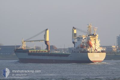
The vessel OSLO BULK 1 (IMO: 9485758, MMSI: 257482000) is a General Cargo that was built in 2010 ( 14 Age ). It's sailing under the flag of [NO] Norway.
In this page you can find informations about the vessels current position, last detected port calls, and current voyage information. If the vessels is not in coverage by AIS you will find the latest position.
The current position of OSLO BULK 1 is detected by our AIS receivers and we are not responsible for the reliability of the data. The last position was recorded while the vessel was in Coverage by the Ais receivers of our vessel tracking app.
The current draught of OSLO BULK 1 as reported by AIS is 7.2 meters
Weather
| Temperature | 29°C / 84.2°F |
|---|---|
| Wind Speed | 4 knots |
| Direction | 103° ESE |
| Pressure | 1015.1 hPa |
| Humidity | 59.8 % |
| Cloud Coverage | 10 % |
Featured Company
Last Port Calls
| Port | Arrival | Departure | Time In Port |
|---|---|---|---|
| 2024-05-14 15:08 | |||
| 2024-05-08 05:04 | 2024-05-12 04:10 | 3 d | |
| 2024-05-05 10:43 | 2024-05-05 22:00 | 11 h | |
| 2024-05-03 00:42 | 2024-05-03 13:38 | 12 h | |
| 2024-04-25 19:50 | 2024-04-27 18:10 | 1 d | |
| 2024-04-19 20:07 | 2024-04-21 17:01 | 1 d | |
| 2024-04-02 20:47 | 2024-04-04 00:51 | 1 d | |
| 2024-04-01 11:48 | 2024-04-02 01:06 | 13 h | |
| 2024-03-26 08:39 | 2024-03-27 20:18 | 1 d | |
| 2024-03-18 00:20 |
Most Visited Ports (Last year)
| Port | Arrivals | |
|---|---|---|
| 7 | ||
| 4 | ||
| 3 | ||
| 3 | ||
| 3 | ||
| 3 |
Last Trips
| Origin | Departure | Destination | Arrival | Distance | |
|---|---|---|---|---|---|
| 2024-05-12 04:10 | 2024-05-14 15:08 | 496.94 nm | |||
| 2024-05-05 22:00 | 2024-05-08 05:04 | 497.02 nm | |||
| 2024-05-03 13:38 | 2024-05-05 10:43 | 437.16 nm | |||
| 2024-04-27 18:10 | 2024-05-03 00:42 | 1132.08 nm | |||
| 2024-04-21 17:01 | 2024-04-25 19:50 | 1091.09 nm | |||
| 2024-04-04 00:51 | 2024-04-19 20:07 | 2506.43 nm | |||
| 2024-04-02 01:06 | 2024-04-02 20:47 | 218.78 nm | |||
| 2024-03-27 20:18 | 2024-04-01 11:48 | 1046.52 nm | |||
| 2024-03-12 14:24 | 2024-03-18 00:20 | 327.64 nm | |||
| 2024-03-02 04:29 | 2024-03-10 01:24 | 1723.56 nm |
Events
| Heure | Evenement | Détails | Position/ Destination | Info |
|---|---|---|---|---|
| 2024-05-14 19:08 | Port d'arrivée |
|
18.69333 / -72.36500
[HT] LAFITEAU
|
Vitesse: Parcours: -1° |
| 2024-05-14 12:23 | Arret | 1.18 nm, North West of PORT AU PRINCE |
18.56500 / -72.38167
HTLFF
|
Vitesse: Parcours: -1° |
| 2024-05-13 14:11 | Démarrage |
17.92500 / -74.48834
HTLFF
|
Vitesse: 10 kn Parcours: 302° |
|
| 2024-05-13 12:14 | Arret |
17.91833 / -74.44666
HTLFF
|
Vitesse: Parcours: -1° |
|
| 2024-05-12 09:13 | Etat Changé | Default Under way using engine |
18.23363 / -70.08106
HTLFF
|
Vitesse: 11.1 kn Parcours: 210.3° |
| 2024-05-12 09:06 | Hors de la zone couverte |
18.25175 / -70.07009
Caribbean Sea
HTLFF
|
Vitesse: 11.1 kn Parcours: 210.3° |
|
| 2024-05-12 08:26 | Tirant d'eau modifié | 7.2 5 |
18.36316 / -70.01453
HTLFF
|
Vitesse: 10.9 kn Parcours: 183.4° |
| 2024-05-12 08:26 | Changement de destination | HTLFF DOHAI |
18.36316 / -70.01453
HTLFF
|
Vitesse: 10.9 kn Parcours: 183.4° |
| 2024-05-12 08:26 | Changement d'ETA | 2024/05/14 06:00 2024/05/08 05:00 |
18.36316 / -70.01453
HTLFF
|
Vitesse: 10.9 kn Parcours: 183.4° |
| 2024-05-12 08:10 | PORT DE DEPART |
|
18.40645 / -70.01604
DOHAI
|
Vitesse: 6.7 kn Parcours: 161° |