
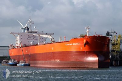
ORCA PEARL
Crude Oil Tanker
Current Trip
| Time Travelled | 33 days |
|---|---|
| Remaining Time | 19 days |
| Distance Travelled | 8165.62 nm |
| Remaining Distance | 5240.31 nm |
| AVG Speed | 10.4 Noeuds |
| MAX Speed | 13.6 Noeuds |
| AVG Wind | 11.1 knots |
| MAX Wind | 21 knots |
| MIN Temp | 14.7°C / 58.46°F |
| MAX Temp | 29.3°C / 84.74°F |
| Tirant d eau | 14 m |
| Position reçue | 1 d depuis |
Current Position
| Longitude | 18.41054° |
|---|---|
| Latitude | -34.91083° |
| Etat | Under way using engine |
| Vitesse | 10.8 Noeuds |
| Parcours | 111.9° |
| Zone | South Atlantic Ocean |
| Station | T-AIS |
| Position reçue | 1 d depuis |
Info
Information
The current position of ORCA PEARL is in South Atlantic Ocean with coordinates -34.91083° / 18.41054° as reported on 2024-05-08 17:03 by AIS to our vessel tracker app. The vessel's current speed is 10.8 Noeuds and is heading at the port of TANJUNG PELEPAS. The estimated time of arrival as calculated by MyShipTracking vessel tracking app is 2024-05-29 11:16 LT
The vessel ORCA PEARL (IMO: 9402249, MMSI: 354306000) is a Crude Oil Tanker that was built in 2009 ( 15 Age ). It's sailing under the flag of [PA] Panama.
In this page you can find informations about the vessels current position, last detected port calls, and current voyage information. If the vessels is not in coverage by AIS you will find the latest position.
The current position of ORCA PEARL is detected by our AIS receivers and we are not responsible for the reliability of the data. The last position was recorded while the vessel was in Coverage by the Ais receivers of our vessel tracking app.
The current draught of ORCA PEARL as reported by AIS is 14 meters
Weather
| Temperature | 20.2°C / 68.36°F |
|---|---|
| Wind Speed | 4 knots |
| Direction | 262° W |
| Pressure | 1009.2 hPa |
| Humidity | 69.3 % |
| Cloud Coverage | --- |
Featured Company
Last Port Calls
| Port | Arrival | Departure | Time In Port |
|---|---|---|---|
| 2024-04-03 09:15 | 2024-04-06 11:51 | 3 d | |
| 2024-04-01 07:27 | 2024-04-03 00:15 | 1 d | |
| 2024-03-28 02:41 | 2024-03-29 20:28 | 1 d | |
| 2024-03-22 20:21 | 2024-03-24 10:54 | 1 d | |
| 2024-03-14 14:37 | 2024-03-22 19:39 | 8 d |
Most Visited Ports (Last year)
| Port | Arrivals | |
|---|---|---|
| 7 | ||
| 3 | ||
| 3 | ||
| 2 | ||
| 2 | ||
| 1 |
Last Trips
| Origin | Departure | Destination | Arrival | Distance | |
|---|---|---|---|---|---|
| 2024-04-02 19:15 | 2024-04-03 04:15 | 97.83 nm | |||
| 2024-03-29 15:28 | 2024-04-01 02:27 | 579.28 nm | |||
| 2024-03-24 05:54 | 2024-03-27 21:41 | 506.12 nm | |||
| 2024-03-22 14:39 | 2024-03-22 15:21 | 1.81 nm | |||
| 2024-02-17 12:56 | 2024-03-14 09:37 | 2904.39 nm |
Events
| Heure | Evenement | Détails | Position/ Destination | Info |
|---|---|---|---|---|
| 2024-05-08 17:09 | Etat Changé | Default Under way using engine |
-34.91673 / 18.43154
MYTPP
|
Vitesse: 10.8 kn Parcours: 111.9° |
| 2024-05-08 17:03 | Etat Changé | Under way using engine Default |
-34.91083 / 18.41054
MYTPP
|
Vitesse: 11 kn Parcours: 121° |
| 2024-05-08 17:03 | Hors de la zone couverte |
-34.91083 / 18.41054
South Atlantic Ocean
MYTPP
|
Vitesse: 10.8 kn Parcours: 111.9° |
|
| 2024-05-08 16:54 | Etat Changé | Default Under way using engine |
-34.89783 / 18.38037
MYTPP
|
Vitesse: 10.9 kn Parcours: 126.2° |
| 2024-05-08 16:50 | Etat Changé | Under way using engine Default |
-34.89075 / 18.36739
MYTPP
|
Vitesse: 10.9 kn Parcours: 126° |
| 2024-05-08 16:38 | Dans la zone couverte |
-34.89075 / 18.36739
South Atlantic Ocean
MYTPP
|
Vitesse: 10.9 kn Parcours: 126.2° |
|
| 2024-05-08 15:44 | Etat Changé | Default Under way using engine |
-34.77446 / 18.17298
MYTPP
|
Vitesse: 10.9 kn Parcours: 126° |
| 2024-05-08 15:41 | Etat Changé | Under way using engine Default |
-34.76907 / 18.16437
MYTPP
|
Vitesse: 10.7 kn Parcours: 126° |
| 2024-05-08 15:41 | Hors de la zone couverte |
-34.76907 / 18.16437
South Atlantic Ocean
MYTPP
|
Vitesse: 10.9 kn Parcours: 126° |
|
| 2024-05-08 15:35 | Dans la zone couverte |
-34.76907 / 18.16437
South Atlantic Ocean
MYTPP
|
Vitesse: 10.9 kn Parcours: 126° |