
OKEE CUNO
Container Ship
Current Trip
NOUAKCHOTT
| Time Travelled | 4 days |
|---|---|
| Remaining Time | --- |
| Distance Travelled | 643.14 nm |
| Remaining Distance | --- |
| AVG Speed | 6.6 Noeuds |
| MAX Speed | 18 Noeuds |
| AVG Wind | 12.2 knots |
| MAX Wind | 22 knots |
| MIN Temp | 21.1°C / 69.98°F |
| MAX Temp | 27.7°C / 81.86°F |
| Tirant d eau | 10.6 m |
| Position reçue | 1 d depuis |
Current Position
| Longitude | -16.94660° |
|---|---|
| Latitude | 10.72357° |
| Etat | Under way using engine |
| Vitesse | 6.4 Noeuds |
| Parcours | 154.3° |
| Zone | North Atlantic Ocean |
| Station | T-AIS |
| Position reçue | 1 d depuis |
Info
Information
The current position of OKEE CUNO is in North Atlantic Ocean with coordinates 10.72357° / -16.94660° as reported on 2024-05-02 08:57 by AIS to our vessel tracker app. The vessel's current speed is 6.4 Noeuds
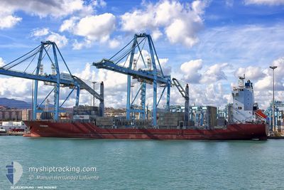
The vessel OKEE CUNO (IMO: 9406960, MMSI: 636020401) is a Container Ship that was built in 2008 ( 16 Age ). It's sailing under the flag of [LR] Liberia.
In this page you can find informations about the vessels current position, last detected port calls, and current voyage information. If the vessels is not in coverage by AIS you will find the latest position.
The current position of OKEE CUNO is detected by our AIS receivers and we are not responsible for the reliability of the data. The last position was recorded while the vessel was in Coverage by the Ais receivers of our vessel tracking app.
The current draught of OKEE CUNO as reported by AIS is 10.6 meters
Weather
| Temperature | 27.1°C / 80.78°F |
|---|---|
| Wind Speed | 12 knots |
| Direction | 248° WSW |
| Pressure | 1009.8 hPa |
| Humidity | 87.1 % |
| Cloud Coverage | 99 % |
Featured Company
Last Port Calls
| Port | Arrival | Departure | Time In Port |
|---|---|---|---|
| 2024-04-28 11:06 | 2024-04-29 10:02 | 22 h | |
| 2024-04-15 00:03 | 2024-04-16 04:12 | 1 d | |
| 2024-04-12 15:57 | 2024-04-13 09:31 | 17 h | |
| 2024-04-09 11:39 | 2024-04-10 13:50 | 1 d | |
| 2024-03-22 20:07 | 2024-03-25 09:26 | 2 d | |
| 2024-03-20 16:09 | 2024-03-22 02:06 | 1 d | |
| 2024-03-11 14:37 | 2024-03-12 07:56 | 17 h |
Last Trips
| Origin | Departure | Destination | Arrival | Distance | |
|---|---|---|---|---|---|
| 2024-04-16 04:12 | 2024-04-28 11:06 | 3421.11 nm | |||
| 2024-04-13 09:31 | 2024-04-15 00:03 | 157.73 nm | |||
| 2024-04-10 13:50 | 2024-04-12 15:57 | 746.75 nm | |||
| 2024-03-25 09:26 | 2024-04-09 11:39 | 3296.04 nm | |||
| 2024-03-22 02:06 | 2024-03-22 20:07 | 2.11 nm | |||
| 2024-03-12 07:56 | 2024-03-20 16:09 | 1628.59 nm | |||
| 2024-02-24 05:41 | 2024-03-11 14:37 | 2926.56 nm |
Events
| Heure | Evenement | Détails | Position/ Destination | Info |
|---|---|---|---|---|
| 2024-05-03 06:40 | Arret |
9.09500 / -15.13167
NOUAKCHOTT
|
Vitesse: Parcours: -1° |
|
| 2024-05-02 09:17 | Etat Changé | Default Under way using engine |
10.67917 / -16.92512
NOUAKCHOTT
|
Vitesse: 6.4 kn Parcours: 154.3° |
| 2024-05-02 08:57 | Hors de la zone couverte |
10.72357 / -16.94660
North Atlantic Ocean
|
Vitesse: 6.4 kn Parcours: 154.3° |
|
| 2024-05-02 08:27 | Etat Changé | Under way using engine Default |
10.76900 / -16.97020
NOUAKCHOTT
|
Vitesse: 6.3 kn Parcours: 153° |
| 2024-05-02 08:18 | Dans la zone couverte |
10.76900 / -16.97020
North Atlantic Ocean
|
Vitesse: 6.3 kn Parcours: 152.9° |
|
| 2024-05-02 05:19 | Etat Changé | Default Under way using engine |
11.05833 / -17.11167
NOUAKCHOTT
|
Vitesse: 6.2 kn Parcours: 150.5° |
| 2024-05-02 05:05 | Hors de la zone couverte |
11.09132 / -17.13083
North Atlantic Ocean
|
Vitesse: 6.2 kn Parcours: 150.5° |
|
| 2024-05-02 03:38 | Etat Changé | Under way using engine Default |
11.22007 / -17.20152
NOUAKCHOTT
|
Vitesse: 5.8 kn Parcours: 154° |
| 2024-05-02 03:22 | Etat Changé | Default Under way using engine |
11.23375 / -17.20809
NOUAKCHOTT
|
Vitesse: 6.1 kn Parcours: 153.3° |
| 2024-05-02 03:02 | Etat Changé | Under way using engine Default |
11.27803 / -17.22989
NOUAKCHOTT
|
Vitesse: 6.1 kn Parcours: 153° |