
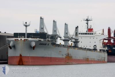
OBE GRANDE
Bulk Carrier
Current Trip
ARG_RECALADA
| Time Travelled | 10 days |
|---|---|
| Remaining Time | --- |
| Distance Travelled | 1145.84 nm |
| Remaining Distance | --- |
| AVG Speed | 11.1 Noeuds |
| MAX Speed | 12.8 Noeuds |
| AVG Wind | 10.5 knots |
| MAX Wind | 20 knots |
| MIN Temp | 20.2°C / 68.36°F |
| MAX Temp | 24.7°C / 76.46°F |
| Tirant d eau | 6.6 m |
| Position reçue | 3 h, 18 m depuis |
Current Position
| Longitude | 9.07479° |
|---|---|
| Latitude | 37.42584° |
| Etat | Under way using engine |
| Vitesse | 11.7 Noeuds |
| Parcours | 252.2° |
| Zone | Mediterranean Sea - Western Basin |
| Station | T-AIS |
| Position reçue | 3 h, 18 m depuis |
Info
Information
The current position of OBE GRANDE is in Mediterranean Sea - Western Basin with coordinates 37.42584° / 9.07479° as reported on 2024-06-15 04:07 by AIS to our vessel tracker app. The vessel's current speed is 11.7 Noeuds
The vessel OBE GRANDE (IMO: 9615731, MMSI: 314571000) is a Bulk Carrier that was built in 2012 ( 12 Age ). It's sailing under the flag of [BB] Barbados.
In this page you can find informations about the vessels current position, last detected port calls, and current voyage information. If the vessels is not in coverage by AIS you will find the latest position.
The current position of OBE GRANDE is detected by our AIS receivers and we are not responsible for the reliability of the data. The last position was recorded while the vessel was in Coverage by the Ais receivers of our vessel tracking app.
The current draught of OBE GRANDE as reported by AIS is 6.6 meters
Weather
| Temperature | 23.7°C / 74.66°F |
|---|---|
| Wind Speed | 6 knots |
| Direction | 101° E |
| Pressure | 1010.9 hPa |
| Humidity | 66.3 % |
| Cloud Coverage | 47 % |
Featured Company
Last Port Calls
| Port | Arrival | Departure | Time In Port |
|---|---|---|---|
| 2024-06-04 15:39 | |||
| 2024-05-23 11:39 | 2024-05-29 07:25 | 5 d |
Most Visited Ports (Last year)
| Port | Arrivals | |
|---|---|---|
| 2 | ||
| 2 | ||
| 2 | ||
| 2 | ||
| 1 | ||
| 1 |
Last Trips
| Origin | Departure | Destination | Arrival | Distance | |
|---|---|---|---|---|---|
| 2024-03-04 11:23 | 2024-05-23 11:39 | 9058.79 nm |
Events
| Heure | Evenement | Détails | Position/ Destination | Info |
|---|---|---|---|---|
| 2024-06-15 04:11 | Etat Changé | Default Under way using engine |
37.42277 / 9.06242
ARG_RECALADA
|
Vitesse: 11.7 kn Parcours: 252.2° |
| 2024-06-15 04:07 | Hors de la zone couverte |
37.42584 / 9.07479
Mediterranean Sea - Western Basin
ARG_RECALADA
|
Vitesse: 11.7 kn Parcours: 252.2° |
|
| 2024-06-15 03:59 | Etat Changé | Under way using engine Default |
37.43356 / 9.10631
ARG_RECALADA
|
Vitesse: 11.8 kn Parcours: 253° |
| 2024-06-15 03:37 | Etat Changé | Default Under way using engine |
37.45603 / 9.19463
ARG_RECALADA
|
Vitesse: 11.8 kn Parcours: 252° |
| 2024-06-15 02:42 | Etat Changé | Under way using engine Default |
37.51300 / 9.41459
ARG_RECALADA
|
Vitesse: 12.4 kn Parcours: 252° |
| 2024-06-15 02:37 | Dans la zone couverte |
37.51179 / 9.40985
Mediterranean Sea - Western Basin
ARG_RECALADA
|
Vitesse: 12.4 kn Parcours: 252.6° |
|
| 2024-06-15 01:35 | Etat Changé | Default Under way using engine |
37.57659 / 9.68829
ARG_RECALADA
|
Vitesse: 12.1 kn Parcours: 252.7° |
| 2024-06-15 01:35 | Hors de la zone couverte |
37.57741 / 9.69174
Mediterranean Sea - Western Basin
ARG_RECALADA
|
Vitesse: 12.1 kn Parcours: 252.7° |
|
| 2024-06-15 01:28 | Etat Changé | Under way using engine Default |
37.58640 / 9.71843
ARG_RECALADA
|
Vitesse: 12.3 kn Parcours: 250° |
| 2024-06-15 01:16 | Etat Changé | Default Under way using engine |
37.60290 / 9.76431
ARG_RECALADA
|
Vitesse: 12.2 kn Parcours: 252.2° |