
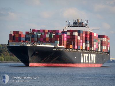
NYK OCEANUS
Container Ship
Current Trip
| Trip Time | 1 day |
|---|---|
| Trip Distance | 312.66 nm |
| AVG Speed | 10 Noeuds |
| MAX Speed | 10 Noeuds |
| Tirant d eau | 12.4 m |
| AVG Wind | 20 knots |
| MAX Wind | 30 knots |
| MIN Temp | 5°C / 41°F |
| MAX Temp | 11.8°C / 53.24°F |
| Position reçue | 1 d depuis |
Current Position
| Longitude | --- |
|---|---|
| Latitude | --- |
| Etat | Under way using engine |
| Vitesse | 5.3 Noeuds |
| Parcours | 339° |
| Zone | Philippine Sea |
| Station | T-AIS |
| Position reçue | 1 d depuis |
Info
Information
The current position of NYK OCEANUS is in Philippine Sea with coordinates 35.01702° / 136.83606° as reported on 2026-01-01 21:59 by AIS to our vessel tracker app. The vessel's current speed is 5.3 Noeuds and is currently inside the port of NAGOYA.
The vessel NYK OCEANUS (IMO: 9312975, MMSI: 351249000) is a Container Ship that was built in 2007 ( 19 Age ). It's sailing under the flag of [PA] Panama.
In this page you can find informations about the vessels current position, last detected port calls, and current voyage information. If the vessels is not in coverage by AIS you will find the latest position.
The current position of NYK OCEANUS is detected by our AIS receivers and we are not responsible for the reliability of the data. The last position was recorded while the vessel was in Coverage by the Ais receivers of our vessel tracking app.
The current draught of NYK OCEANUS as reported by AIS is 12.4 meters
Weather
| Temperature | 5.4°C / 41.72°F |
|---|---|
| Wind Speed | 13 knots |
| Direction | 317° NW |
| Pressure | 1020.1 hPa |
| Humidity | 62.2 % |
| Cloud Coverage | 3 % |
Featured Company
Last Port Calls
| Port | Arrival | Departure | Time In Port |
|---|---|---|---|
| 2026-01-02 06:44 | |||
| 2025-12-30 08:09 | 2025-12-31 15:40 | 1 d | |
| 2025-12-22 04:46 | 2025-12-23 15:52 | 1 d | |
| 2025-11-22 13:51 | 2025-11-24 03:20 | 1 d | |
| 2025-11-15 13:34 | 2025-11-17 01:22 | 1 d | |
| 2025-11-11 05:44 | 2025-11-13 23:07 | 2 d |
Last Trips
| Origin | Departure | Destination | Arrival | Distance | |
|---|---|---|---|---|---|
| 2025-12-31 15:40 | 2026-01-02 06:44 | 312.66 nm | |||
| 2025-12-23 15:52 | 2025-12-30 08:09 | 2721.35 nm | |||
| 2025-11-24 03:20 | 2025-12-22 04:46 | 11657.07 nm | |||
| 2025-11-17 01:22 | 2025-11-22 13:51 | 680.82 nm | |||
| 2025-11-13 23:07 | 2025-11-15 13:34 | 353.34 nm | |||
| 2025-10-01 00:28 | 2025-11-11 05:44 | 12093.60 nm |
Events
| Heure | Evenement | Détails | Position/ Destination | Info |
|---|---|---|---|---|
| 2026-01-01 22:32 | Arret |
35.02696 / 136.82509
[JP] NAGOYA
|
Vitesse: 0.2 kn Parcours: 257° |
|
| 2026-01-01 22:04 | Etat Changé | Default Under way using engine |
35.02273 / 136.83133
[JP] NAGOYA
|
Vitesse: 5.3 kn Parcours: 339° |
| 2026-01-01 21:59 | Hors de la zone couverte |
35.01702 / 136.83606
Philippine Sea
[JP] NAGOYA
|
Vitesse: 5.3 kn Parcours: 345.9° |
|
| 2026-01-01 21:44 | Port d'arrivée |
|
34.99266 / 136.82084
[JP] NAGOYA
|
Vitesse: 9.5 kn Parcours: 33.3° |
| 2026-01-01 21:43 | Etat Changé | Under way using engine Default |
34.98862 / 136.81762
JP NGO
|
Vitesse: 10.2 kn Parcours: 32° |
| 2026-01-01 21:32 | Etat Changé | Default Under way using engine |
34.96349 / 136.79758
JP NGO
|
Vitesse: 12.8 kn Parcours: 19.4° |
| 2026-01-01 21:16 | Etat Changé | Under way using engine Default |
34.90971 / 136.77249
JP NGO
|
Vitesse: 12.8 kn Parcours: 359° |
| 2026-01-01 21:08 | Dans la zone couverte |
34.91037 / 136.77247
Philippine Sea
JP NGO
|
Vitesse: 12.9 kn Parcours: 358.3° |
|
| 2026-01-01 20:09 | Etat Changé | Default Under way using engine |
34.65643 / 136.88849
JP NGO
|
Vitesse: 16.6 kn Parcours: 313.7° |
| 2026-01-01 20:00 | Hors de la zone couverte |
34.62814 / 136.92311
Philippine Sea
JP NGO
|
Vitesse: 16.6 kn Parcours: 313.7° |