
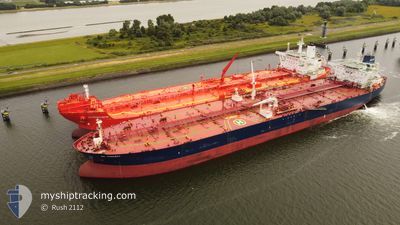
GUANYIN
Crude Oil Tanker
Current Trip
| Time Travelled | 51 days |
|---|---|
| Remaining Time | --- |
| Distance Travelled | 6665.53 nm |
| Remaining Distance | --- |
| AVG Speed | 11.8 Noeuds |
| MAX Speed | 16.2 Noeuds |
| AVG Wind | 11.9 knots |
| MAX Wind | 27.9 knots |
| MIN Temp | 17.3°C / 63.14°F |
| MAX Temp | 33°C / 91.4°F |
| Tirant d eau | 8.5 m |
| Position reçue | 1 d depuis |
Current Position
| Longitude | 30.43418° |
|---|---|
| Latitude | 32.23761° |
| Etat | Under way using engine |
| Vitesse | 12.2 Noeuds |
| Parcours | 286.4° |
| Zone | Mediterranean Sea - Eastern Basin |
| Station | T-AIS |
| Position reçue | 1 d depuis |
Info
Information
The current position of GUANYIN is in Mediterranean Sea - Eastern Basin with coordinates 32.23761° / 30.43418° as reported on 2024-05-04 00:34 by AIS to our vessel tracker app. The vessel's current speed is 12.2 Noeuds and is heading at the port of UST-LUGA. The estimated time of arrival as calculated by MyShipTracking vessel tracking app is 2024-05-20 20:00 LT
The vessel GUANYIN (IMO: 9299707, MMSI: 636012383) is a Crude Oil Tanker that was built in 2005 ( 19 Age ). It's sailing under the flag of [LR] Liberia.
In this page you can find informations about the vessels current position, last detected port calls, and current voyage information. If the vessels is not in coverage by AIS you will find the latest position.
The current position of GUANYIN is detected by our AIS receivers and we are not responsible for the reliability of the data. The last position was recorded while the vessel was in Coverage by the Ais receivers of our vessel tracking app.
The current draught of GUANYIN as reported by AIS is 8.5 meters
Weather
| Temperature | 17.6°C / 63.68°F |
|---|---|
| Wind Speed | 23 knots |
| Direction | 302° WNW |
| Pressure | 1011.9 hPa |
| Humidity | 79 % |
| Cloud Coverage | --- |
Featured Company
Last Port Calls
| Port | Arrival | Departure | Time In Port |
|---|---|---|---|
| 2024-05-03 05:01 | 2024-05-03 14:07 | 9 h | |
| 2024-04-01 04:45 | 2024-04-01 13:42 | 8 h | |
| 2024-03-13 09:08 | 2024-03-14 17:24 | 1 d | |
| 2024-03-09 04:48 | 2024-03-10 16:50 | 1 d |
Last Trips
| Origin | Departure | Destination | Arrival | Distance | |
|---|---|---|---|---|---|
| 2024-03-14 20:24 | 2024-05-03 07:01 | 6123.58 nm | |||
| 2024-03-14 20:24 | 2024-04-01 06:45 | 4784.29 nm | |||
| 2024-03-10 17:50 | 2024-03-13 12:08 | 564.37 nm | |||
| 2023-12-27 12:11 | 2024-03-09 05:48 | 7127.28 nm |
Events
| Heure | Evenement | Détails | Position/ Destination | Info |
|---|---|---|---|---|
| 2024-05-04 00:41 | Etat Changé | Default Under way using engine |
32.24436 / 30.40788
RUULU
|
Vitesse: 12.2 kn Parcours: 286.4° |
| 2024-05-04 00:34 | Hors de la zone couverte |
32.23761 / 30.43418
Mediterranean Sea - Eastern Basin
RUULU
|
Vitesse: 12.2 kn Parcours: 286.4° |
|
| 2024-05-04 00:25 | Etat Changé | Under way using engine Default |
32.22850 / 30.46911
RUULU
|
Vitesse: 12.3 kn Parcours: 288° |
| 2024-05-04 00:25 | Dans la zone couverte |
32.22976 / 30.46409
Mediterranean Sea - Eastern Basin
RUULU
|
Vitesse: 12.2 kn Parcours: 286.7° |
|
| 2024-05-03 15:28 | Etat Changé | Default Under way using engine |
31.46601 / 32.36789
RUULU
|
Vitesse: 11 kn Parcours: 319.1° |
| 2024-05-03 15:21 | Hors de la zone couverte |
31.44690 / 32.38735
Mediterranean Sea - Eastern Basin
RUULU
|
Vitesse: 11 kn Parcours: 319.1° |
|
| 2024-05-03 15:16 | Etat Changé | Under way using engine Default |
31.43586 / 32.39793
RUULU
|
Vitesse: 10 kn Parcours: 338° |
| 2024-05-03 15:12 | Etat Changé | Default Under way using engine |
31.42728 / 32.40412
RUULU
|
Vitesse: 11.6 kn Parcours: 14.9° |
| 2024-05-03 14:16 | Changement de zone | Egyptian part of the Mediterranean Sea - Eastern Basin Egyptian part of the Gulf of Suez |
31.25821 / 32.35516
Mediterranean Sea - Eastern Basin
RUULU
|
Vitesse: 11 kn Parcours: 11.4° |
| 2024-05-03 14:07 | PORT DE DEPART |
|
31.23337 / 32.34810
RUULU
|
Vitesse: 7.3 kn Parcours: 9° |