
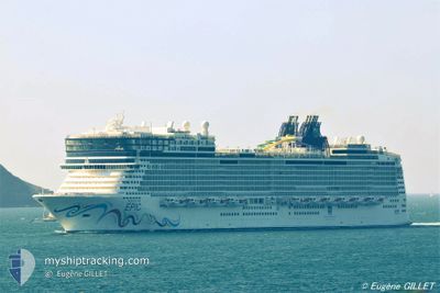
NORWEGIAN EPIC
Passengers Ship
Current Trip
| Trip Time | 18 h, 17 mins |
|---|---|
| Trip Distance | 345.81 nm |
| AVG Speed | 17.7 Noeuds |
| MAX Speed | 20.7 Noeuds |
| Tirant d eau | 9.5 m |
| AVG Wind | 11.9 knots |
| MAX Wind | 23.8 knots |
| MIN Temp | 15°C / 59°F |
| MAX Temp | 19.5°C / 67.1°F |
| Position reçue | 18 h, 13 m depuis |
Current Position
| Longitude | 19.65302° |
|---|---|
| Latitude | 37.21426° |
| Etat | Under way using engine |
| Vitesse | 20.6 Noeuds |
| Parcours | 251.6° |
| Zone | Ionian Sea |
| Station | T-AIS |
| Position reçue | 18 h, 13 m depuis |
Info
Information
The current position of NORWEGIAN EPIC is in Ionian Sea with coordinates 37.21426° / 19.65302° as reported on 2024-05-14 17:59 by AIS to our vessel tracker app. The vessel's current speed is 20.6 Noeuds and is currently inside the port of VALLETTA.
The vessel NORWEGIAN EPIC (IMO: 9410569, MMSI: 311018500) is a Passengers Ship that was built in 2010 ( 14 Age ). It's sailing under the flag of [BS] Bahamas.
In this page you can find informations about the vessels current position, last detected port calls, and current voyage information. If the vessels is not in coverage by AIS you will find the latest position.
The current position of NORWEGIAN EPIC is detected by our AIS receivers and we are not responsible for the reliability of the data. The last position was recorded while the vessel was in Coverage by the Ais receivers of our vessel tracking app.
The current draught of NORWEGIAN EPIC as reported by AIS is 9.5 meters
Weather
| Temperature | 19.8°C / 67.64°F |
|---|---|
| Wind Speed | 13 knots |
| Direction | 101° E |
| Pressure | 1007.4 hPa |
| Humidity | 85.4 % |
| Cloud Coverage | 100 % |
Featured Company
Last Port Calls
| Port | Arrival | Departure | Time In Port |
|---|---|---|---|
| 2024-05-15 07:52 | |||
| 2024-05-14 03:59 | 2024-05-14 13:35 | 9 h | |
| 2024-05-13 02:50 | 2024-05-13 14:55 | 12 h | |
| 2024-05-12 03:33 | 2024-05-12 15:04 | 11 h | |
| 2024-05-11 10:49 | 2024-05-11 18:57 | 8 h | |
| 2024-05-09 03:17 | 2024-05-09 15:17 | 12 h | |
| 2024-05-08 05:50 | 2024-05-08 19:04 | 13 h | |
| 2024-05-07 03:31 | 2024-05-07 15:01 | 11 h | |
| 2024-05-06 05:00 | 2024-05-06 16:00 | 11 h | |
| 2024-05-05 10:36 | 2024-05-05 20:07 | 9 h |
Most Visited Ports (Last year)
| Port | Arrivals | |
|---|---|---|
| 171 | ||
| 21 | ||
| 20 | ||
| 18 | ||
| 16 | ||
| 15 |
Last Trips
| Origin | Departure | Destination | Arrival | Distance | |
|---|---|---|---|---|---|
| 2024-05-14 16:35 | 2024-05-15 09:52 | 345.81 nm | |||
| 2024-05-13 17:55 | 2024-05-14 06:59 | 252.21 nm | |||
| 2024-05-12 18:04 | 2024-05-13 05:50 | 133.91 nm | |||
| 2024-05-11 21:57 | 2024-05-12 06:33 | 114.51 nm | |||
| 2024-05-09 17:17 | 2024-05-11 13:49 | 823.74 nm | |||
| 2024-05-08 21:04 | 2024-05-09 05:17 | 149.87 nm | |||
| 2024-05-07 17:01 | 2024-05-08 07:50 | 294.10 nm | |||
| 2024-05-06 18:00 | 2024-05-07 05:31 | 180.60 nm | |||
| 2024-05-05 22:07 | 2024-05-06 07:00 | 165.03 nm | |||
| 2024-05-03 09:37 | 2024-05-05 12:36 | 692.62 nm |
Events
| Heure | Evenement | Détails | Position/ Destination | Info |
|---|---|---|---|---|
| 2024-05-15 08:24 | Arret |
35.89347 / 14.51303
[MT] VALLETTA
|
Vitesse: 0.3 kn Parcours: 54° |
|
| 2024-05-15 07:52 | Port d'arrivée |
|
35.89892 / 14.52165
[MT] VALLETTA
|
Vitesse: 6.6 kn Parcours: 246° |
| 2024-05-14 17:59 | Hors de la zone couverte |
37.21426 / 19.65302
Ionian Sea
GR KAK>MT MLA
|
Vitesse: 20.6 kn Parcours: 251.6° |
|
| 2024-05-14 13:35 | Démarrage | 0.4 nm, East of KATAKOLO |
37.64864 / 21.33120
GR KAK>MT MLA
|
Vitesse: 3.2 kn Parcours: 97° |
| 2024-05-14 13:35 | PORT DE DEPART |
|
37.64864 / 21.33120
GR KAK>MT MLA
|
Vitesse: 2.1 kn Parcours: 37° |
| 2024-05-14 13:24 | Etat Changé | Under way using engine Moored |
37.64695 / 21.32554
[GR] KATAKOLO
|
Vitesse: Parcours: 24° |
| 2024-05-14 12:40 | Changement de destination | GR KAK>MT MLA GR STN>GR KAT |
37.64697 / 21.32556
[GR] KATAKOLO
|
Vitesse: Parcours: 24° |
| 2024-05-14 12:40 | Changement d'ETA | 2024/05/15 07:45 2024/05/14 03:30 |
37.64697 / 21.32556
[GR] KATAKOLO
|
Vitesse: Parcours: 24° |
| 2024-05-14 12:13 | Dans la zone couverte |
37.64697 / 21.32556
Ionian Sea
[GR] KATAKOLO
|
Vitesse: Parcours: 198.2° |
|
| 2024-05-14 10:59 | Hors de la zone couverte |
37.64695 / 21.32557
Ionian Sea
[GR] KATAKOLO
|
Vitesse: Parcours: 328° |