
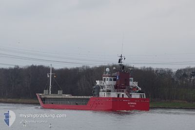
NORMAN
General Cargo
Current Trip
| Time Travelled | 17 h, 8 mins |
|---|---|
| Remaining Time | --- |
| Distance Travelled | 70.66 nm |
| Remaining Distance | --- |
| AVG Speed | 10.2 Noeuds |
| MAX Speed | 11 Noeuds |
| AVG Wind | 13.5 knots |
| MAX Wind | 18.8 knots |
| MIN Temp | 13.5°C / 56.3°F |
| MAX Temp | 15.1°C / 59.18°F |
| Tirant d eau | 6 m |
| Position reçue | 10 h, 4 m depuis |
Current Position
| Longitude | -9.28307° |
|---|---|
| Latitude | 41.25542° |
| Etat | Under way using engine |
| Vitesse | 9.5 Noeuds |
| Parcours | 342.5° |
| Zone | North Atlantic Ocean |
| Station | T-AIS |
| Position reçue | 10 h, 4 m depuis |
Info
Information
The current position of NORMAN is in North Atlantic Ocean with coordinates 41.25542° / -9.28307° as reported on 2024-04-30 14:21 by AIS to our vessel tracker app. The vessel's current speed is 9.5 Noeuds and is heading at the port of LONDONDERRY. The estimated time of arrival as calculated by MyShipTracking vessel tracking app is 2024-05-04 04:00 LT
The vessel NORMAN (IMO: 9361342, MMSI: 304491000) is a General Cargo that was built in 2007 ( 17 Age ). It's sailing under the flag of [AG] Antigua Barbuda.
In this page you can find informations about the vessels current position, last detected port calls, and current voyage information. If the vessels is not in coverage by AIS you will find the latest position.
The current position of NORMAN is detected by our AIS receivers and we are not responsible for the reliability of the data. The last position was recorded while the vessel was in Coverage by the Ais receivers of our vessel tracking app.
The current draught of NORMAN as reported by AIS is 6 meters
Weather
| Temperature | 12.2°C / 53.96°F |
|---|---|
| Wind Speed | 20 knots |
| Direction | 296° WNW |
| Pressure | 1013 hPa |
| Humidity | 66.6 % |
| Cloud Coverage | 99 % |
Featured Company
Last Port Calls
| Port | Arrival | Departure | Time In Port |
|---|---|---|---|
| 2024-04-27 16:21 | 2024-04-30 07:18 | 2 d | |
| 2024-04-24 15:03 | 2024-04-27 06:22 | 2 d | |
| 2024-04-17 08:37 | 2024-04-19 14:39 | 2 d | |
| 2024-04-14 20:50 | 2024-04-16 21:07 | 2 d | |
| 2024-04-13 13:06 | 2024-04-13 14:25 | 1 h | |
| 2024-03-29 08:44 | 2024-04-02 15:40 | 4 d | |
| 2024-03-16 09:37 | 2024-03-22 22:26 | 6 d | |
| 2024-03-06 19:34 | 2024-03-08 07:34 | 1 d | |
| 2024-03-03 15:13 | 2024-03-05 01:13 | 1 d | |
| 2024-03-01 00:36 |
Last Trips
| Origin | Departure | Destination | Arrival | Distance | |
|---|---|---|---|---|---|
| 2024-04-27 07:22 | 2024-04-27 17:21 | 48.39 nm | |||
| 2024-04-19 16:39 | 2024-04-24 16:03 | 1256.82 nm | |||
| 2024-04-16 23:07 | 2024-04-17 10:37 | 148.84 nm | |||
| 2024-04-13 16:25 | 2024-04-14 22:50 | 171.83 nm | |||
| 2024-04-02 17:40 | 2024-04-13 15:06 | 1542.52 nm | |||
| 2024-03-22 22:26 | 2024-03-29 09:44 | 1430.84 nm | |||
| 2024-03-08 09:34 | 2024-03-16 09:37 | 1659.44 nm | |||
| 2024-03-05 02:13 | 2024-03-06 21:34 | 476.51 nm | |||
| 2024-03-01 02:36 | 2024-03-03 16:13 | 738.34 nm |
Events
| Heure | Evenement | Détails | Position/ Destination | Info |
|---|---|---|---|---|
| 2024-04-30 14:21 | Hors de la zone couverte |
41.25542 / -9.28307
North Atlantic Ocean
LONDONDERRY
|
Vitesse: 9.5 kn Parcours: 342.5° |
|
| 2024-04-30 12:01 | Etat Changé | Under way using engine Default |
40.88423 / -9.16350
LONDONDERRY
|
Vitesse: 9.2 kn Parcours: 344° |
| 2024-04-30 11:37 | Etat Changé | Default Under way using engine |
40.83133 / -9.14588
LONDONDERRY
|
Vitesse: 9 kn Parcours: 349.1° |
| 2024-04-30 11:00 | Etat Changé | Under way using engine Default |
40.73277 / -9.11690
LONDONDERRY
|
Vitesse: 10.4 kn Parcours: 342° |
| 2024-04-30 11:00 | Dans la zone couverte |
40.73277 / -9.11690
North Atlantic Ocean
LONDONDERRY
|
Vitesse: 10 kn Parcours: 349.4° |
|
| 2024-04-30 09:25 | Etat Changé | Default Under way using engine |
40.46365 / -9.03914
LONDONDERRY
|
Vitesse: 10.7 kn Parcours: 341° |
| 2024-04-30 09:09 | Hors de la zone couverte |
40.41855 / -9.02235
North Atlantic Ocean
LONDONDERRY
|
Vitesse: 10.7 kn Parcours: 341° |
|
| 2024-04-30 07:18 | PORT DE DEPART |
|
40.14122 / -8.87914
LONDONDERRY
|
Vitesse: 9.5 kn Parcours: 230° |
| 2024-04-30 07:10 | Démarrage |
40.14651 / -8.85446
[PT] FIGUEIRA DA FOZ
|
Vitesse: 5 kn Parcours: 265° |
|
| 2024-04-30 07:04 | Etat Changé | Under way using engine Moored |
40.14685 / -8.85221
[PT] FIGUEIRA DA FOZ
|
Vitesse: 0.1 kn Parcours: 271° |