
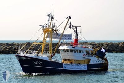
NG-21 MARIA-CHRIS
Fishing
Current Trip
FISHING
| Time Travelled | 8 days |
|---|---|
| Remaining Time | --- |
| Distance Travelled | 208.87 nm |
| Remaining Distance | --- |
| AVG Speed | 4.2 Noeuds |
| MAX Speed | 9 Noeuds |
| AVG Wind | 12.6 knots |
| MAX Wind | 21.2 knots |
| MIN Temp | 9.2°C / 48.56°F |
| MAX Temp | 11.5°C / 52.7°F |
| Tirant d eau | 4.4 m |
| Position reçue | 17 h, 8 m depuis |
Current Position
| Longitude | 6.18763° |
|---|---|
| Latitude | 54.51790° |
| Etat | Engaged in Fishing |
| Vitesse | 3.5 Noeuds |
| Parcours | 44° |
| Zone | North Sea |
| Station | T-AIS |
| Position reçue | 17 h, 8 m depuis |
Info
Information
The current position of NG-21 MARIA-CHRIS is in North Sea with coordinates 54.51790° / 6.18763° as reported on 2024-05-06 17:40 by AIS to our vessel tracker app. The vessel's current speed is 3.5 Noeuds
The vessel NG-21 MARIA-CHRIS (IMO: 9013921, MMSI: 211680250) is a Fishing It's sailing under the flag of [DE] Germany.
In this page you can find informations about the vessels current position, last detected port calls, and current voyage information. If the vessels is not in coverage by AIS you will find the latest position.
The current position of NG-21 MARIA-CHRIS is detected by our AIS receivers and we are not responsible for the reliability of the data. The last position was recorded while the vessel was in Coverage by the Ais receivers of our vessel tracking app.
The current draught of NG-21 MARIA-CHRIS as reported by AIS is 4.4 meters
Weather
| Temperature | 11.6°C / 52.88°F |
|---|---|
| Wind Speed | 9 knots |
| Direction | 358° N |
| Pressure | 1011.2 hPa |
| Humidity | 83 % |
| Cloud Coverage | 77 % |
Featured Company
Last Port Calls
| Port | Arrival | Departure | Time In Port |
|---|---|---|---|
| 2024-04-25 19:59 | 2024-04-28 21:34 | 3 d | |
| 2024-04-21 17:42 | 2024-04-22 06:55 | 13 h | |
| 2024-04-05 23:24 | 2024-04-16 11:28 | 10 d | |
| 2024-03-30 02:12 | 2024-04-01 21:43 | 2 d | |
| 2024-03-18 12:23 | 2024-03-25 08:58 | 6 d | |
| 2024-03-07 05:19 | 2024-03-11 21:27 | 4 d | |
| 2024-03-06 17:14 |
Most Visited Ports (Last year)
| Port | Arrivals | |
|---|---|---|
| 28 | ||
| 7 | ||
| 1 | ||
| 1 | ||
| 1 |
Last Trips
| Origin | Departure | Destination | Arrival | Distance | |
|---|---|---|---|---|---|
| 2024-04-22 08:55 | 2024-04-25 21:59 | 21.86 nm | |||
| 2024-04-16 13:28 | 2024-04-21 19:42 | 157.67 nm | |||
| 2024-04-01 23:43 | 2024-04-06 01:24 | 142.64 nm | |||
| 2024-03-25 09:58 | 2024-03-30 03:12 | 197.65 nm | |||
| 2024-03-11 22:27 | 2024-03-18 13:23 | 225.12 nm | |||
| 2024-03-06 18:14 | 2024-03-07 06:19 | 95.75 nm |
Events
| Heure | Evenement | Détails | Position/ Destination | Info |
|---|---|---|---|---|
| 2024-05-06 17:40 | Hors de la zone couverte |
54.51790 / 6.18763
North Sea
|
Vitesse: 3.5 kn Parcours: 56° |
|
| 2024-05-06 17:40 | Dans la zone couverte |
54.51790 / 6.18763
North Sea
|
Vitesse: 3.5 kn Parcours: 56° |
|
| 2024-05-06 14:08 | Hors de la zone couverte |
54.45992 / 6.15228
North Sea
|
Vitesse: 1.7 kn Parcours: 256° |
|
| 2024-05-06 14:08 | Dans la zone couverte |
54.45992 / 6.15228
North Sea
|
Vitesse: 1.7 kn Parcours: 256° |
|
| 2024-05-06 10:51 | Hors de la zone couverte |
54.55202 / 6.33147
North Sea
|
Vitesse: 3 kn Parcours: 252° |
|
| 2024-05-06 09:51 | Dans la zone couverte |
54.57830 / 6.40575
North Sea
|
Vitesse: 3.5 kn Parcours: 249° |
|
| 2024-05-05 03:43 | Hors de la zone couverte |
54.56638 / 6.46342
North Sea
|
Vitesse: 3.5 kn Parcours: 221° |
|
| 2024-05-05 03:35 | Dans la zone couverte |
54.57020 / 6.47087
North Sea
|
Vitesse: 3.5 kn Parcours: 239° |
|
| 2024-05-04 18:13 | Hors de la zone couverte |
54.54617 / 6.31870
North Sea
|
Vitesse: 3.5 kn Parcours: 81° |
|
| 2024-05-04 17:40 | Dans la zone couverte |
54.53903 / 6.26730
North Sea
|
Vitesse: 3.5 kn Parcours: 70° |