
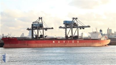
NAVIOS STELLAR
Bulk Carrier
Current Trip
PUERTO BOLIVAR
| Time Travelled | 1 day |
|---|---|
| Remaining Time | --- |
| Distance Travelled | 327.67 nm |
| Remaining Distance | --- |
| AVG Speed | 9 Noeuds |
| MAX Speed | 10.5 Noeuds |
| AVG Wind | 14.1 knots |
| MAX Wind | 19 knots |
| MIN Temp | 25.8°C / 78.44°F |
| MAX Temp | 27.2°C / 80.96°F |
| Tirant d eau | 9.6 m |
| Position reçue | 5 d depuis |
Current Position
| Longitude | --- |
|---|---|
| Latitude | --- |
| Etat | Under way using engine |
| Vitesse | 12.9 Noeuds |
| Parcours | 248.8° |
| Zone | Caribbean Sea |
| Station | T-AIS |
| Position reçue | 5 d depuis |
Info
Information
The current position of NAVIOS STELLAR is in Caribbean Sea with coordinates 16.18346° / -62.90517° as reported on 2025-12-31 22:19 by AIS to our vessel tracker app. The vessel's current speed is 12.9 Noeuds
The vessel NAVIOS STELLAR (IMO: 9498781, MMSI: 370435000) is a Bulk Carrier that was built in 2009 ( 17 Age ). It's sailing under the flag of [PA] Panama.
In this page you can find informations about the vessels current position, last detected port calls, and current voyage information. If the vessels is not in coverage by AIS you will find the latest position.
The current position of NAVIOS STELLAR is detected by our AIS receivers and we are not responsible for the reliability of the data. The last position was recorded while the vessel was in Coverage by the Ais receivers of our vessel tracking app.
The current draught of NAVIOS STELLAR as reported by AIS is 9.6 meters
Weather
| Temperature | 26.1°C / 78.98°F |
|---|---|
| Wind Speed | 9 knots |
| Direction | 84° E |
| Pressure | 1013.6 hPa |
| Humidity | 71.2 % |
| Cloud Coverage | 75 % |
Featured Company
Last Port Calls
| Port | Arrival | Departure | Time In Port |
|---|---|---|---|
| 2026-01-03 01:57 | 2026-01-04 09:09 | 1 d | |
| 2025-12-14 13:38 | 2025-12-17 01:01 | 2 d | |
| 2025-11-23 15:59 | 2025-11-25 09:32 | 1 d |
Most Visited Ports (Last year)
| Port | Arrivals | |
|---|---|---|
| 2 | ||
| 1 | ||
| 1 | ||
| 1 | ||
| 1 | ||
| 1 |
Last Trips
| Origin | Departure | Destination | Arrival | Distance | |
|---|---|---|---|---|---|
| 2025-12-17 01:01 | 2026-01-03 01:57 | 4620.63 nm | |||
| 2025-11-25 09:32 | 2025-12-14 13:38 | 5035.04 nm | |||
| 2025-10-09 11:28 | 2025-11-23 15:59 | 11288.00 nm |
Events
| Heure | Evenement | Détails | Position/ Destination | Info |
|---|---|---|---|---|
| 2026-01-04 14:09 | Démarrage | 0.65 nm, North West of PUERTO BOLIVAR |
12.26833 / -71.96500
PUERTO BOLIVAR
|
Vitesse: 4 kn Parcours: -1° |
| 2026-01-04 14:09 | PORT DE DEPART |
|
12.26833 / -71.96500
PUERTO BOLIVAR
|
Vitesse: 2.7 kn Parcours: 325° |
| 2026-01-03 06:57 | Port d'arrivée |
|
12.25667 / -71.96000
[CO] PUERTO BOLIVAR
|
Vitesse: Parcours: -1° |
| 2026-01-03 06:09 | Arret | 0.24 nm, South of PUERTO BOLIVAR |
12.25500 / -71.95834
PUERTO BOLIVAR
|
Vitesse: Parcours: -1° |
| 2026-01-03 05:00 | Démarrage | 4.25 nm, North West of PUERTO BOLIVAR |
12.30833 / -72.01166
PUERTO BOLIVAR
|
Vitesse: 4 kn Parcours: -1° |
| 2026-01-02 22:09 | Arret | 4.33 nm, North West of PUERTO BOLIVAR |
12.30667 / -72.01500
PUERTO BOLIVAR
|
Vitesse: Parcours: -1° |
| 2025-12-31 22:25 | Etat Changé | Default Under way using engine |
16.17503 / -62.92656
PUERTO BOLIVAR
|
Vitesse: 12.9 kn Parcours: 248.8° |
| 2025-12-31 22:19 | Hors de la zone couverte |
16.18346 / -62.90517
Caribbean Sea
|
Vitesse: 12.9 kn Parcours: 248.8° |
|
| 2025-12-31 22:14 | Etat Changé | Under way using engine Default |
16.18915 / -62.89076
PUERTO BOLIVAR
|
Vitesse: 12 kn Parcours: 248° |
| 2025-12-31 22:09 | Etat Changé | Default Under way using engine |
16.19500 / -62.87167
PUERTO BOLIVAR
|
Vitesse: 12.8 kn Parcours: 247.7° |