
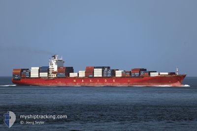
NAVIOS AZURE
Container Ship
Current Trip
| Time Travelled | 8 h, 23 mins |
|---|---|
| Remaining Time | 1 h, 47 mins |
| Distance Travelled | 97.59 nm |
| Remaining Distance | 28.98 nm |
| AVG Speed | 10.8 Noeuds |
| MAX Speed | 18.6 Noeuds |
| AVG Wind | 6.5 knots |
| MAX Wind | 9 knots |
| MIN Temp | 12°C / 53.6°F |
| MAX Temp | 13.8°C / 56.84°F |
| Tirant d eau | 9.5 m |
| Position reçue | Maintenant |
Current Position
| Longitude | 3.71066° |
|---|---|
| Latitude | 51.39116° |
| Etat | Under way using engine |
| Vitesse | 17.2 Noeuds |
| Parcours | 174.5° |
| Zone | North Sea |
| Station | T-AIS |
| Position reçue | Maintenant |
Info
Information
The current position of NAVIOS AZURE is in North Sea with coordinates 51.39116° / 3.71066° as reported on 2024-05-01 03:46 by AIS to our vessel tracker app. The vessel's current speed is 17.2 Noeuds and is heading at the port of ANTWERP. The estimated time of arrival as calculated by MyShipTracking vessel tracking app is 2024-05-01 05:33 LT
The vessel NAVIOS AZURE (IMO: 9324851, MMSI: 538007610) is a Container Ship that was built in 2007 ( 17 Age ). It's sailing under the flag of [MH] Marshall Is.
In this page you can find informations about the vessels current position, last detected port calls, and current voyage information. If the vessels is not in coverage by AIS you will find the latest position.
The current position of NAVIOS AZURE is detected by our AIS receivers and we are not responsible for the reliability of the data. The last position was recorded while the vessel was in Coverage by the Ais receivers of our vessel tracking app.
The current draught of NAVIOS AZURE as reported by AIS is 9.5 meters
Weather
| Temperature | 13.8°C / 56.84°F |
|---|---|
| Wind Speed | 4 knots |
| Direction | 130° SE |
| Pressure | 1010.2 hPa |
| Humidity | 92.6 % |
| Cloud Coverage | 100 % |
Featured Company
Last Port Calls
| Port | Arrival | Departure | Time In Port |
|---|---|---|---|
| 2024-04-30 02:42 | 2024-04-30 19:23 | 16 h | |
| 2024-04-29 02:45 | 2024-04-29 16:42 | 13 h | |
| 2024-04-20 19:38 | 2024-04-21 14:57 | 19 h | |
| 2024-04-15 10:12 | 2024-04-17 13:35 | 2 d | |
| 2024-04-10 16:28 | 2024-04-12 11:08 | 1 d | |
| 2024-04-04 19:04 | 2024-04-05 09:06 | 14 h | |
| 2024-04-03 08:51 | 2024-04-04 10:59 | 1 d | |
| 2024-03-25 12:05 | 2024-03-26 05:39 | 17 h | |
| 2024-03-23 03:45 | 2024-03-23 13:52 | 10 h | |
| 2024-03-22 03:17 | 2024-03-23 01:36 | 22 h |
Last Trips
| Origin | Departure | Destination | Arrival | Distance | |
|---|---|---|---|---|---|
| 2024-04-29 17:42 | 2024-04-30 04:42 | 134.15 nm | |||
| 2024-04-21 14:57 | 2024-04-29 03:45 | 2639.13 nm | |||
| 2024-04-17 13:35 | 2024-04-20 19:38 | 1178.20 nm | |||
| 2024-04-12 11:08 | 2024-04-15 10:12 | 1176.34 nm | |||
| 2024-04-05 11:06 | 2024-04-10 16:28 | 1571.20 nm | |||
| 2024-04-04 10:59 | 2024-04-04 21:04 | 47.81 nm | |||
| 2024-03-26 06:39 | 2024-04-03 08:51 | 1257.69 nm | |||
| 2024-03-23 14:52 | 2024-03-25 13:05 | 258.66 nm | |||
| 2024-03-23 02:36 | 2024-03-23 04:45 | 31.08 nm | |||
| 2024-03-21 09:03 | 2024-03-22 04:17 | 157.19 nm |
Events
| Heure | Evenement | Détails | Position/ Destination | Info |
|---|---|---|---|---|
| 2024-05-01 02:32 | Changement de zone | Dutch part of the North Sea Belgian part of the North Sea |
51.40635 / 3.35187
North Sea
BEANR
|
Vitesse: 18.4 kn Parcours: 84.4° |
| 2024-04-30 23:26 | Changement de zone | Belgian part of the North Sea French part of the North Sea |
51.32747 / 2.36063
North Sea
BEANR
|
Vitesse: 9.7 kn Parcours: 66.8° |
| 2024-04-30 19:23 | PORT DE DEPART |
|
51.04752 / 2.14640
BEANR
|
Vitesse: 15.3 kn Parcours: 300° |
| 2024-04-30 19:07 | Démarrage |
51.00793 / 2.18136
[FR] DUNKERQUE
|
Vitesse: 4.3 kn Parcours: 339° |
|
| 2024-04-30 19:05 | Etat Changé | Under way using engine Default |
51.00629 / 2.18252
[FR] DUNKERQUE
|
Vitesse: Parcours: 345° |
| 2024-04-30 18:54 | Etat Changé | Default Moored |
51.00607 / 2.18297
[FR] DUNKERQUE
|
Vitesse: Parcours: 345° |
| 2024-04-30 18:48 | Etat Changé | Moored Default |
51.00601 / 2.18297
[FR] DUNKERQUE
|
Vitesse: Parcours: 345° |
| 2024-04-30 18:36 | Dans la zone couverte |
51.00601 / 2.18297
North Sea
[FR] DUNKERQUE
|
Vitesse: Parcours: 40.2° |
|
| 2024-04-30 16:12 | Etat Changé | Default Moored |
51.00603 / 2.18298
[FR] DUNKERQUE
|
Vitesse: Parcours: 345° |
| 2024-04-30 16:06 | Hors de la zone couverte |
51.00613 / 2.18299
North Sea
[FR] DUNKERQUE
|
Vitesse: Parcours: 40.2° |