
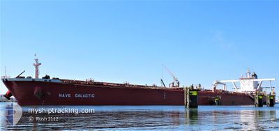
NAVE GALACTIC
Tanker
Current Trip
FOR ORDERS
| Time Travelled | --- |
|---|---|
| Remaining Time | --- |
| Distance Travelled | 6081.38 nm |
| Remaining Distance | --- |
| AVG Speed | 9.8 Noeuds |
| MAX Speed | 16 Noeuds |
| AVG Wind | 12.9 knots |
| MAX Wind | 25.3 knots |
| MIN Temp | 13.2°C / 55.76°F |
| MAX Temp | 29.6°C / 85.28°F |
| Tirant d eau | 11.5 m |
| Position reçue | 2 d depuis |
Current Position
| Longitude | 125.19334° |
|---|---|
| Latitude | 27.46164° |
| Etat | Under way using engine |
| Vitesse | 11.4 Noeuds |
| Parcours | 209° |
| Zone | Eastern China Sea |
| Station | T-AIS |
| Position reçue | 2 d depuis |
Info
Information
The current position of NAVE GALACTIC is in Eastern China Sea with coordinates 27.46164° / 125.19334° as reported on 2024-06-05 07:25 by AIS to our vessel tracker app. The vessel's current speed is 11.4 Noeuds
The vessel NAVE GALACTIC (IMO: 9384617, MMSI: 636021885) is a Tanker It's sailing under the flag of [LR] Liberia.
In this page you can find informations about the vessels current position, last detected port calls, and current voyage information. If the vessels is not in coverage by AIS you will find the latest position.
The current position of NAVE GALACTIC is detected by our AIS receivers and we are not responsible for the reliability of the data. The last position was recorded while the vessel was in Coverage by the Ais receivers of our vessel tracking app.
The current draught of NAVE GALACTIC as reported by AIS is 11.5 meters
Weather
| Temperature | 28.9°C / 84.02°F |
|---|---|
| Wind Speed | 7 knots |
| Direction | 270° W |
| Pressure | 1008.9 hPa |
| Humidity | 78 % |
| Cloud Coverage | 100 % |
Featured Company
Last Port Calls
Most Visited Ports (Last year)
| Port | Arrivals | |
|---|---|---|
| 1 | ||
| 1 |
Last Trips
| Origin | Departure | Destination | Arrival | Distance |
|---|
Events
| Heure | Evenement | Détails | Position/ Destination | Info |
|---|---|---|---|---|
| 2024-06-05 07:27 | Etat Changé | Default Under way using engine |
27.45500 / 125.18833
FOR ORDERS
|
Vitesse: 11.4 kn Parcours: 209° |
| 2024-06-05 07:25 | Detecté en mer | Conflict Zone part of the Eastern China Sea |
27.46164 / 125.19334
Eastern China Sea
FOR ORDERS
|
Vitesse: 11.4 kn Parcours: 209° |
| 2024-06-05 07:25 | Etat Changé | Under way using engine Default |
27.46164 / 125.19334
FOR ORDERS
|
Vitesse: 11.5 kn Parcours: 209° |
| 2024-06-05 07:25 | Dans la zone couverte |
27.46164 / 125.19334
Eastern China Sea
FOR ORDERS
|
Vitesse: 11.4 kn Parcours: 209° |
|
| 2024-06-05 07:25 | Hors de la zone couverte |
27.46164 / 125.19334
Eastern China Sea
FOR ORDERS
|
Vitesse: 11.4 kn Parcours: 209° |
|
| 2024-06-03 10:50 | Etat Changé | Default Under way using engine |
34.88405 / 129.30772
FOR ORDERS
|
Vitesse: 9.9 kn Parcours: 198.2° |
| 2024-06-03 10:45 | Detecté en mer | Japanese part of the Japan Sea |
34.89641 / 129.31528
Japan Sea
FOR ORDERS
|
Vitesse: 9.9 kn Parcours: 198.2° |
| 2024-06-03 10:45 | Etat Changé | Under way using engine Default |
34.89641 / 129.31528
FOR ORDERS
|
Vitesse: 9.5 kn Parcours: 197° |
| 2024-06-03 10:45 | Hors de la zone couverte |
34.89641 / 129.31528
Japan Sea
FOR ORDERS
|
Vitesse: 9.9 kn Parcours: 198.2° |
|
| 2024-06-03 10:15 | Etat Changé | Default Under way using engine |
34.97440 / 129.34409
FOR ORDERS
|
Vitesse: 9.6 kn Parcours: 188.9° |