
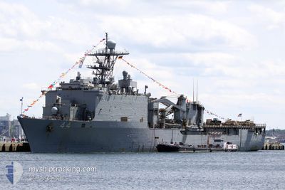
US GOV VESSEL 44
Military ops
Current Trip
Unknown
| Time Travelled | 3 days |
|---|---|
| Remaining Time | --- |
| Distance Travelled | 146.78 nm |
| Remaining Distance | --- |
| AVG Speed | 8.5 Noeuds |
| MAX Speed | 17 Noeuds |
| AVG Wind | 10.1 knots |
| MAX Wind | 17.1 knots |
| MIN Temp | 13.4°C / 56.12°F |
| MAX Temp | 21.2°C / 70.16°F |
| Tirant d eau | 6.5 m |
| Position reçue | 6 h, 20 m depuis |
Current Position
| Longitude | -75.36280° |
|---|---|
| Latitude | 36.57853° |
| Etat | Under way using engine |
| Vitesse | 16.6 Noeuds |
| Parcours | 90° |
| Zone | North Atlantic Ocean |
| Station | T-AIS |
| Position reçue | 6 h, 20 m depuis |
Info
Information
The current position of US GOV VESSEL 44 is in North Atlantic Ocean with coordinates 36.57853° / -75.36280° as reported on 2024-05-03 03:45 by AIS to our vessel tracker app. The vessel's current speed is 16.6 Noeuds
The vessel US GOV VESSEL 44 (MMSI: 368869000) is a Military ops It's sailing under the flag of [US] USA.
In this page you can find informations about the vessels current position, last detected port calls, and current voyage information. If the vessels is not in coverage by AIS you will find the latest position.
The current position of US GOV VESSEL 44 is detected by our AIS receivers and we are not responsible for the reliability of the data. The last position was recorded while the vessel was in Coverage by the Ais receivers of our vessel tracking app.
The current draught of US GOV VESSEL 44 as reported by AIS is 6.5 meters
Weather
| Temperature | 16.7°C / 62.06°F |
|---|---|
| Wind Speed | 10 knots |
| Direction | 192° SSW |
| Pressure | 1016.3 hPa |
| Humidity | 89.3 % |
| Cloud Coverage | 26 % |
Featured Company
Most Visited Ports (Last year)
| Port | Arrivals | |
|---|---|---|
| 2 | ||
| 1 | ||
| 1 |
Events
| Heure | Evenement | Détails | Position/ Destination | Info |
|---|---|---|---|---|
| 2024-05-03 03:45 | Hors de la zone couverte |
36.57853 / -75.36280
North Atlantic Ocean
|
Vitesse: 16.6 kn Parcours: 90° |
|
| 2024-05-03 03:17 | Dans la zone couverte |
36.57937 / -75.52099
North Atlantic Ocean
|
Vitesse: 16.7 kn Parcours: 90.4° |
|
| 2024-05-03 01:42 | Hors de la zone couverte |
36.62711 / -75.73737
North Atlantic Ocean
|
Vitesse: 2.9 kn Parcours: 155.6° |
|
| 2024-05-03 01:13 | Dans la zone couverte |
36.63666 / -75.73589
North Atlantic Ocean
|
Vitesse: 4 kn Parcours: 340.7° |
|
| 2024-05-02 23:21 | Hors de la zone couverte |
36.65011 / -75.73775
North Atlantic Ocean
|
Vitesse: 6 kn Parcours: 313° |
|
| 2024-05-02 15:20 | Dans la zone couverte |
36.57133 / -75.29098
North Atlantic Ocean
|
Vitesse: 16 kn Parcours: 272° |
|
| 2024-05-01 02:21 | Hors de la zone couverte |
36.73184 / -75.18868
North Atlantic Ocean
|
Vitesse: 15 kn Parcours: 108° |
|
| 2024-05-01 02:02 | Dans la zone couverte |
36.75381 / -75.27388
North Atlantic Ocean
|
Vitesse: 14.7 kn Parcours: 107.5° |
|
| 2024-04-29 19:05 | Hors de la zone couverte |
36.72933 / -75.69363
North Atlantic Ocean
|
Vitesse: 4.7 kn Parcours: 129.3° |
|
| 2024-04-29 18:24 | Etat Changé | Restricted manoeuverability Under way using engine |
36.76277 / -75.73175
|
Vitesse: 3.5 kn Parcours: 167.4° |