
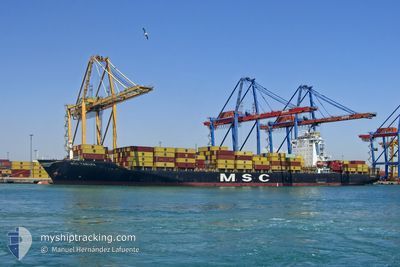
MSC TAMARA
Container Ship
Current Trip
| Time Travelled | 5 days |
|---|---|
| Remaining Time | --- |
| Distance Travelled | 1525.22 nm |
| Remaining Distance | 0.48 nm |
| AVG Speed | 14.6 Noeuds |
| MAX Speed | 17.1 Noeuds |
| AVG Wind | 9.8 knots |
| MAX Wind | 24 knots |
| MIN Temp | 22.4°C / 72.32°F |
| MAX Temp | 28.7°C / 83.66°F |
| Tirant d eau | 12.9 m |
| Position reçue | 5 d depuis |
Current Position
| Longitude | --- |
|---|---|
| Latitude | --- |
| Etat | Under way using engine |
| Vitesse | 16.2 Noeuds |
| Parcours | 174.6° |
| Zone | North Atlantic Ocean |
| Station | T-AIS |
| Position reçue | 5 d depuis |
Info
Information
The current position of MSC TAMARA is in North Atlantic Ocean with coordinates 14.15077° / -17.39286° as reported on 2025-12-03 10:13 by AIS to our vessel tracker app. The vessel's current speed is 16.2 Noeuds and is heading at the port of TEMA. The estimated time of arrival as calculated by MyShipTracking vessel tracking app is 2025-12-07 08:00 LT
The vessel MSC TAMARA (IMO: 9351579, MMSI: 354745000) is a Container Ship that was built in 2008 ( 17 Age ). It's sailing under the flag of [PA] Panama.
In this page you can find informations about the vessels current position, last detected port calls, and current voyage information. If the vessels is not in coverage by AIS you will find the latest position.
The current position of MSC TAMARA is detected by our AIS receivers and we are not responsible for the reliability of the data. The last position was recorded while the vessel was in Coverage by the Ais receivers of our vessel tracking app.
The current draught of MSC TAMARA as reported by AIS is 12.9 meters
Weather
| Temperature | 27.6°C / 81.68°F |
|---|---|
| Wind Speed | 9 knots |
| Direction | 193° SSW |
| Pressure | 1012 hPa |
| Humidity | 80.9 % |
| Cloud Coverage | 100 % |
Featured Company
Last Port Calls
| Port | Arrival | Departure | Time In Port |
|---|---|---|---|
| 2025-12-02 18:00 | 2025-12-03 07:42 | 13 h | |
| 2025-11-27 18:44 | 2025-11-28 16:44 | 21 h | |
| 2025-11-23 06:20 | 2025-11-24 20:37 | 1 d | |
| 2025-11-18 16:11 | 2025-11-19 16:12 | 1 d | |
| 2025-11-17 08:44 | 2025-11-17 23:13 | 14 h | |
| 2025-11-14 14:57 | 2025-11-15 10:16 | 19 h | |
| 2025-11-13 11:40 | 2025-11-13 19:36 | 7 h | |
| 2025-11-08 19:57 | 2025-11-09 16:02 | 20 h | |
| 2025-11-02 14:26 | 2025-11-03 07:02 | 16 h | |
| 2025-10-30 01:55 | 2025-10-31 00:56 | 23 h |
Most Visited Ports (Last year)
| Port | Arrivals | |
|---|---|---|
| 12 | ||
| 8 | ||
| 7 | ||
| 7 | ||
| 7 | ||
| 5 |
Last Trips
| Origin | Departure | Destination | Arrival | Distance | |
|---|---|---|---|---|---|
| 2025-11-28 16:44 | 2025-12-02 18:00 | 929.89 nm | |||
| 2025-11-24 20:37 | 2025-11-27 18:44 | 1106.90 nm | |||
| 2025-11-19 16:12 | 2025-11-23 06:20 | 852.74 nm | |||
| 2025-11-17 23:13 | 2025-11-18 16:11 | 172.99 nm | |||
| 2025-11-15 10:16 | 2025-11-17 08:44 | 382.27 nm | |||
| 2025-11-13 19:36 | 2025-11-14 14:57 | 239.35 nm | |||
| 2025-11-09 16:02 | 2025-11-13 11:40 | 1446.69 nm | |||
| 2025-11-03 07:02 | 2025-11-08 19:57 | 2020.83 nm | |||
| 2025-10-31 00:56 | 2025-11-02 14:26 | 543.45 nm | |||
| 2025-10-29 08:00 | 2025-10-30 01:55 | 171.13 nm |
Events
| Heure | Evenement | Détails | Position/ Destination | Info |
|---|---|---|---|---|
| 2025-12-08 07:27 | Arret | 1.62 nm, South West of TEMA |
5.61486 / -.00849
GHTEM
|
Vitesse: 0.1 kn Parcours: 246° |
| 2025-12-08 04:01 | Démarrage | 13.13 nm, South East of TEMA |
5.52025 / .20466
GHTEM
|
Vitesse: 3.3 kn Parcours: 327° |
| 2025-12-08 01:29 | Arret | 11.36 nm, South East of TEMA |
5.49619 / .14956
GHTEM
|
Vitesse: 0.2 kn Parcours: 250° |
| 2025-12-07 23:05 | Démarrage | 18.68 nm, East of TEMA |
5.59280 / .32438
GHTEM
|
Vitesse: 3.3 kn Parcours: 245° |
| 2025-12-07 15:17 | Arret | 10.87 nm, South East of TEMA |
5.52005 / .15937
GHTEM
|
Vitesse: 0.3 kn Parcours: 223° |
| 2025-12-07 13:45 | Démarrage | 14.42 nm, East of TEMA |
5.61487 / .25491
GHTEM
|
Vitesse: 3.4 kn Parcours: 163° |
| 2025-12-07 06:13 | Arret | 9.77 nm, South East of TEMA |
5.52987 / .14368
GHTEM
|
Vitesse: 0.2 kn Parcours: 261° |
| 2025-12-03 10:19 | Etat Changé | Default Under way using engine |
14.12366 / -17.39380
GHTEM
|
Vitesse: 16.2 kn Parcours: 174.6° |
| 2025-12-03 10:13 | Hors de la zone couverte |
14.15077 / -17.39286
North Atlantic Ocean
GHTEM
|
Vitesse: 16.2 kn Parcours: 174.6° |
|
| 2025-12-03 07:42 | PORT DE DEPART |
|
14.67780 / -17.41919
GHTEM
|
Vitesse: 5.6 kn Parcours: 89° |