
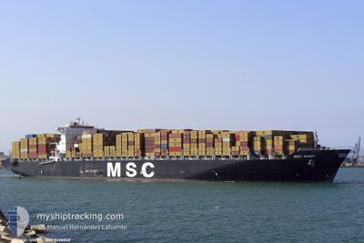
MSC SINDY
Container Ship
Current Trip
INNSA
| Time Travelled | 4 h, 57 mins |
|---|---|
| Remaining Time | --- |
| Distance Travelled | 48.20 nm |
| Remaining Distance | --- |
| AVG Speed | 10 Noeuds |
| MAX Speed | 12.2 Noeuds |
| AVG Wind | 8.6 knots |
| MAX Wind | 13 knots |
| MIN Temp | 25.9°C / 78.62°F |
| MAX Temp | 27°C / 80.6°F |
| Tirant d eau | 13.7 m |
| Position reçue | 3 d depuis |
Current Position
| Longitude | --- |
|---|---|
| Latitude | --- |
| Etat | Under way using engine |
| Vitesse | 20 Noeuds |
| Parcours | 316.6° |
| Zone | Laccadive Sea |
| Station | T-AIS |
| Position reçue | 3 d depuis |
Info
Information
The current position of MSC SINDY is in Laccadive Sea with coordinates 7.86474° / 76.86590° as reported on 2025-12-10 00:08 by AIS to our vessel tracker app. The vessel's current speed is 20 Noeuds
The vessel MSC SINDY (IMO: 9336048, MMSI: 372736000) is a Container Ship that was built in 2007 ( 18 Age ). It's sailing under the flag of [PA] Panama.
In this page you can find informations about the vessels current position, last detected port calls, and current voyage information. If the vessels is not in coverage by AIS you will find the latest position.
The current position of MSC SINDY is detected by our AIS receivers and we are not responsible for the reliability of the data. The last position was recorded while the vessel was in Coverage by the Ais receivers of our vessel tracking app.
The current draught of MSC SINDY as reported by AIS is 13.7 meters
Weather
| Temperature | 25.9°C / 78.62°F |
|---|---|
| Wind Speed | 9 knots |
| Direction | 357° N |
| Pressure | 1014.1 hPa |
| Humidity | 61.8 % |
| Cloud Coverage | 1 % |
Featured Company
Last Port Calls
| Port | Arrival | Departure | Time In Port |
|---|---|---|---|
| 2025-12-12 11:41 | 2025-12-13 12:05 | 1 d | |
| 2025-12-08 11:01 | 2025-12-09 13:57 | 1 d | |
| 2025-12-01 05:51 | 2025-12-02 11:51 | 1 d | |
| 2025-11-28 09:31 | 2025-11-29 15:01 | 1 d | |
| 2025-11-06 00:33 | 2025-11-06 22:48 | 22 h | |
| 2025-11-02 11:09 | 2025-11-03 13:34 | 1 d | |
| 2025-10-30 18:24 | 2025-11-01 04:57 | 1 d | |
| 2025-10-27 16:33 | 2025-10-28 10:07 | 17 h | |
| 2025-10-25 16:49 | 2025-10-27 07:21 | 1 d | |
| 2025-10-22 13:21 | 2025-10-23 12:29 | 23 h |
Most Visited Ports (Last year)
| Port | Arrivals | |
|---|---|---|
| 4 | ||
| 3 | ||
| 3 | ||
| 3 | ||
| 3 | ||
| 3 |
Last Trips
| Origin | Departure | Destination | Arrival | Distance | |
|---|---|---|---|---|---|
| 2025-12-09 19:27 | 2025-12-12 17:11 | 929.45 nm | |||
| 2025-12-02 15:51 | 2025-12-08 16:31 | 2246.30 nm | |||
| 2025-11-29 19:01 | 2025-12-01 09:51 | 173.24 nm | |||
| 2025-11-06 22:48 | 2025-11-28 13:31 | 8624.04 nm | |||
| 2025-11-03 14:34 | 2025-11-06 00:33 | 374.66 nm | |||
| 2025-11-01 05:57 | 2025-11-02 12:09 | 270.77 nm | |||
| 2025-10-28 11:07 | 2025-10-30 19:24 | 396.27 nm | |||
| 2025-10-27 08:21 | 2025-10-27 17:33 | 126.87 nm | |||
| 2025-10-23 14:29 | 2025-10-25 18:49 | 444.69 nm | |||
| 2025-10-19 23:18 | 2025-10-22 15:21 | 392.16 nm |
Events
| Heure | Evenement | Détails | Position/ Destination | Info |
|---|---|---|---|---|
| 2025-12-13 12:05 | PORT DE DEPART |
|
18.95032 / 72.93887
INNSA
|
Vitesse: 6.3 kn Parcours: 218° |
| 2025-12-13 11:57 | Démarrage |
18.96234 / 72.94753
[IN] NHAVA SHEVA
|
Vitesse: 4.1 kn Parcours: 208° |
|
| 2025-12-12 11:45 | Arret |
18.96523 / 72.95119
[IN] NHAVA SHEVA
|
Vitesse: 0.1 kn Parcours: 205° |
|
| 2025-12-12 11:41 | Port d'arrivée |
|
18.96543 / 72.95085
[IN] NHAVA SHEVA
|
Vitesse: 1.1 kn Parcours: 185° |
| 2025-12-10 00:18 | Etat Changé | Default Under way using engine |
7.90555 / 76.82614
INNSA
|
Vitesse: 20 kn Parcours: 316.6° |
| 2025-12-10 00:08 | Etat Changé | Under way using engine Default |
7.86474 / 76.86590
INNSA
|
Vitesse: 20 kn Parcours: 317° |
| 2025-12-10 00:08 | Hors de la zone couverte |
7.86474 / 76.86590
Laccadive Sea
INNSA
|
Vitesse: 20 kn Parcours: 316.6° |
|
| 2025-12-10 00:03 | Etat Changé | Default Under way using engine |
7.84667 / 76.88167
INNSA
|
Vitesse: 20.1 kn Parcours: 309.9° |
| 2025-12-09 23:02 | Changement de destination | INNSA LKCMB |
7.63440 / 77.15316
INNSA
|
Vitesse: 20.4 kn Parcours: 293.3° |
| 2025-12-09 23:02 | Changement d'ETA | 2025/12/11 14:30 2025/12/08 00:30 |
7.63440 / 77.15316
INNSA
|
Vitesse: 20.4 kn Parcours: 293.3° |