
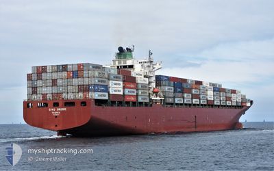
MSC SHANELLE V
Container Ship
Current Trip
| Time Travelled | 6 days |
|---|---|
| Remaining Time | --- |
| Distance Travelled | 1594.96 nm |
| Remaining Distance | --- |
| AVG Speed | 12 Noeuds |
| MAX Speed | 14.3 Noeuds |
| AVG Wind | 11.1 knots |
| MAX Wind | 24 knots |
| MIN Temp | 26°C / 78.8°F |
| MAX Temp | 29.4°C / 84.92°F |
| Tirant d eau | 9.3 m |
| Position reçue | 6 d depuis |
Current Position
| Longitude | -97.23828° |
|---|---|
| Latitude | 22.49353° |
| Etat | Under way using engine |
| Vitesse | 10.9 Noeuds |
| Parcours | 91° |
| Zone | Gulf of Mexico |
| Station | T-AIS |
| Position reçue | 6 d depuis |
Info
Information
The current position of MSC SHANELLE V is in Gulf of Mexico with coordinates 22.49353° / -97.23828° as reported on 2024-05-17 10:29 by AIS to our vessel tracker app. The vessel's current speed is 10.9 Noeuds and is heading at the port of PANAMA CITY. The estimated time of arrival as calculated by MyShipTracking vessel tracking app is 2024-05-23 02:00 LT
The vessel MSC SHANELLE V (IMO: 9292175, MMSI: 353111000) is a Container Ship that was built in 2004 ( 20 Age ). It's sailing under the flag of [PA] Panama.
In this page you can find informations about the vessels current position, last detected port calls, and current voyage information. If the vessels is not in coverage by AIS you will find the latest position.
The current position of MSC SHANELLE V is detected by our AIS receivers and we are not responsible for the reliability of the data. The last position was recorded while the vessel was in Coverage by the Ais receivers of our vessel tracking app.
The current draught of MSC SHANELLE V as reported by AIS is 9.3 meters
Weather
| Temperature | 29.1°C / 84.38°F |
|---|---|
| Wind Speed | 1 knots |
| Direction | 222° SW |
| Pressure | 1012.4 hPa |
| Humidity | 80.4 % |
| Cloud Coverage | 79 % |
Featured Company
Last Port Calls
| Port | Arrival | Departure | Time In Port |
|---|---|---|---|
| 2024-05-16 11:19 | 2024-05-17 07:25 | 20 h | |
| 2024-04-28 16:09 | 2024-04-29 19:34 | 1 d | |
| 2024-04-26 11:37 | 2024-04-27 13:08 | 1 d | |
| 2024-04-22 16:17 | 2024-04-23 08:12 | 15 h | |
| 2024-04-21 10:47 | 2024-04-22 09:20 | 22 h | |
| 2024-04-18 02:43 | 2024-04-19 04:29 | 1 d | |
| 2024-04-01 19:14 | 2024-04-02 15:08 | 19 h | |
| 2024-03-13 09:56 | 2024-03-14 03:41 | 17 h | |
| 2024-03-10 18:22 | 2024-03-12 05:45 | 1 d |
Most Visited Ports (Last year)
| Port | Arrivals | |
|---|---|---|
| 13 | ||
| 10 | ||
| 6 | ||
| 6 | ||
| 5 | ||
| 5 |
Last Trips
| Origin | Departure | Destination | Arrival | Distance | |
|---|---|---|---|---|---|
| 2024-04-29 21:34 | 2024-05-16 06:19 | 5648.79 nm | |||
| 2024-04-27 15:08 | 2024-04-28 18:09 | 376.84 nm | |||
| 2024-04-23 10:12 | 2024-04-26 13:37 | 717.01 nm | |||
| 2024-04-22 11:20 | 2024-04-22 18:17 | 83.45 nm | |||
| 2024-04-19 06:29 | 2024-04-21 12:47 | 750.61 nm | |||
| 2024-04-02 09:08 | 2024-04-18 04:43 | 5588.44 nm | |||
| 2024-03-14 04:41 | 2024-04-01 13:14 | 5740.82 nm | |||
| 2024-03-12 06:45 | 2024-03-13 10:56 | 375.42 nm | |||
| 2024-02-22 13:42 | 2024-03-10 19:22 | 5842.97 nm |
Events
| Heure | Evenement | Détails | Position/ Destination | Info |
|---|---|---|---|---|
| 2024-05-23 16:22 | Démarrage | 5.01 nm, South of CRISTOBAL |
9.26380 / -79.92415
PAPTY
|
Vitesse: 5.5 kn Parcours: 193° |
| 2024-05-23 14:30 | Arret | 3.96 nm, South of CRISTOBAL |
9.28110 / -79.92175
PAPTY
|
Vitesse: Parcours: 188° |
| 2024-05-23 11:39 | Démarrage | 4.68 nm, North West of COLON |
9.41953 / -79.95280
PAPTY
|
Vitesse: 4.6 kn Parcours: 295° |
| 2024-05-22 12:55 | Arret | 4.44 nm, North West of COLON |
9.41803 / -79.94867
PAPTY
|
Vitesse: 0.2 kn Parcours: 193° |
| 2024-05-17 10:33 | Etat Changé | Default Under way using engine |
22.49328 / -97.22407
PAPTY
|
Vitesse: 10.9 kn Parcours: 91° |
| 2024-05-17 10:29 | Etat Changé | Under way using engine Default |
22.49353 / -97.23828
PAPTY
|
Vitesse: 10.9 kn Parcours: 91° |
| 2024-05-17 10:29 | Hors de la zone couverte |
22.49353 / -97.23828
Gulf of Mexico
PAPTY
|
Vitesse: 10.9 kn Parcours: 91° |
|
| 2024-05-17 10:26 | Etat Changé | Default Under way using engine |
22.49372 / -97.24931
PAPTY
|
Vitesse: 11 kn Parcours: 90° |
| 2024-05-17 07:25 | PORT DE DEPART |
|
22.48730 / -97.85663
PAPTY
|
Vitesse: 7.6 kn Parcours: 91° |
| 2024-05-17 07:04 | Démarrage |
22.47832 / -97.88612
[MX] ALTAMIRA
|
Vitesse: 3.1 kn Parcours: 348° |