
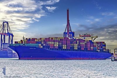
MSC RIDA VIII
Container Ship
Current Trip
| Time Travelled | 2 days |
|---|---|
| Remaining Time | --- |
| Distance Travelled | 702.58 nm |
| Remaining Distance | --- |
| AVG Speed | 13.4 Noeuds |
| MAX Speed | 17.8 Noeuds |
| AVG Wind | 9.3 knots |
| MAX Wind | 26.7 knots |
| MIN Temp | 7.5°C / 45.5°F |
| MAX Temp | 13.9°C / 57.02°F |
| Tirant d eau | 13.3 m |
| Position reçue | 1 d depuis |
Current Position
| Longitude | --- |
|---|---|
| Latitude | --- |
| Etat | Under way using engine |
| Vitesse | 11.7 Noeuds |
| Parcours | 235° |
| Zone | North Pacific Ocean |
| Station | T-AIS |
| Position reçue | 1 d depuis |
Info
Information
The current position of MSC RIDA VIII is in North Pacific Ocean with coordinates 48.14165° / -125.98727° as reported on 2025-12-10 02:05 by AIS to our vessel tracker app. The vessel's current speed is 11.7 Noeuds and is heading at the port of YANTIAN. The estimated time of arrival as calculated by MyShipTracking vessel tracking app is 2025-12-25 13:00 LT
The vessel MSC RIDA VIII (IMO: 9393307, MMSI: 255803480) is a Container Ship that was built in 2009 ( 16 Age ). It's sailing under the flag of [PT] Portugal.
In this page you can find informations about the vessels current position, last detected port calls, and current voyage information. If the vessels is not in coverage by AIS you will find the latest position.
The current position of MSC RIDA VIII is detected by our AIS receivers and we are not responsible for the reliability of the data. The last position was recorded while the vessel was in Coverage by the Ais receivers of our vessel tracking app.
The current draught of MSC RIDA VIII as reported by AIS is 13.3 meters
Weather
| Temperature | 13.9°C / 57.02°F |
|---|---|
| Wind Speed | 21 knots |
| Direction | 200° SSW |
| Pressure | 1014 hPa |
| Humidity | 89.5 % |
| Cloud Coverage | 100 % |
Featured Company
Last Port Calls
| Port | Arrival | Departure | Time In Port |
|---|---|---|---|
| 2025-12-06 05:36 | 2025-12-09 04:44 | 2 d | |
| 2025-12-02 05:10 | 2025-12-05 07:36 | 3 d | |
| 2025-11-28 21:39 | 2025-11-30 01:24 | 1 d | |
| 2025-11-12 14:44 | 2025-11-13 18:04 | 1 d | |
| 2025-11-10 04:58 | 2025-11-10 15:52 | 10 h | |
| 2025-10-28 05:32 | 2025-10-30 01:28 | 1 d |
Most Visited Ports (Last year)
| Port | Arrivals | |
|---|---|---|
| 5 | ||
| 5 | ||
| 4 | ||
| 4 | ||
| 3 | ||
| 2 |
Last Trips
| Origin | Departure | Destination | Arrival | Distance | |
|---|---|---|---|---|---|
| 2025-12-05 07:36 | 2025-12-06 05:36 | 185.64 nm | |||
| 2025-11-30 01:24 | 2025-12-02 05:10 | 655.27 nm | |||
| 2025-11-13 18:04 | 2025-11-28 21:39 | 6144.99 nm | |||
| 2025-11-10 15:52 | 2025-11-12 14:44 | 493.87 nm | |||
| 2025-10-30 01:28 | 2025-11-10 04:58 | 1056.25 nm | |||
| 2025-09-25 13:30 | 2025-10-28 05:32 | 11436.74 nm |
Events
| Heure | Evenement | Détails | Position/ Destination | Info |
|---|---|---|---|---|
| 2025-12-10 02:11 | Etat Changé | Default Under way using engine |
48.13145 / -126.00897
CNYTN
|
Vitesse: 11.7 kn Parcours: 235° |
| 2025-12-10 02:05 | Hors de la zone couverte |
48.14165 / -125.98727
North Pacific Ocean
CNYTN
|
Vitesse: 11.7 kn Parcours: 235° |
|
| 2025-12-10 02:02 | Etat Changé | Under way using engine Default |
48.14877 / -125.97207
CNYTN
|
Vitesse: 11.8 kn Parcours: 235° |
| 2025-12-10 01:51 | Etat Changé | Default Under way using engine |
48.16853 / -125.93012
CNYTN
|
Vitesse: 11.7 kn Parcours: 234° |
| 2025-12-10 01:42 | Detecté en mer | United States part of the North Pacific Ocean |
48.18488 / -125.89605
North Pacific Ocean
CNYTN
|
Vitesse: 11.7 kn Parcours: 234° |
| 2025-12-10 01:29 | Etat Changé | Under way using engine Default |
48.21148 / -125.84138
CNYTN
|
Vitesse: 11.7 kn Parcours: 233° |
| 2025-12-10 01:27 | Etat Changé | Default Under way using engine |
48.21435 / -125.83550
CNYTN
|
Vitesse: 11.5 kn Parcours: 233° |
| 2025-12-10 01:17 | Etat Changé | Under way using engine Default |
48.23398 / -125.79512
CNYTN
|
Vitesse: 11.6 kn Parcours: 233° |
| 2025-12-10 00:59 | Etat Changé | Default Under way using engine |
48.26732 / -125.72543
CNYTN
|
Vitesse: 11.3 kn Parcours: 234° |
| 2025-12-10 00:53 | Etat Changé | Under way using engine Default |
48.27857 / -125.70188
CNYTN
|
Vitesse: 11.6 kn Parcours: 232° |