
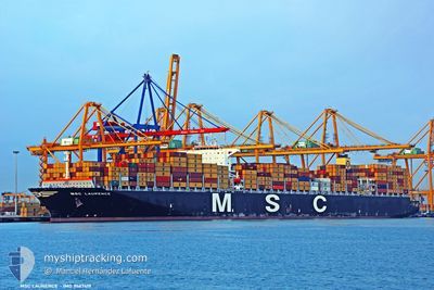
MSC LAURENCE
Container Ship
Current Trip
| Time Travelled | 17 days |
|---|---|
| Remaining Time | 3 days |
| Distance Travelled | 7271.37 nm |
| Remaining Distance | 1382.06 nm |
| AVG Speed | 16.9 Noeuds |
| MAX Speed | 19.7 Noeuds |
| AVG Wind | 13.8 knots |
| MAX Wind | 28 knots |
| MIN Temp | 0.3°C / 32.54°F |
| MAX Temp | 28.4°C / 83.12°F |
| Tirant d eau | 15.5 m |
| Position reçue | 1 d depuis |
Current Position
| Longitude | --- |
|---|---|
| Latitude | --- |
| Etat | Under way using engine |
| Vitesse | 18.2 Noeuds |
| Parcours | 81.2° |
| Zone | Indian Ocean |
| Station | T-AIS |
| Position reçue | 1 d depuis |
Info
Information
The current position of MSC LAURENCE is in Indian Ocean with coordinates -34.46434° / 23.65004° as reported on 2025-12-05 10:30 by AIS to our vessel tracker app. The vessel's current speed is 18.2 Noeuds and is heading at the port of PORT LOUIS. The estimated time of arrival as calculated by MyShipTracking vessel tracking app is 2025-12-10 09:21 LT
The vessel MSC LAURENCE (IMO: 9467419, MMSI: 371582000) is a Container Ship that was built in 2011 ( 14 Age ). It's sailing under the flag of [PA] Panama.
In this page you can find informations about the vessels current position, last detected port calls, and current voyage information. If the vessels is not in coverage by AIS you will find the latest position.
The current position of MSC LAURENCE is detected by our AIS receivers and we are not responsible for the reliability of the data. The last position was recorded while the vessel was in Coverage by the Ais receivers of our vessel tracking app.
The current draught of MSC LAURENCE as reported by AIS is 15.5 meters
Weather
| Temperature | 21.7°C / 71.06°F |
|---|---|
| Wind Speed | 16 knots |
| Direction | 188° S |
| Pressure | 1016.7 hPa |
| Humidity | 82 % |
| Cloud Coverage | 98 % |
Featured Company
Last Port Calls
| Port | Arrival | Departure | Time In Port |
|---|---|---|---|
| 2025-11-17 13:27 | 2025-11-19 21:48 | 2 d | |
| 2025-11-13 08:54 | 2025-11-14 04:08 | 19 h | |
| 2025-11-09 03:53 | 2025-11-11 05:45 | 2 d | |
| 2025-11-04 21:25 | 2025-11-06 02:29 | 1 d | |
| 2025-10-31 13:52 | 2025-11-04 08:01 | 3 d | |
| 2025-10-25 21:14 | 2025-10-27 03:30 | 1 d | |
| 2025-10-17 22:25 | 2025-10-19 10:37 | 1 d |
Most Visited Ports (Last year)
| Port | Arrivals | |
|---|---|---|
| 4 | ||
| 3 | ||
| 3 | ||
| 3 | ||
| 3 | ||
| 2 |
Last Trips
| Origin | Departure | Destination | Arrival | Distance | |
|---|---|---|---|---|---|
| 2025-11-14 04:08 | 2025-11-17 13:27 | 501.21 nm | |||
| 2025-11-11 05:45 | 2025-11-13 08:54 | 414.52 nm | |||
| 2025-11-06 02:29 | 2025-11-09 03:53 | 1169.43 nm | |||
| 2025-11-04 08:01 | 2025-11-04 21:25 | 172.03 nm | |||
| 2025-10-27 03:30 | 2025-10-31 13:52 | 1363.09 nm | |||
| 2025-10-19 10:37 | 2025-10-25 21:14 | 839.63 nm | |||
| 2025-09-22 09:57 | 2025-10-17 22:25 | 10686.51 nm |
Events
| Heure | Evenement | Détails | Position/ Destination | Info |
|---|---|---|---|---|
| 2025-12-05 10:37 | Etat Changé | Default Under way using engine |
-34.45829 / 23.69682
PORT LOUIS
|
Vitesse: 18.2 kn Parcours: 81.2° |
| 2025-12-05 10:30 | Hors de la zone couverte |
-34.46434 / 23.65004
Indian Ocean
PORT LOUIS
|
Vitesse: 18.2 kn Parcours: 81.2° |
|
| 2025-12-05 09:26 | Etat Changé | Under way using engine Default |
-34.51757 / 23.26486
PORT LOUIS
|
Vitesse: 18.4 kn Parcours: 81° |
| 2025-12-05 09:18 | Etat Changé | Default Under way using engine |
-34.52426 / 23.21598
PORT LOUIS
|
Vitesse: 18 kn Parcours: 80° |
| 2025-12-05 07:58 | Etat Changé | Under way using engine Default |
-34.58531 / 22.72835
PORT LOUIS
|
Vitesse: 18 kn Parcours: 84° |
| 2025-12-05 07:54 | Etat Changé | Default Under way using engine |
-34.58790 / 22.70050
PORT LOUIS
|
Vitesse: 18 kn Parcours: 83.4° |
| 2025-12-05 07:27 | Etat Changé | Under way using engine Default |
-34.60919 / 22.53996
PORT LOUIS
|
Vitesse: 18.1 kn Parcours: 77° |
| 2025-12-05 07:23 | Etat Changé | Default Under way using engine |
-34.61401 / 22.51426
PORT LOUIS
|
Vitesse: 18.2 kn Parcours: 77.1° |
| 2025-12-05 07:17 | Etat Changé | Under way using engine Default |
-34.62004 / 22.48189
PORT LOUIS
|
Vitesse: 18.2 kn Parcours: 78° |
| 2025-12-05 07:12 | Etat Changé | Default Under way using engine |
-34.62529 / 22.45307
PORT LOUIS
|
Vitesse: 18.2 kn Parcours: 78.1° |