
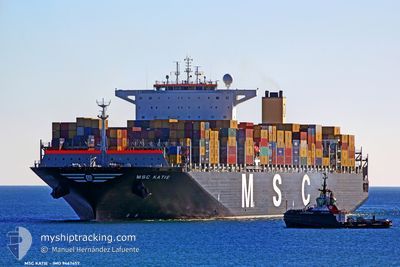
MSC KATIE
Container Ship
Current Trip
| Trip Time | 5 mins |
|---|---|
| Trip Distance | 0.72 nm |
| AVG Speed | --- |
| MAX Speed | --- |
| Tirant d eau | 10.5 m |
| AVG Wind | 10 knots |
| MAX Wind | 10 knots |
| MIN Temp | 32.5°C / 90.5°F |
| MAX Temp | 32.8°C / 91.04°F |
| Position reçue | 2 d depuis |
Current Position
| Longitude | 34.36547° |
|---|---|
| Latitude | 31.92366° |
| Etat | Under way using engine |
| Vitesse | 3.8 Noeuds |
| Parcours | 114° |
| Zone | Mediterranean Sea - Eastern Basin |
| Station | T-AIS |
| Position reçue | 2 d depuis |
Info
Information
The current position of MSC KATIE is in Mediterranean Sea - Eastern Basin with coordinates 31.92366° / 34.36547° as reported on 2024-06-13 01:08 by AIS to our vessel tracker app. The vessel's current speed is 3.8 Noeuds and is currently inside the port of ASHDOD.
The vessel MSC KATIE (IMO: 9467457, MMSI: 351848000) is a Container Ship that was built in 2012 ( 12 Age ). It's sailing under the flag of [PA] Panama.
In this page you can find informations about the vessels current position, last detected port calls, and current voyage information. If the vessels is not in coverage by AIS you will find the latest position.
The current position of MSC KATIE is detected by our AIS receivers and we are not responsible for the reliability of the data. The last position was recorded while the vessel was in Coverage by the Ais receivers of our vessel tracking app.
The current draught of MSC KATIE as reported by AIS is 10.5 meters
Weather
| Temperature | 30.8°C / 87.44°F |
|---|---|
| Wind Speed | 10 knots |
| Direction | 347° NNW |
| Pressure | 1009 hPa |
| Humidity | 47.5 % |
| Cloud Coverage | --- |
Featured Company
Last Port Calls
| Port | Arrival | Departure | Time In Port |
|---|---|---|---|
| 2024-06-13 11:24 | |||
| 2024-06-13 07:32 | 2024-06-13 11:19 | 3 h | |
| 2024-06-10 21:39 | 2024-06-11 13:02 | 15 h | |
| 2024-06-05 04:11 | 2024-06-08 05:05 | 3 d | |
| 2024-06-02 12:49 | 2024-06-03 10:18 | 21 h | |
| 2024-05-31 17:52 | 2024-06-01 18:32 | 1 d | |
| 2024-05-25 05:13 | 2024-05-27 02:22 | 1 d | |
| 2024-04-29 22:28 | 2024-05-01 07:53 | 1 d | |
| 2024-04-17 05:05 |
Most Visited Ports (Last year)
| Port | Arrivals | |
|---|---|---|
| 4 | ||
| 4 | ||
| 3 | ||
| 3 | ||
| 2 | ||
| 2 |
Last Trips
| Origin | Departure | Destination | Arrival | Distance | |
|---|---|---|---|---|---|
| 2024-06-13 14:19 | 2024-06-13 14:24 | 0.72 nm | |||
| 2024-06-11 16:02 | 2024-06-13 10:32 | 682.20 nm | |||
| 2024-06-08 07:05 | 2024-06-11 00:39 | 554.17 nm | |||
| 2024-06-03 12:18 | 2024-06-05 06:11 | 686.11 nm | |||
| 2024-06-01 20:32 | 2024-06-02 14:49 | 167.31 nm | |||
| 2024-05-27 03:22 | 2024-05-31 19:52 | 1111.84 nm | |||
| 2024-05-01 13:23 | 2024-05-25 06:13 | 8832.04 nm | |||
| 2024-03-22 11:04 | 2024-04-17 10:35 | 9882.39 nm |
Events
| Heure | Evenement | Détails | Position/ Destination | Info |
|---|---|---|---|---|
| 2024-06-13 11:24 | Port d'arrivée |
|
31.84249 / 34.64443
[IL] ASHDOD
|
Vitesse: 9.4 kn Parcours: 269° |
| 2024-06-13 11:19 | Démarrage | 1.19 nm, North East of ASHDOD |
31.85269 / 34.65192
ILASH
|
Vitesse: 9.4 kn Parcours: 269° |
| 2024-06-13 11:19 | PORT DE DEPART |
|
31.85269 / 34.65192
ILASH
|
Vitesse: Parcours: 269° |
| 2024-06-13 07:32 | Port d'arrivée |
|
31.83986 / 34.64189
[IL] ASHDOD
|
Vitesse: 6.5 kn Parcours: 154° |
| 2024-06-13 06:49 | Démarrage | 3.25 nm, North of ASHDOD |
31.88545 / 34.61869
ILASH
|
Vitesse: 3.6 kn Parcours: 159° |
| 2024-06-13 06:08 | Arret | 2.55 nm, North West of ASHDOD |
31.87343 / 34.62026
ILASH
|
Vitesse: Parcours: 113° |
| 2024-06-13 01:13 | Etat Changé | Default Under way using engine |
31.92261 / 34.37178
ILASH
|
Vitesse: 3.8 kn Parcours: 114° |
| 2024-06-13 01:08 | Etat Changé | Under way using engine Default |
31.92366 / 34.36547
ILASH
|
Vitesse: 4.2 kn Parcours: 121° |
| 2024-06-13 01:08 | Hors de la zone couverte |
31.92366 / 34.36547
Mediterranean Sea - Eastern Basin
ILASH
|
Vitesse: 3.8 kn Parcours: 111.3° |
|
| 2024-06-13 01:05 | Etat Changé | Default Under way using engine |
31.92460 / 34.36288
ILASH
|
Vitesse: 5.6 kn Parcours: 113.4° |