
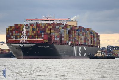
MSC ERICA
Cargo
Current Trip
| Time Travelled | 23 days |
|---|---|
| Remaining Time | --- |
| Distance Travelled | 10042.59 nm |
| Remaining Distance | --- |
| AVG Speed | 17.5 Noeuds |
| MAX Speed | 21.7 Noeuds |
| AVG Wind | 11 knots |
| MAX Wind | 38 knots |
| MIN Temp | 16.2°C / 61.16°F |
| MAX Temp | 30.3°C / 86.54°F |
| Tirant d eau | 16.5 m |
| Position reçue | 2 m depuis |
Current Position
| Longitude | -13.99323° |
|---|---|
| Latitude | 27.51366° |
| Etat | Under way using engine |
| Vitesse | 16.7 Noeuds |
| Parcours | 35° |
| Zone | North Atlantic Ocean |
| Station | T-AIS |
| Position reçue | 2 m depuis |
Info
Information
The current position of MSC ERICA is in North Atlantic Ocean with coordinates 27.51366° / -13.99323° as reported on 2024-05-07 13:38 by AIS to our vessel tracker app. The vessel's current speed is 16.7 Noeuds and is heading at the port of PORT SAID. The estimated time of arrival as calculated by MyShipTracking vessel tracking app is 2024-05-13 19:00 LT
The vessel MSC ERICA (IMO: 9755191, MMSI: 636017726) is a Cargo It's sailing under the flag of [LR] Liberia.
In this page you can find informations about the vessels current position, last detected port calls, and current voyage information. If the vessels is not in coverage by AIS you will find the latest position.
The current position of MSC ERICA is detected by our AIS receivers and we are not responsible for the reliability of the data. The last position was recorded while the vessel was in Coverage by the Ais receivers of our vessel tracking app.
The current draught of MSC ERICA as reported by AIS is 16.5 meters
Weather
| Temperature | 19.5°C / 67.1°F |
|---|---|
| Wind Speed | 16 knots |
| Direction | 42° NE |
| Pressure | 1014.1 hPa |
| Humidity | 88.1 % |
| Cloud Coverage | 100 % |
Featured Company
Last Port Calls
Most Visited Ports (Last year)
| Port | Arrivals | |
|---|---|---|
| 6 | ||
| 6 | ||
| 4 | ||
| 3 | ||
| 2 | ||
| 2 |
Last Trips
| Origin | Departure | Destination | Arrival | Distance | |
|---|---|---|---|---|---|
| 2024-03-29 15:01 | 2024-04-13 00:28 | 2460.67 nm | |||
| 2024-03-26 14:52 | 2024-03-28 12:06 | 480.50 nm | |||
| 2024-03-15 01:12 | 2024-03-23 09:05 | 2552.32 nm | |||
| 2024-03-03 23:27 | 2024-03-12 23:05 | 3541.88 nm | |||
| 2024-02-25 12:38 | 2024-03-02 19:19 | 101.16 nm |
Events
| Heure | Evenement | Détails | Position/ Destination | Info |
|---|---|---|---|---|
| 2024-05-07 13:31 | Changement de zone | Spanish (Canary Islands) part of the North Atlantic Ocean Western Saharan part of the North Atlantic Ocean |
27.48943 / -14.01255
North Atlantic Ocean
PORT SAID EAST
|
Vitesse: 16.8 kn Parcours: 35.3° |
| 2024-05-07 13:15 | Etat Changé | Under way using engine Default |
27.42651 / -14.06286
PORT SAID EAST
|
Vitesse: 16.6 kn Parcours: 36° |
| 2024-05-07 13:02 | Etat Changé | Default Under way using engine |
27.37981 / -14.10031
PORT SAID EAST
|
Vitesse: 16.5 kn Parcours: 36° |
| 2024-05-07 12:53 | Etat Changé | Under way using engine Default |
27.34277 / -14.12985
PORT SAID EAST
|
Vitesse: 16.6 kn Parcours: 35° |
| 2024-05-07 11:58 | Etat Changé | Default Under way using engine |
27.13289 / -14.29730
PORT SAID EAST
|
Vitesse: 17.3 kn Parcours: 35.8° |
| 2024-05-07 11:00 | Etat Changé | Under way using engine Default |
26.90407 / -14.47950
PORT SAID EAST
|
Vitesse: 17 kn Parcours: 36° |
| 2024-05-07 10:38 | Etat Changé | Default Under way using engine |
26.82263 / -14.54425
PORT SAID EAST
|
Vitesse: 16.9 kn Parcours: 35.8° |
| 2024-05-07 10:32 | Etat Changé | Under way using engine Default |
26.79815 / -14.56375
PORT SAID EAST
|
Vitesse: 16.9 kn Parcours: 35° |
| 2024-05-07 10:30 | Dans la zone couverte |
26.80272 / -14.56001
North Atlantic Ocean
PORT SAID EAST
|
Vitesse: 16.9 kn Parcours: 35.8° |
|
| 2024-05-07 09:26 | Hors de la zone couverte |
26.54956 / -14.76124
North Atlantic Ocean
PORT SAID EAST
|
Vitesse: 16.4 kn Parcours: 35.5° |