
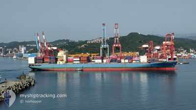
MOL EARNEST
Container Ship
Current Trip
VNCMT
| Time Travelled | 2 days |
|---|---|
| Remaining Time | --- |
| Distance Travelled | 526.18 nm |
| Remaining Distance | --- |
| AVG Speed | 13 Noeuds |
| MAX Speed | 14.8 Noeuds |
| AVG Wind | 13.2 knots |
| MAX Wind | 19.8 knots |
| MIN Temp | 24.4°C / 75.92°F |
| MAX Temp | 26.4°C / 79.52°F |
| Tirant d eau | 11 m |
| Position reçue | 4 d depuis |
Current Position
| Longitude | --- |
|---|---|
| Latitude | --- |
| Etat | Under way using engine |
| Vitesse | 10.9 Noeuds |
| Parcours | 51.2° |
| Zone | Singapore Strait |
| Station | T-AIS |
| Position reçue | 4 d depuis |
Info
Information
The current position of MOL EARNEST is in Singapore Strait with coordinates 1.29472° / 104.33150° as reported on 2025-12-07 21:34 by AIS to our vessel tracker app. The vessel's current speed is 10.9 Noeuds
The vessel MOL EARNEST (IMO: 9333840, MMSI: 351496000) is a Container Ship that was built in 2007 ( 18 Age ). It's sailing under the flag of [PA] Panama.
In this page you can find informations about the vessels current position, last detected port calls, and current voyage information. If the vessels is not in coverage by AIS you will find the latest position.
The current position of MOL EARNEST is detected by our AIS receivers and we are not responsible for the reliability of the data. The last position was recorded while the vessel was in Coverage by the Ais receivers of our vessel tracking app.
The current draught of MOL EARNEST as reported by AIS is 11 meters
Weather
| Temperature | 25.2°C / 77.36°F |
|---|---|
| Wind Speed | 19 knots |
| Direction | 49° NE |
| Pressure | 1012.1 hPa |
| Humidity | 75.8 % |
| Cloud Coverage | 8 % |
Featured Company
Last Port Calls
| Port | Arrival | Departure | Time In Port |
|---|---|---|---|
| 2025-12-09 18:31 | 2025-12-10 04:26 | 9 h | |
| 2025-12-06 15:19 | 2025-12-08 01:23 | 1 d | |
| 2025-11-11 01:13 | 2025-11-12 06:30 | 1 d | |
| 2025-11-09 11:21 | 2025-11-10 05:45 | 18 h | |
| 2025-10-13 01:52 | 2025-10-14 04:01 | 1 d | |
| 2025-10-08 01:56 | 2025-10-08 16:01 | 14 h | |
| 2025-10-01 09:44 | 2025-10-02 02:32 | 16 h |
Most Visited Ports (Last year)
| Port | Arrivals | |
|---|---|---|
| 16 | ||
| 10 | ||
| 6 | ||
| 3 | ||
| 3 | ||
| 2 |
Last Trips
| Origin | Departure | Destination | Arrival | Distance | |
|---|---|---|---|---|---|
| 2025-12-08 01:23 | 2025-12-09 18:31 | 637.97 nm | |||
| 2025-11-12 06:30 | 2025-12-06 15:19 | 9075.12 nm | |||
| 2025-11-10 05:45 | 2025-11-11 01:13 | 204.97 nm | |||
| 2025-10-14 04:01 | 2025-11-09 11:21 | 9758.86 nm | |||
| 2025-10-08 16:01 | 2025-10-13 01:52 | 1503.08 nm | |||
| 2025-10-02 02:32 | 2025-10-08 01:56 | 1296.02 nm | |||
| 2025-09-03 08:03 | 2025-10-01 09:44 | 1065.47 nm |
Events
| Heure | Evenement | Détails | Position/ Destination | Info |
|---|---|---|---|---|
| 2025-12-09 21:29 | Démarrage | 0.35 nm, South of CAI MEP |
10.53546 / 107.02549
VNCMT
|
Vitesse: 6.1 kn Parcours: 215° |
| 2025-12-09 21:26 | PORT DE DEPART |
|
10.53546 / 107.02549
VNCMT
|
Vitesse: Parcours: 186° |
| 2025-12-09 11:34 | Arret |
10.54042 / 107.02856
[VN] CAI MEP
|
Vitesse: 0.1 kn Parcours: 186° |
|
| 2025-12-09 11:31 | Port d'arrivée |
|
10.54069 / 107.02831
[VN] CAI MEP
|
Vitesse: 1.4 kn Parcours: 176° |
| 2025-12-07 21:41 | Etat Changé | Default Under way using engine |
1.30778 / 104.34796
VNCMT
|
Vitesse: 10.9 kn Parcours: 51.2° |
| 2025-12-07 21:34 | Hors de la zone couverte |
1.29472 / 104.33150
Singapore Strait
VNCMT
|
Vitesse: 10.9 kn Parcours: 51.2° |
|
| 2025-12-07 21:29 | Etat Changé | Under way using engine Default |
1.28688 / 104.31958
VNCMT
|
Vitesse: 12.2 kn Parcours: 82° |
| 2025-12-07 21:21 | Etat Changé | Default Under way using engine |
1.28195 / 104.29054
VNCMT
|
Vitesse: 12.5 kn Parcours: 81.6° |
| 2025-12-07 21:15 | Etat Changé | Under way using engine Default |
1.27892 / 104.27090
VNCMT
|
Vitesse: 12.5 kn Parcours: 82° |
| 2025-12-07 21:09 | Etat Changé | Default Under way using engine |
1.27630 / 104.25010
VNCMT
|
Vitesse: 12.9 kn Parcours: 79.1° |