
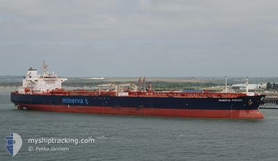
MINERVA PISCES
Crude Oil Tanker
Current Trip
TURKEY FOR ORDER
| Time Travelled | --- |
|---|---|
| Remaining Time | --- |
| Distance Travelled | --- |
| Remaining Distance | --- |
| AVG Speed | --- |
| MAX Speed | --- |
| AVG Wind | --- |
| MAX Wind | --- |
| MIN Temp | --- |
| MAX Temp | --- |
| Tirant d eau | 14.1 m |
| Position reçue | 2 h, 49 m depuis |
Current Position
| Longitude | --- |
|---|---|
| Latitude | --- |
| Etat | Under way using engine |
| Vitesse | 11.1 Noeuds |
| Parcours | 206.4° |
| Zone | North Sea |
| Station | T-AIS |
| Position reçue | 2 h, 49 m depuis |
Info
Information
The current position of MINERVA PISCES is in North Sea with coordinates 55.32750° / 5.73108° as reported on 2026-01-06 21:28 by AIS to our vessel tracker app. The vessel's current speed is 11.1 Noeuds
The vessel MINERVA PISCES (IMO: 9410179, MMSI: 229094000) is a Crude Oil Tanker that was built in 2008 ( 18 Age ). It's sailing under the flag of [MT] Malta.
In this page you can find informations about the vessels current position, last detected port calls, and current voyage information. If the vessels is not in coverage by AIS you will find the latest position.
The current position of MINERVA PISCES is detected by our AIS receivers and we are not responsible for the reliability of the data. The last position was recorded while the vessel was in Coverage by the Ais receivers of our vessel tracking app.
The current draught of MINERVA PISCES as reported by AIS is 14.1 meters
Weather
| Temperature | 5°C / 41°F |
|---|---|
| Wind Speed | 22 knots |
| Direction | 195° SSW |
| Pressure | 1004 hPa |
| Humidity | 85.3 % |
| Cloud Coverage | 100 % |
Featured Company
Events
| Heure | Evenement | Détails | Position/ Destination | Info |
|---|---|---|---|---|
| 2026-01-06 21:30 | Etat Changé | Default Under way using engine |
55.32058 / 5.72523
TURKEY FOR ORDER
|
Vitesse: 11.1 kn Parcours: 206.4° |
| 2026-01-06 21:28 | Hors de la zone couverte |
55.32750 / 5.73108
North Sea
TURKEY FOR ORDER
|
Vitesse: 11.1 kn Parcours: 206.4° |
|
| 2026-01-06 20:53 | Changement de zone | German part of the North Sea Danish part of the North Sea |
55.42437 / 5.81273
North Sea
TURKEY FOR ORDER
|
Vitesse: 11.1 kn Parcours: 203.3° |
| 2026-01-06 20:51 | Etat Changé | Under way using engine Default |
55.43050 / 5.81744
TURKEY FOR ORDER
|
Vitesse: 11.1 kn Parcours: 204° |
| 2026-01-06 20:47 | Dans la zone couverte |
55.42437 / 5.81273
North Sea
TURKEY FOR ORDER
|
Vitesse: 11.1 kn Parcours: 203.3° |
|
| 2026-01-06 10:21 | Etat Changé | Default Under way using engine |
57.11074 / 7.51803
TURKEY FOR ORDER
|
Vitesse: 10.6 kn Parcours: 222.7° |
| 2026-01-06 10:20 | Hors de la zone couverte |
57.11333 / 7.52245
North Sea
TURKEY FOR ORDER
|
Vitesse: 10.6 kn Parcours: 222.7° |
|
| 2026-01-06 10:03 | Etat Changé | Under way using engine Default |
57.14814 / 7.58255
TURKEY FOR ORDER
|
Vitesse: 10.8 kn Parcours: 224° |
| 2026-01-06 09:50 | Etat Changé | Default Under way using engine |
57.17637 / 7.63200
TURKEY FOR ORDER
|
Vitesse: 10.7 kn Parcours: 224.2° |
| 2026-01-06 07:52 | Detecté en mer | Danish part of the North Sea |
57.38710 / 8.12274
North Sea
TURKEY FOR ORDER
|
Vitesse: 10.5 kn Parcours: 242.9° |