
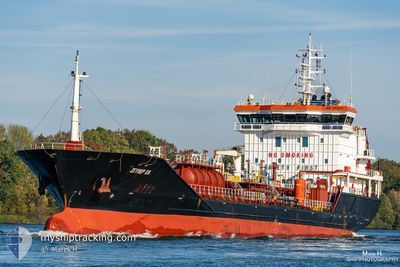
MG DERIN
Oil/Chemical Tanker
Current Trip
BANCO DEL HOYO
| Time Travelled | 2 days |
|---|---|
| Remaining Time | --- |
| Distance Travelled | 169.17 nm |
| Remaining Distance | --- |
| AVG Speed | 8.1 Noeuds |
| MAX Speed | 10 Noeuds |
| AVG Wind | 9.9 knots |
| MAX Wind | 16.9 knots |
| MIN Temp | 15.2°C / 59.36°F |
| MAX Temp | 17.7°C / 63.86°F |
| Tirant d eau | 5.2 m |
| Position reçue | 13 h, 24 m depuis |
Current Position
| Longitude | -6.26145° |
|---|---|
| Latitude | 36.07961° |
| Etat | At anchor |
| Vitesse | |
| Parcours | 290° |
| Zone | North Atlantic Ocean |
| Station | T-AIS |
| Position reçue | 13 h, 24 m depuis |
Info
Information
The current position of MG DERIN is in North Atlantic Ocean with coordinates 36.07961° / -6.26145° as reported on 2024-05-20 18:46 by AIS to our vessel tracker app. The vessel's current speed is 0 Noeuds
The vessel MG DERIN (IMO: 9445411, MMSI: 271002601) is a Oil/Chemical Tanker that was built in 2008 ( 16 Age ). It's sailing under the flag of [TR] Turkey.
In this page you can find informations about the vessels current position, last detected port calls, and current voyage information. If the vessels is not in coverage by AIS you will find the latest position.
The current position of MG DERIN is detected by our AIS receivers and we are not responsible for the reliability of the data. The last position was recorded while the vessel was in Coverage by the Ais receivers of our vessel tracking app.
The current draught of MG DERIN as reported by AIS is 5.2 meters
Weather
| Temperature | 16.6°C / 61.88°F |
|---|---|
| Wind Speed | 11 knots |
| Direction | 316° NW |
| Pressure | 1019.2 hPa |
| Humidity | 74.7 % |
| Cloud Coverage | --- |
Featured Company
Last Port Calls
| Port | Arrival | Departure | Time In Port |
|---|---|---|---|
| 2024-05-17 00:50 | 2024-05-18 23:39 | 1 d | |
| 2024-05-08 01:29 | 2024-05-08 21:58 | 20 h | |
| 2024-04-20 22:46 | 2024-04-21 18:27 | 19 h | |
| 2024-04-13 08:25 | 2024-04-15 01:09 | 1 d | |
| 2024-03-28 15:18 | 2024-03-30 01:07 | 1 d | |
| 2024-03-21 16:54 | 2024-03-22 22:32 | 1 d | |
| 2024-03-12 19:03 | 2024-03-13 17:05 | 22 h | |
| 2024-03-04 21:55 | 2024-03-06 18:22 | 1 d | |
| 2024-03-02 07:56 |
Most Visited Ports (Last year)
| Port | Arrivals | |
|---|---|---|
| 6 | ||
| 5 | ||
| 4 | ||
| 3 | ||
| 2 | ||
| 2 |
Last Trips
| Origin | Departure | Destination | Arrival | Distance | |
|---|---|---|---|---|---|
| 2024-05-08 23:58 | 2024-05-17 01:50 | 923.19 nm | |||
| 2024-04-21 20:27 | 2024-05-08 03:29 | 1933.16 nm | |||
| 2024-04-15 03:09 | 2024-04-21 00:46 | 1303.56 nm | |||
| 2024-03-30 02:07 | 2024-04-13 10:25 | 1866.87 nm | |||
| 2024-03-22 23:32 | 2024-03-28 16:18 | 553.18 nm | |||
| 2024-03-13 19:05 | 2024-03-21 17:54 | 1466.83 nm | |||
| 2024-03-06 22:22 | 2024-03-12 21:03 | 693.14 nm | |||
| 2024-03-02 09:56 | 2024-03-05 01:55 | 595.43 nm |
Events
| Heure | Evenement | Détails | Position/ Destination | Info |
|---|---|---|---|---|
| 2024-05-20 18:49 | Etat Changé | Default At anchor |
36.07960 / -6.26145
BANCO DEL HOYO
|
Vitesse: Parcours: 290° |
| 2024-05-20 18:46 | Etat Changé | At anchor Default |
36.07961 / -6.26145
BANCO DEL HOYO
|
Vitesse: Parcours: 282° |
| 2024-05-20 18:46 | Hors de la zone couverte |
36.07961 / -6.26145
North Atlantic Ocean
|
Vitesse: Parcours: 220° |
|
| 2024-05-20 18:34 | Dans la zone couverte |
36.07961 / -6.26145
North Atlantic Ocean
|
Vitesse: Parcours: 220° |
|
| 2024-05-20 17:52 | Etat Changé | Default At anchor |
36.07978 / -6.26135
BANCO DEL HOYO
|
Vitesse: Parcours: 281° |
| 2024-05-20 17:37 | Etat Changé | At anchor Default |
36.07969 / -6.26140
BANCO DEL HOYO
|
Vitesse: Parcours: 278° |
| 2024-05-20 17:37 | Hors de la zone couverte |
36.07969 / -6.26140
North Atlantic Ocean
|
Vitesse: Parcours: 188° |
|
| 2024-05-20 17:10 | Etat Changé | Default At anchor |
36.07975 / -6.26135
BANCO DEL HOYO
|
Vitesse: 0.1 kn Parcours: 277° |
| 2024-05-20 17:01 | Detecté en mer | Spanish part of the North Atlantic Ocean |
36.07976 / -6.26137
North Atlantic Ocean
|
Vitesse: 0.1 kn Parcours: 170° |
| 2024-05-20 17:01 | Etat Changé | At anchor Default |
36.07976 / -6.26137
BANCO DEL HOYO
|
Vitesse: 0.1 kn Parcours: 275° |