
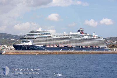
MEIN SCHIFF 2
Passenger
Current Trip
| Trip Time | 8 h, 27 mins |
|---|---|
| Trip Distance | 56.39 nm |
| AVG Speed | 6.4 Noeuds |
| MAX Speed | 9 Noeuds |
| Tirant d eau | 8.2 m |
| AVG Wind | 16.1 knots |
| MAX Wind | 19.7 knots |
| MIN Temp | 26.3°C / 79.34°F |
| MAX Temp | 26.8°C / 80.24°F |
| Position reçue | 15 h, 27 m depuis |
Current Position
| Longitude | --- |
|---|---|
| Latitude | --- |
| Etat | Under way using engine |
| Vitesse | 6.1 Noeuds |
| Parcours | 130.9° |
| Zone | Caribbean Sea |
| Station | T-AIS |
| Position reçue | 15 h, 27 m depuis |
Info
Information
The current position of MEIN SCHIFF 2 is in Caribbean Sea with coordinates 17.45545° / -63.02869° as reported on 2025-12-10 07:19 by AIS to our vessel tracker app. The vessel's current speed is 6.1 Noeuds and is currently inside the port of BASSETERRE.
The vessel MEIN SCHIFF 2 (IMO: 9783576, MMSI: 248956000) is a Passenger It's sailing under the flag of [MT] Malta.
In this page you can find informations about the vessels current position, last detected port calls, and current voyage information. If the vessels is not in coverage by AIS you will find the latest position.
The current position of MEIN SCHIFF 2 is detected by our AIS receivers and we are not responsible for the reliability of the data. The last position was recorded while the vessel was in Coverage by the Ais receivers of our vessel tracking app.
The current draught of MEIN SCHIFF 2 as reported by AIS is 8.2 meters
Weather
| Temperature | 26.9°C / 80.42°F |
|---|---|
| Wind Speed | 16 knots |
| Direction | 94° E |
| Pressure | 1013.7 hPa |
| Humidity | 75.2 % |
| Cloud Coverage | 5 % |
Featured Company
Last Port Calls
| Port | Arrival | Departure | Time In Port |
|---|---|---|---|
| 2025-12-10 06:25 | |||
| 2025-12-09 06:43 | 2025-12-09 21:58 | 15 h | |
| 2025-12-07 13:18 | 2025-12-08 19:12 | 1 d | |
| 2025-12-06 06:33 | 2025-12-06 21:56 | 15 h | |
| 2025-12-05 06:35 | 2025-12-05 22:10 | 15 h | |
| 2025-12-04 06:46 | 2025-12-05 00:11 | 17 h | |
| 2025-12-03 06:53 | 2025-12-03 18:57 | 12 h | |
| 2025-12-01 06:17 | 2025-12-02 19:20 | 1 d | |
| 2025-11-27 23:47 | 2025-11-28 21:56 | 22 h | |
| 2025-11-26 06:43 | 2025-11-26 23:45 | 17 h |
Most Visited Ports (Last year)
| Port | Arrivals | |
|---|---|---|
| 14 | ||
| 14 | ||
| 14 | ||
| 13 | ||
| 13 | ||
| 13 |
Last Trips
| Origin | Departure | Destination | Arrival | Distance | |
|---|---|---|---|---|---|
| 2025-12-09 21:58 | 2025-12-10 06:25 | 56.39 nm | |||
| 2025-12-08 19:12 | 2025-12-09 06:43 | 90.83 nm | |||
| 2025-12-06 21:56 | 2025-12-07 13:18 | 126.94 nm | |||
| 2025-12-05 22:10 | 2025-12-06 06:33 | 52.08 nm | |||
| 2025-12-05 00:11 | 2025-12-05 06:35 | 36.09 nm | |||
| 2025-12-03 18:57 | 2025-12-04 06:46 | 128.62 nm | |||
| 2025-12-02 19:20 | 2025-12-03 06:53 | 147.89 nm | |||
| 2025-11-28 21:56 | 2025-12-01 06:17 | 646.41 nm | |||
| 2025-11-26 23:45 | 2025-11-27 23:47 | 376.27 nm | |||
| 2025-11-25 22:03 | 2025-11-26 06:43 | 57.10 nm |
Events
| Heure | Evenement | Détails | Position/ Destination | Info |
|---|---|---|---|---|
| 2025-12-10 10:38 | Arret |
17.29008 / -62.72505
[KN] BASSETERRE
|
Vitesse: Parcours: 34° |
|
| 2025-12-10 10:25 | Port d'arrivée |
|
17.28947 / -62.72563
[KN] BASSETERRE
|
Vitesse: 5 kn Parcours: 90° |
| 2025-12-10 07:23 | Etat Changé | Default Under way using engine |
17.45029 / -63.02273
KN BAS
|
Vitesse: 6.1 kn Parcours: 130.9° |
| 2025-12-10 07:19 | Etat Changé | Under way using engine Default |
17.45545 / -63.02869
KN BAS
|
Vitesse: 6 kn Parcours: 132° |
| 2025-12-10 07:19 | Hors de la zone couverte |
17.45545 / -63.02869
Caribbean Sea
KN BAS
|
Vitesse: 6.1 kn Parcours: 130.9° |
|
| 2025-12-10 07:14 | Etat Changé | Default Under way using engine |
17.46079 / -63.03512
KN BAS
|
Vitesse: 5.7 kn Parcours: 127.2° |
| 2025-12-10 06:28 | Etat Changé | Under way using engine Default |
17.54256 / -63.05621
KN BAS
|
Vitesse: 7.3 kn Parcours: 175° |
| 2025-12-10 06:26 | Etat Changé | Default Under way using engine |
17.54653 / -63.05660
KN BAS
|
Vitesse: 7.2 kn Parcours: 174.4° |
| 2025-12-10 05:34 | Changement de zone | Sint-Eustasius part of the Caribbean Sea Saba part of the Caribbean Sea |
17.64976 / -63.06712
Caribbean Sea
KN BAS
|
Vitesse: 7 kn Parcours: 173.4° |
| 2025-12-10 04:22 | Detecté en mer | Saba part of the Caribbean Sea |
17.79188 / -63.08203
Caribbean Sea
KN BAS
|
Vitesse: 6.9 kn Parcours: 172.8° |