
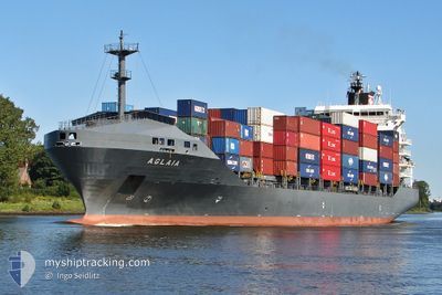
MAYFIELD
Container Ship
Current Trip
| Time Travelled | 22 h, 48 mins |
|---|---|
| Remaining Time | --- |
| Distance Travelled | --- |
| Remaining Distance | --- |
| AVG Speed | --- |
| MAX Speed | --- |
| AVG Wind | --- |
| MAX Wind | --- |
| MIN Temp | --- |
| MAX Temp | --- |
| Tirant d eau | 7.6 m |
| Position reçue | 5 d depuis |
Current Position
| Longitude | 20.04737° |
|---|---|
| Latitude | 32.11520° |
| Etat | Under way using engine |
| Vitesse | |
| Parcours | 129° |
| Zone | Mediterranean Sea - Eastern Basin |
| Station | T-AIS |
| Position reçue | 5 d depuis |
Info
Information
The current position of MAYFIELD is in Mediterranean Sea - Eastern Basin with coordinates 32.11520° / 20.04737° as reported on 2024-05-07 19:24 by AIS to our vessel tracker app. The vessel's current speed is 0 Noeuds
The vessel MAYFIELD (IMO: 9216353, MMSI: 538009458) is a Container Ship that was built in 2001 ( 23 Age ). It's sailing under the flag of [MH] Marshall Is.
In this page you can find informations about the vessels current position, last detected port calls, and current voyage information. If the vessels is not in coverage by AIS you will find the latest position.
The current position of MAYFIELD is detected by our AIS receivers and we are not responsible for the reliability of the data. The last position was recorded while the vessel was in Coverage by the Ais receivers of our vessel tracking app.
The current draught of MAYFIELD as reported by AIS is 7.6 meters
Weather
| Temperature | 19.3°C / 66.74°F |
|---|---|
| Wind Speed | 6 knots |
| Direction | 313° NW |
| Pressure | 1019.4 hPa |
| Humidity | 79.5 % |
| Cloud Coverage | --- |
Featured Company
Last Port Calls
| Port | Arrival | Departure | Time In Port |
|---|---|---|---|
| 2024-05-10 12:04 | 2024-05-11 21:44 | 1 d | |
| 2024-05-07 17:46 | 2024-05-09 10:10 | 1 d | |
| 2024-05-03 17:33 | 2024-05-04 04:19 | 10 h | |
| 2024-05-01 08:40 | 2024-05-01 23:32 | 14 h | |
| 2024-04-27 14:15 | 2024-04-28 20:49 | 1 d | |
| 2024-04-22 22:14 | 2024-04-25 06:58 | 2 d | |
| 2024-04-20 16:33 | 2024-04-21 19:36 | 1 d | |
| 2024-04-11 20:04 | 2024-04-13 00:01 | 1 d | |
| 2024-04-07 16:25 | 2024-04-09 04:14 | 1 d | |
| 2024-04-03 10:39 | 2024-04-05 21:25 | 2 d |
Most Visited Ports (Last year)
| Port | Arrivals | |
|---|---|---|
| 11 | ||
| 10 | ||
| 10 | ||
| 8 | ||
| 6 | ||
| 6 |
Last Trips
| Origin | Departure | Destination | Arrival | Distance | |
|---|---|---|---|---|---|
| 2024-05-09 12:10 | 2024-05-10 14:04 | 246.36 nm | |||
| 2024-05-04 06:19 | 2024-05-07 19:46 | 694.74 nm | |||
| 2024-05-02 02:32 | 2024-05-03 19:33 | 392.26 nm | |||
| 2024-04-28 23:49 | 2024-05-01 11:40 | 617.09 nm | |||
| 2024-04-25 08:58 | 2024-04-27 17:15 | 571.82 nm | |||
| 2024-04-21 21:36 | 2024-04-23 00:14 | 245.41 nm | |||
| 2024-04-13 02:01 | 2024-04-20 18:33 | 697.99 nm | |||
| 2024-04-09 07:14 | 2024-04-11 22:04 | 576.30 nm | |||
| 2024-04-05 23:25 | 2024-04-07 19:25 | 408.33 nm | |||
| 2024-04-01 01:29 | 2024-04-03 12:39 | 250.82 nm |
Events
| Heure | Evenement | Détails | Position/ Destination | Info |
|---|---|---|---|---|
| 2024-05-11 22:11 | Démarrage | 3.98 nm, North East of MISURATA |
32.40825 / 15.28889
EGDAM
|
Vitesse: 10.1 kn Parcours: 47° |
| 2024-05-11 21:44 | PORT DE DEPART |
|
32.40825 / 15.28889
EGDAM
|
Vitesse: 3.5 kn Parcours: 354° |
| 2024-05-10 12:25 | Arret |
32.36433 / 15.21715
[LY] MISURATA
|
Vitesse: Parcours: 1° |
|
| 2024-05-10 12:04 | Port d'arrivée |
|
32.36747 / 15.21631
[LY] MISURATA
|
Vitesse: 7.5 kn Parcours: 261° |
| 2024-05-10 11:22 | Démarrage | 3.01 nm, East of MISURATA |
32.37335 / 15.29355
EGDAM
|
Vitesse: 6.1 kn Parcours: 252° |
| 2024-05-10 10:19 | Arret | 3.6 nm, East of MISURATA |
32.37289 / 15.30573
EGDAM
|
Vitesse: 0.2 kn Parcours: 348° |
| 2024-05-09 10:10 | PORT DE DEPART |
|
32.10658 / 19.94844
EGDAM
|
Vitesse: 4.5 kn Parcours: 256° |
| 2024-05-09 10:07 | Démarrage |
32.11756 / 20.04008
[LY] BENGHAZI
|
Vitesse: 4.5 kn Parcours: 256° |
|
| 2024-05-07 19:27 | Etat Changé | Default Under way using engine |
32.11519 / 20.04737
[LY] BENGHAZI
|
Vitesse: Parcours: 129° |
| 2024-05-07 19:24 | Hors de la zone couverte |
32.11520 / 20.04737
Mediterranean Sea - Eastern Basin
[LY] BENGHAZI
|
Vitesse: Parcours: 117.8° |