
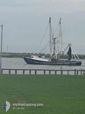
MASTER LEE
Fishing
Current Trip
Unknown
Destination Port
ETA*
---
| Time Travelled | 5 days |
|---|---|
| Remaining Time | --- |
| Distance Travelled | 188.91 nm |
| Remaining Distance | --- |
| AVG Speed | 4.6 Noeuds |
| MAX Speed | 9 Noeuds |
| AVG Wind | 6.3 knots |
| MAX Wind | 14.3 knots |
| MIN Temp | 10°C / 50°F |
| MAX Temp | 19.4°C / 66.92°F |
| Tirant d eau | --- |
| Position reçue | 2 m depuis |
Current Position
| Longitude | --- |
|---|---|
| Latitude | --- |
| Etat | Default |
| Vitesse | 2.9 Noeuds |
| Parcours | --- |
| Zone | Gulf of Mexico |
| Station | T-AIS |
| Position reçue | 2 m depuis |
Info
info
Information
The current position of MASTER LEE is in Gulf of Mexico with coordinates 29.64961° / -93.46747° as reported on 2025-12-08 03:45 by AIS to our vessel tracker app. The vessel's current speed is 2.9 Noeuds
The vessel MASTER LEE (MMSI: 367661970) is a Fishing It's sailing under the flag of [US] USA.
In this page you can find informations about the vessels current position, last detected port calls, and current voyage information. If the vessels is not in coverage by AIS you will find the latest position.
The current position of MASTER LEE is detected by our AIS receivers and we are not responsible for the reliability of the data. The last position was recorded while the vessel was in Coverage by the Ais receivers of our vessel tracking app.
Weather
| Temperature | 17.9°C / 64.22°F |
|---|---|
| Wind Speed | 9 knots |
| Direction | 309° NW |
| Pressure | 1016.6 hPa |
| Humidity | 93.9 % |
| Cloud Coverage | 100 % |
Featured Company
Limited time offer - Install a base station receiver to your area and list your company on MyShipTracking Free forever!
Last Port Calls
| Port | Arrival | Departure | Time In Port |
|---|---|---|---|
| 2025-11-27 10:27 | 2025-12-02 17:19 | 5 d | |
| 2025-11-18 13:20 | 2025-11-25 12:22 | 6 d | |
| 2025-10-07 17:34 | 2025-10-15 11:13 | 7 d | |
| 2025-10-01 11:46 |
Most Visited Ports (Last year)
| Port | Arrivals | |
|---|---|---|
| 8 |
Last Trips
| Origin | Departure | Destination | Arrival | Distance | |
|---|---|---|---|---|---|
| 2025-11-25 12:22 | 2025-11-27 10:27 | 101.41 nm | |||
| 2025-10-15 11:13 | 2025-11-18 13:20 | 425.61 nm | |||
| 2025-10-01 11:46 | 2025-10-07 17:34 | 60.38 nm |
Events
| Heure | Evenement | Détails | Position/ Destination | Info |
|---|---|---|---|---|
| 2025-12-07 10:23 | Dans la zone couverte |
29.46590 / -93.96711
Gulf of Mexico
|
Vitesse: 7.8 kn Parcours: 68.4° |
|
| 2025-12-07 06:47 | Hors de la zone couverte |
29.27330 / -94.46682
Gulf of Mexico
|
Vitesse: 7.5 kn Parcours: 64° |
|
| 2025-12-07 06:20 | Démarrage | 14.61 nm, East of GALVESTON |
29.24279 / -94.52778
|
Vitesse: 7.7 kn Parcours: 52° |
| 2025-12-07 06:18 | Arret | 14.58 nm, East of GALVESTON |
29.24119 / -94.52899
|
Vitesse: 0.3 kn Parcours: 511° |
| 2025-12-07 04:41 | Dans la zone couverte |
29.24809 / -94.58736
Gulf of Mexico
|
Vitesse: 3.4 kn Parcours: 147.7° |
|
| 2025-12-03 16:32 | Hors de la zone couverte |
29.41561 / -94.02379
Gulf of Mexico
|
Vitesse: 8.4 kn Parcours: 236.5° |
|
| 2025-12-03 09:25 | Dans la zone couverte |
29.47675 / -94.06311
Gulf of Mexico
|
Vitesse: 2.9 kn Parcours: 255.9° |
|
| 2025-12-03 07:57 | Hors de la zone couverte |
29.49458 / -93.98522
Gulf of Mexico
|
Vitesse: 3.1 kn Parcours: 255.6° |
|
| 2025-12-02 23:19 | PORT DE DEPART |
|
29.69257 / -93.84034
|
Vitesse: 7.1 kn Parcours: 147.2° |
| 2025-12-02 22:31 | Démarrage |
29.76091 / -93.90194
[US] SABINE PASS
|
Vitesse: 7.5 kn Parcours: 136° |