
MARY A
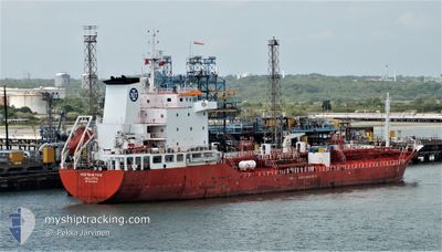
Oil/Chemical Tanker
Current Trip
| Time Travelled | 1 day |
|---|---|
| Remaining Time | --- |
| Distance Travelled | 233.69 nm |
| Remaining Distance | --- |
| AVG Speed | 11.1 Noeuds |
| MAX Speed | 13.5 Noeuds |
| AVG Wind | 8.7 knots |
| MAX Wind | 17.8 knots |
| MIN Temp | 10.9°C / 51.62°F |
| MAX Temp | 12.6°C / 54.68°F |
| Tirant d eau | 5.3 m |
| Position reçue | 1 m depuis |
Current Position
| Longitude | -1.04091° |
|---|---|
| Latitude | 50.71698° |
| Etat | At anchor |
| Vitesse | 0.1 Noeuds |
| Parcours | 294° |
| Zone | English Channel |
| Station | T-AIS |
| Position reçue | 1 m depuis |
Info
Information
The current position of MARY A is in English Channel with coordinates 50.71698° / -1.04091° as reported on 2024-05-02 13:43 by AIS to our vessel tracker app. The vessel's current speed is 0.1 Noeuds
The vessel MARY A (IMO: 9321433, MMSI: 247373700) is a Oil/Chemical Tanker that was built in 2007 ( 17 Age ). It's sailing under the flag of [IT] Italy.
In this page you can find informations about the vessels current position, last detected port calls, and current voyage information. If the vessels is not in coverage by AIS you will find the latest position.
The current position of MARY A is detected by our AIS receivers and we are not responsible for the reliability of the data. The last position was recorded while the vessel was in Coverage by the Ais receivers of our vessel tracking app.
The current draught of MARY A as reported by AIS is 5.3 meters
Weather
| Temperature | 12.5°C / 54.5°F |
|---|---|
| Wind Speed | 9 knots |
| Direction | 275° W |
| Pressure | 1001.8 hPa |
| Humidity | 91.6 % |
| Cloud Coverage | 100 % |
Featured Company
Last Port Calls
| Port | Arrival | Departure | Time In Port |
|---|---|---|---|
| 2024-04-28 22:10 | 2024-05-01 13:33 | 2 d | |
| 2024-04-22 09:43 | 2024-04-26 10:54 | 4 d | |
| 2024-04-18 18:38 | 2024-04-21 11:01 | 2 d | |
| 2024-04-12 13:42 | 2024-04-16 17:27 | 4 d | |
| 2024-04-06 00:04 | 2024-04-09 14:48 | 3 d | |
| 2024-03-30 11:52 | 2024-04-03 20:15 | 4 d | |
| 2024-03-26 06:19 | 2024-03-29 07:34 | 3 d | |
| 2024-03-20 23:24 | 2024-03-26 05:18 | 5 d | |
| 2024-03-15 13:57 | 2024-03-18 19:45 | 3 d | |
| 2024-03-11 19:51 | 2024-03-14 14:10 | 2 d |
Most Visited Ports (Last year)
| Port | Arrivals | |
|---|---|---|
| 36 | ||
| 34 | ||
| 4 | ||
| 2 | ||
| 1 |
Last Trips
| Origin | Departure | Destination | Arrival | Distance | |
|---|---|---|---|---|---|
| 2024-04-26 11:54 | 2024-04-29 00:10 | 267.72 nm | |||
| 2024-04-21 13:01 | 2024-04-22 10:43 | 247.10 nm | |||
| 2024-04-16 18:27 | 2024-04-18 20:38 | 263.56 nm | |||
| 2024-04-09 16:48 | 2024-04-12 14:42 | 250.30 nm | |||
| 2024-04-03 21:15 | 2024-04-06 02:04 | 261.49 nm | |||
| 2024-03-29 08:34 | 2024-03-30 11:52 | 247.43 nm | |||
| 2024-03-26 06:18 | 2024-03-26 07:19 | 11.62 nm | |||
| 2024-03-18 19:45 | 2024-03-21 00:24 | 275.53 nm | |||
| 2024-03-14 15:10 | 2024-03-15 13:57 | 247.21 nm | |||
| 2024-03-09 10:26 | 2024-03-11 20:51 | 260.17 nm |
Events
| Heure | Evenement | Détails | Position/ Destination | Info |
|---|---|---|---|---|
| 2024-05-02 09:43 | Etat Changé | At anchor Under way using engine |
50.71659 / -1.04289
GBFAW
|
Vitesse: 1.3 kn Parcours: 22° |
| 2024-05-02 09:40 | Arret | 2.92 nm, North East of ST HELENS |
50.71741 / -1.04224
GBFAW
|
Vitesse: 0.3 kn Parcours: 342° |
| 2024-05-02 00:23 | Changement de zone | United Kingdom part of the English Channel United Kingdom part of the North Sea |
51.07521 / 1.47026
English Channel
GBFAW
|
Vitesse: 13.5 kn Parcours: 231° |
| 2024-05-01 20:11 | Changement de zone | United Kingdom part of the North Sea Belgian part of the North Sea |
51.69509 / 2.34924
North Sea
GBFAW
|
Vitesse: 10.9 kn Parcours: 223.3° |
| 2024-05-01 19:02 | Changement de zone | Belgian part of the North Sea Dutch part of the North Sea |
51.85011 / 2.56851
North Sea
GBFAW
|
Vitesse: 10.8 kn Parcours: 221.7° |
| 2024-05-01 15:36 | Etat Changé | Under way using engine Default |
52.05206 / 3.50271
GBFAW
|
Vitesse: 12.2 kn Parcours: 270° |
| 2024-05-01 15:22 | Etat Changé | Default Under way using engine |
52.05208 / 3.57817
GBFAW
|
Vitesse: 12.1 kn Parcours: 278.2° |
| 2024-05-01 13:33 | PORT DE DEPART |
|
51.96810 / 4.11923
GBFAW
|
Vitesse: 11.1 kn Parcours: 305° |
| 2024-05-01 13:01 | Démarrage |
51.92327 / 4.19723
[NL] ROTTERDAM
|
Vitesse: 3.3 kn Parcours: 51° |
|
| 2024-05-01 13:00 | Etat Changé | Under way using engine Moored |
51.92248 / 4.19575
[NL] ROTTERDAM
|
Vitesse: 0.9 kn Parcours: 46° |