
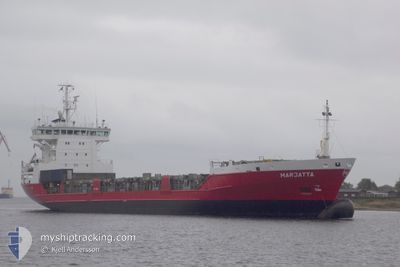
MARJATTA
General Cargo
Current Trip
| Time Travelled | 3 days |
|---|---|
| Remaining Time | 1 day |
| Distance Travelled | 1091.44 nm |
| Remaining Distance | 420.64 nm |
| AVG Speed | 14.3 Noeuds |
| MAX Speed | 17.9 Noeuds |
| AVG Wind | 20.6 knots |
| MAX Wind | 29.3 knots |
| MIN Temp | 2.2°C / 35.96°F |
| MAX Temp | 13.1°C / 55.58°F |
| Tirant d eau | 6.8 m |
| Position reçue | 1 m depuis |
Current Position
| Longitude | --- |
|---|---|
| Latitude | --- |
| Etat | Under way using engine |
| Vitesse | 14 Noeuds |
| Parcours | 316° |
| Zone | Baltic Sea |
| Station | T-AIS |
| Position reçue | 1 m depuis |
Info
Information
The current position of MARJATTA is in Baltic Sea with coordinates 59.72083° / 19.89850° as reported on 2025-12-13 00:28 by AIS to our vessel tracker app. The vessel's current speed is 14 Noeuds and is heading at the port of ROYTTA. The estimated time of arrival as calculated by MyShipTracking vessel tracking app is 2025-12-14 07:41 LT
The vessel MARJATTA (IMO: 9126247, MMSI: 230352000) is a General Cargo that was built in 1996 ( 29 Age ). It's sailing under the flag of [FI] Finland.
In this page you can find informations about the vessels current position, last detected port calls, and current voyage information. If the vessels is not in coverage by AIS you will find the latest position.
The current position of MARJATTA is detected by our AIS receivers and we are not responsible for the reliability of the data. The last position was recorded while the vessel was in Coverage by the Ais receivers of our vessel tracking app.
The current draught of MARJATTA as reported by AIS is 6.8 meters
Weather
| Temperature | 2.6°C / 36.68°F |
|---|---|
| Wind Speed | 14 knots |
| Direction | 147° SSE |
| Pressure | 1028.6 hPa |
| Humidity | 56.8 % |
| Cloud Coverage | 100 % |
Featured Company
Last Port Calls
| Port | Arrival | Departure | Time In Port |
|---|---|---|---|
| 2025-12-08 11:10 | 2025-12-09 19:52 | 1 d | |
| 2025-12-07 16:18 | 2025-12-08 10:27 | 18 h | |
| 2025-12-07 15:04 | 2025-12-07 16:11 | 1 h | |
| 2025-11-30 13:37 | 2025-12-02 22:53 | 2 d | |
| 2025-11-23 04:27 | 2025-11-25 22:31 | 2 d | |
| 2025-11-23 04:02 | 2025-11-23 04:15 | 12 m | |
| 2025-11-21 22:14 | 2025-11-21 23:55 | 1 h | |
| 2025-11-11 12:28 | 2025-11-18 17:45 | 7 d | |
| 2025-11-07 01:11 | 2025-11-07 02:20 | 1 h | |
| 2025-11-05 05:00 | 2025-11-07 00:37 | 1 d |
Most Visited Ports (Last year)
| Port | Arrivals | |
|---|---|---|
| 35 | ||
| 22 | ||
| 22 | ||
| 8 | ||
| 5 | ||
| 4 |
Last Trips
| Origin | Departure | Destination | Arrival | Distance | |
|---|---|---|---|---|---|
| 2025-12-08 10:27 | 2025-12-08 11:10 | 5.45 nm | |||
| 2025-12-07 16:11 | 2025-12-07 16:18 | 0.94 nm | |||
| 2025-12-02 22:53 | 2025-12-07 15:04 | 1310.02 nm | |||
| 2025-11-25 22:31 | 2025-11-30 13:37 | 1502.27 nm | |||
| 2025-11-23 04:15 | 2025-11-23 04:27 | 1.31 nm | |||
| 2025-11-21 23:55 | 2025-11-23 04:02 | 326.61 nm | |||
| 2025-11-18 17:45 | 2025-11-21 22:14 | 980.29 nm | |||
| 2025-11-07 02:20 | 2025-11-11 12:28 | 1494.10 nm | |||
| 2025-11-07 00:37 | 2025-11-07 01:11 | 2.09 nm | |||
| 2025-11-05 04:35 | 2025-11-05 05:00 | 1.52 nm |
Events
| Heure | Evenement | Détails | Position/ Destination | Info |
|---|---|---|---|---|
| 2025-12-13 00:11 | Etat Changé | Under way using engine Default |
59.67233 / 19.98917
FITOR
|
Vitesse: 14.3 kn Parcours: 317° |
| 2025-12-13 00:05 | Etat Changé | Default Under way using engine |
59.65583 / 20.01883
FITOR
|
Vitesse: 14.3 kn Parcours: 317° |
| 2025-12-13 00:05 | Etat Changé | Under way using engine Default |
59.65500 / 20.02033
FITOR
|
Vitesse: 14.4 kn Parcours: 316° |
| 2025-12-12 23:57 | Etat Changé | Default Under way using engine |
59.63250 / 20.06233
FITOR
|
Vitesse: 14.1 kn Parcours: 316° |
| 2025-12-12 23:52 | Changement de zone | Finnish part of the Baltic Sea Swedish part of the Baltic Sea |
59.61800 / 20.08967
Baltic Sea
FITOR
|
Vitesse: 14.1 kn Parcours: 316° |
| 2025-12-12 23:52 | Etat Changé | Under way using engine Default |
59.61800 / 20.08967
FITOR
|
Vitesse: 14.1 kn Parcours: 319° |
| 2025-12-12 23:37 | Dans la zone couverte |
59.61800 / 20.08967
Baltic Sea
FITOR
|
Vitesse: 14.1 kn Parcours: 316° |
|
| 2025-12-12 15:49 | Etat Changé | Default Under way using engine |
58.09650 / 18.26200
FITOR
|
Vitesse: 13.7 kn Parcours: 34° |
| 2025-12-12 15:41 | Hors de la zone couverte |
58.06967 / 18.22767
Baltic Sea
FITOR
|
Vitesse: 13.7 kn Parcours: 34° |
|
| 2025-12-12 15:28 | Etat Changé | Under way using engine Default |
58.03083 / 18.17867
FITOR
|
Vitesse: 13.7 kn Parcours: 34° |