
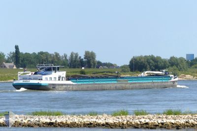
MARELIE
Cargo
Current Trip
| Time Travelled | 1 day |
|---|---|
| Remaining Time | --- |
| Distance Travelled | 38.96 nm |
| Remaining Distance | --- |
| AVG Speed | 5.2 Noeuds |
| MAX Speed | 5.9 Noeuds |
| AVG Wind | 8.6 knots |
| MAX Wind | 20.2 knots |
| MIN Temp | -4.1°C / 24.62°F |
| MAX Temp | -0.5°C / 31.1°F |
| Tirant d eau | 0.3 m |
| Position reçue | 7 h, 30 m depuis |
Current Position
| Longitude | --- |
|---|---|
| Latitude | --- |
| Etat | Under way using engine |
| Vitesse | 5.7 Noeuds |
| Parcours | 58° |
| Zone | North Sea |
| Station | T-AIS |
| Position reçue | 7 h, 30 m depuis |
Info
Information
The current position of MARELIE is in North Sea with coordinates 52.16971° / 6.45065° as reported on 2026-01-07 09:20 by AIS to our vessel tracker app. The vessel's current speed is 5.7 Noeuds
The vessel MARELIE (MMSI: 244670335) is a Cargo It's sailing under the flag of [NL] Netherlands.
In this page you can find informations about the vessels current position, last detected port calls, and current voyage information. If the vessels is not in coverage by AIS you will find the latest position.
The current position of MARELIE is detected by our AIS receivers and we are not responsible for the reliability of the data. The last position was recorded while the vessel was in Coverage by the Ais receivers of our vessel tracking app.
The current draught of MARELIE as reported by AIS is 0.3 meters
Weather
| Temperature | -1.4°C / 29.48°F |
|---|---|
| Wind Speed | 20 knots |
| Direction | 180° S |
| Pressure | 1006.6 hPa |
| Humidity | 94.4 % |
| Cloud Coverage | 100 % |
Featured Company
Last Port Calls
| Port | Arrival | Departure | Time In Port |
|---|---|---|---|
| 2026-01-06 15:51 | 2026-01-06 17:04 | 1 h | |
| 2026-01-05 18:45 | 2026-01-05 19:43 | 58 m | |
| 2026-01-05 16:00 | 2026-01-05 16:32 | 31 m | |
| 2026-01-04 15:12 | 2026-01-05 13:44 | 22 h | |
| 2026-01-04 13:25 | 2026-01-04 13:43 | 17 m | |
| 2026-01-04 11:00 | 2026-01-04 11:28 | 27 m | |
| 2026-01-02 09:15 | 2026-01-04 08:47 | 1 d | |
| 2025-12-30 23:51 | 2025-12-30 23:53 | 2 m | |
| 2025-12-30 16:48 | 2025-12-30 17:52 | 1 h | |
| 2025-12-29 13:04 | 2025-12-30 13:57 | 1 d |
Most Visited Ports (Last year)
| Port | Arrivals | |
|---|---|---|
| 54 | ||
| 30 | ||
| 25 | ||
| 22 | ||
| 19 | ||
| 18 |
Last Trips
| Origin | Departure | Destination | Arrival | Distance | |
|---|---|---|---|---|---|
| 2026-01-05 19:43 | 2026-01-06 15:51 | 71.91 nm | |||
| 2026-01-05 16:32 | 2026-01-05 18:45 | 12.07 nm | |||
| 2026-01-05 13:44 | 2026-01-05 16:00 | 13.69 nm | |||
| 2026-01-04 13:43 | 2026-01-04 15:12 | 13.09 nm | |||
| 2026-01-04 11:28 | 2026-01-04 13:25 | 11.79 nm | |||
| 2026-01-04 08:47 | 2026-01-04 11:00 | 13.85 nm | |||
| 2025-12-30 23:53 | 2026-01-02 09:15 | 25.05 nm | |||
| 2025-12-30 17:52 | 2025-12-30 23:51 | 29.54 nm | |||
| 2025-12-30 13:57 | 2025-12-30 16:48 | 26.24 nm | |||
| 2025-12-29 10:00 | 2025-12-29 13:04 | 25.51 nm |
Events
| Heure | Evenement | Détails | Position/ Destination | Info |
|---|---|---|---|---|
| 2026-01-07 09:20 | Hors de la zone couverte |
52.16971 / 6.45065
North Sea
ALMELO
|
Vitesse: 5.7 kn Parcours: 58° |
|
| 2026-01-07 08:06 | Etat Changé | Under way using engine Default |
52.16573 / 6.27965
ALMELO
|
Vitesse: 5 kn Parcours: 76° |
| 2026-01-07 07:59 | Etat Changé | Default Under way using engine |
52.16425 / 6.26239
ALMELO
|
Vitesse: 4.9 kn Parcours: 75.5° |
| 2026-01-07 07:53 | Dans la zone couverte |
52.16300 / 6.25224
North Sea
ALMELO
|
Vitesse: 1.7 kn Parcours: 79.7° |
|
| 2026-01-06 23:52 | Hors de la zone couverte |
52.16279 / 6.25054
North Sea
ALMELO
|
Vitesse: 1 kn Parcours: 68.5° |
|
| 2026-01-06 23:44 | Dans la zone couverte |
52.16146 / 6.24295
North Sea
ALMELO
|
Vitesse: 2.9 kn Parcours: 83.9° |
|
| 2026-01-06 22:44 | Hors de la zone couverte |
52.17155 / 6.19360
North Sea
ALMELO
|
Vitesse: 4.3 kn Parcours: 193.6° |
|
| 2026-01-06 21:57 | Dans la zone couverte |
52.20501 / 6.18535
North Sea
ALMELO
|
Vitesse: 4.8 kn Parcours: 236.9° |
|
| 2026-01-06 17:42 | Hors de la zone couverte |
52.47937 / 6.08030
North Sea
ALMELO
|
Vitesse: 5.5 kn Parcours: 103.2° |
|
| 2026-01-06 16:46 | Tirant d'eau modifié | 0.3 0 |
52.53117 / 6.00311
ALMELO
|
Vitesse: 4.4 kn Parcours: 73.4° |