
MARCO POLO
Cargo
Current Trip
STRAENBRUCKE VILSHOF
| Time Travelled | 24 days |
|---|---|
| Remaining Time | --- |
| Distance Travelled | 547.63 nm |
| Remaining Distance | --- |
| AVG Speed | 7.9 Noeuds |
| MAX Speed | 13.7 Noeuds |
| AVG Wind | 6.5 knots |
| MAX Wind | 12.1 knots |
| MIN Temp | 3.8°C / 38.84°F |
| MAX Temp | 20.2°C / 68.36°F |
| Tirant d eau | 2.3 m |
| Position reçue | Maintenant |
Current Position
| Longitude | 14.31600° |
|---|---|
| Latitude | 48.32133° |
| Etat | Under way using engine |
| Vitesse | 6.9 Noeuds |
| Parcours | 304° |
| Zone | North Sea |
| Station | T-AIS |
| Position reçue | Maintenant |
Info
Information
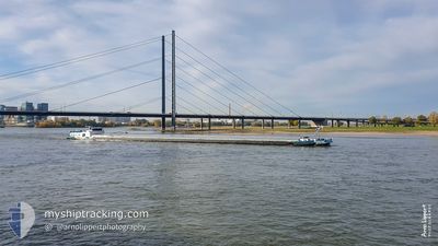
The current position of MARCO POLO is in North Sea with coordinates 48.32133° / 14.31600° as reported on 2024-04-27 16:32 by AIS to our vessel tracker app. The vessel's current speed is 6.9 Noeuds
The vessel MARCO POLO (MMSI: 205387990) is a Cargo It's sailing under the flag of [BE] Belgium.
In this page you can find informations about the vessels current position, last detected port calls, and current voyage information. If the vessels is not in coverage by AIS you will find the latest position.
The current position of MARCO POLO is detected by our AIS receivers and we are not responsible for the reliability of the data. The last position was recorded while the vessel was in Coverage by the Ais receivers of our vessel tracking app.
The current draught of MARCO POLO as reported by AIS is 2.3 meters
Weather
| Temperature | 17.9°C / 64.22°F |
|---|---|
| Wind Speed | 7 knots |
| Direction | 92° E |
| Pressure | 1009.3 hPa |
| Humidity | 54.9 % |
| Cloud Coverage | 4 % |
Featured Company
Last Port Calls
| Port | Arrival | Departure | Time In Port |
|---|---|---|---|
| 2024-04-02 19:05 | 2024-04-03 03:52 | 8 h | |
| 2024-04-02 14:06 | 2024-04-02 14:43 | 36 m | |
| 2024-04-01 11:07 | 2024-04-01 12:01 | 53 m | |
| 2024-03-31 10:38 | 2024-03-31 10:54 | 15 m | |
| 2024-03-27 20:39 | 2024-03-30 11:39 | 2 d | |
| 2024-03-27 13:03 | 2024-03-27 14:22 | 1 h | |
| 2024-03-27 10:23 | 2024-03-27 10:57 | 33 m | |
| 2024-03-26 16:22 | 2024-03-27 04:59 | 12 h | |
| 2024-03-23 16:00 | 2024-03-24 06:15 | 14 h | |
| 2024-03-23 11:42 | 2024-03-23 13:01 | 1 h |
Most Visited Ports (Last year)
| Port | Arrivals | |
|---|---|---|
| 16 | ||
| 16 | ||
| 10 | ||
| 9 | ||
| 9 | ||
| 6 |
Last Trips
| Origin | Departure | Destination | Arrival | Distance | |
|---|---|---|---|---|---|
| 2024-04-02 16:43 | 2024-04-02 21:05 | 17.06 nm | |||
| 2024-04-01 14:01 | 2024-04-02 16:06 | 95.35 nm | |||
| 2024-03-31 12:54 | 2024-04-01 13:07 | 137.37 nm | |||
| 2024-03-30 12:39 | 2024-03-31 12:38 | 44.66 nm | |||
| 2024-03-27 15:22 | 2024-03-27 21:39 | 44.73 nm | |||
| 2024-03-27 11:57 | 2024-03-27 14:03 | 28.09 nm | |||
| 2024-03-27 05:59 | 2024-03-27 11:23 | 61.05 nm | |||
| 2024-03-24 07:15 | 2024-03-26 17:22 | 144.55 nm | |||
| 2024-03-23 14:01 | 2024-03-23 17:00 | 7.84 nm | |||
| 2024-03-05 14:21 | 2024-03-23 12:42 | 531.27 nm |
Events
| Heure | Evenement | Détails | Position/ Destination | Info |
|---|---|---|---|---|
| 2024-04-27 16:13 | Tirant d'eau modifié | 2.3 4 |
48.28650 / 14.34417
STRAENBRUCKE VILSHOF
|
Vitesse: 8 kn Parcours: 340° |
| 2024-04-27 16:13 | Changement de destination | STRAENBRUCKE VILSHOF WIESBADEN |
48.28650 / 14.34417
STRAENBRUCKE VILSHOF
|
Vitesse: 8 kn Parcours: 340° |
| 2024-04-27 16:13 | Changement d'ETA | 2024/04/29 14:21 2024/12/02 14:42 |
48.28650 / 14.34417
STRAENBRUCKE VILSHOF
|
Vitesse: 8 kn Parcours: 340° |
| 2024-04-27 16:00 | Dans la zone couverte |
48.26967 / 14.37883
North Sea
|
Vitesse: 7.7 kn Parcours: 294° |
|
| 2024-04-26 15:11 | Hors de la zone couverte |
48.25600 / 16.37550
North Sea
|
Vitesse: 7.8 kn Parcours: 330° |
|
| 2024-04-26 12:38 | Dans la zone couverte |
48.14950 / 16.53400
North Sea
|
Vitesse: 4.5 kn Parcours: 317° |
|
| 2024-04-26 09:14 | Hors de la zone couverte |
48.13300 / 16.88283
North Sea
|
Vitesse: 4.4 kn Parcours: 230° |
|
| 2024-04-26 07:23 | Tirant d'eau modifié | 4 2.4 |
48.13983 / 17.04017
WIESBADEN
|
Vitesse: 4.9 kn Parcours: 260° |
| 2024-04-26 07:23 | Changement de destination | WIESBADEN STRAUBING |
48.13983 / 17.04017
WIESBADEN
|
Vitesse: 4.9 kn Parcours: 260° |
| 2024-04-26 07:23 | Changement d'ETA | 2024/12/02 14:42 2024/04/29 14:00 |
48.13983 / 17.04017
WIESBADEN
|
Vitesse: 4.9 kn Parcours: 260° |